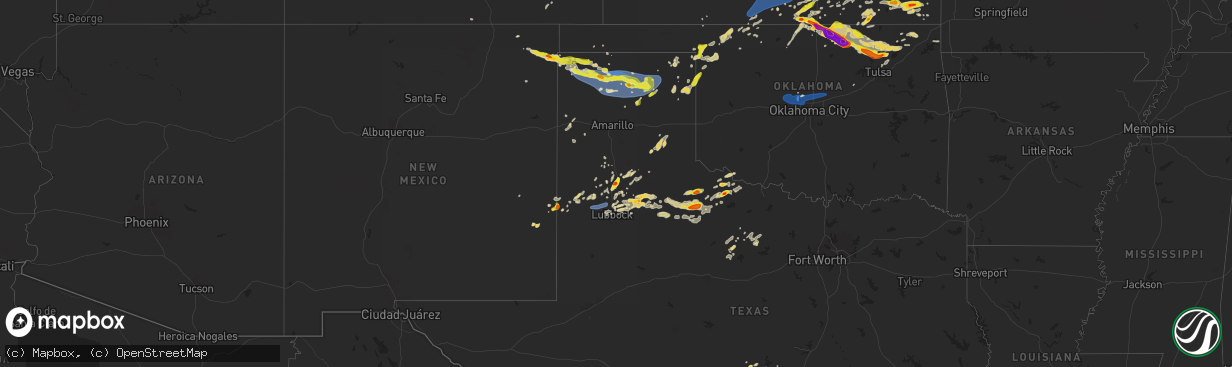
Hail Map on May 15, 2024
The weather event on May 15, 2024 includes Hail and Wind maps. 10 states and 385 cities were impacted and suffered possible damage. The total estimated number of properties impacted is 67,686.
Hail
Wind
67,686
Estimated number of impacted properties by a 1.00" hail or larger15,982
Estimated number of impacted properties by a 1.75" hail or larger7,909
Estimated number of impacted properties by a 2.50" hail or largerStates Impacted by Hail Map on May 15, 2024
Storm reports
Kansas
| Date | Description |
|---|---|
| 05/15/20246:53 PM CDT | A local report indicates 1.00 inch wind near 4 NW Belle Plaine |
| 05/15/20246:38 PM CDT | Report from mping: golf ball |
| 05/15/20246:34 PM CDT | Report from mping: quarter |
| 05/15/20241:36 AM CDT | A local report indicates 1.75 inch wind near 1 NNE Parsons |
| 05/14/202411:25 PM CDT | Quarter to golf ball sized. |
| 05/14/202410:50 PM CDT | A local report indicates 60 MPH wind near Kingman |
| 05/14/202410:14 PM CDT | A local report indicates 60 MPH wind near 3 N Nashville |
| 05/14/20249:40 PM CDT | A local report indicates 1.00 inch wind near 3 SE Douglass |
| 05/14/20249:08 PM CDT | A local report indicates 1.00 inch wind near 1 W Buffalo |
| 05/14/20247:50 PM CDT | A local report indicates 1.00 inch wind near Leon |
| 05/14/20247:40 PM CDT | A local report indicates 1.00 inch wind near 1 N Latham |
| 05/14/20247:16 PM CDT | A local report indicates 1.50 inch wind near Rose Hill |
| 05/14/20247:15 PM CDT | A local report indicates 1.75 inch wind near 2 W Rose Hill |
| 05/14/20247:01 PM CDT | A local report indicates 1.00 inch wind near Mulvane |
New Mexico
| Date | Description |
|---|---|
| 05/15/20243:38 PM CDT | A local report indicates 1.00 inch wind near 1 W Clayton |
| 05/15/20243:35 PM CDT | Corrects previous hail report from 1 w clayton. |
| 05/15/20243:30 PM CDT | A local report indicates 1.50 inch wind near 1 S Clayton |
| 05/15/20243:29 PM CDT | A local report indicates 1.00 inch wind near Clayton |
Florida
| Date | Description |
|---|---|
| 05/15/202411:31 AM CDT | Picture of hail around ping pong ball size in micco received via social media. |
| 05/15/202411:30 AM CDT | Picture of hail around ping pong ball size in roseland received via social media. |
South Carolina
| Date | Description |
|---|---|
| 05/15/20246:42 PM CDT | Quarter to ping pong size hail in maryville relayed by media via social media. |
| 05/15/20246:03 PM CDT | Quarter sized hail on dandelion lane |
| 05/15/20244:55 PM CDT | Amateur radio relayed report from darlington fire dept of a tree down on mill branch rd. Time estimated by time of report and radar. |
| 05/15/20244:44 PM CDT | Amateur radio relayed report from darlington fire dept of multiple trees down on cottonflower rd. Time estimated based on time of report and radar. |
| 05/15/20244:25 PM CDT | Nickel to quarter size hail relayed by media. |
| 05/15/20244:22 PM CDT | Quarter to ping pong size hail in lake city and barrineau relayed by media. Time estimated by radar. |
| 05/15/20244:15 PM CDT | Media relayed report via social media of golf ball size hail in the barrineau community around 515 pm. |
| 05/15/20244:05 PM CDT | Sc dept. Of public safety reported a tree down on convent church rd. Near the intersection of lawson rd. Time estimated by radar. |
| 05/15/20243:42 PM CDT | Sc dept of public safety reports trees down on jehossee dr se in aiken sc near citizens park. Time estimated from radar. |
| 05/15/20243:20 PM CDT | Sc dept of public safety reports trees down across the road on sweetwater rd near the intersection of horn creek w. Time estimated from radar. |
| 05/15/20241:45 PM CDT | One tree reported down in the city by the storm. |
| 05/15/202412:30 PM CDT | Quarter size hail reported via social media just off hwy 22 and hwy 90 near wendys restaurant and speedway gas station. |
Colorado
| Date | Description |
|---|---|
| 05/15/20244:00 PM CDT | Picture of 1 inch diameter hail from social media. |
North Carolina
| Date | Description |
|---|---|
| 05/15/20246:40 PM CDT | Golfball sized hail at the intersection of lisbon rd and rosindale rd. |
| 05/15/20246:23 PM CDT | Baseball sized hail near the intersection of lisbon rd and rosindale rd. Hail damaged windshields on cars. |
| 05/15/20246:15 PM CDT | Tree down on power lines along south page rd in the clarkton area. |
| 05/15/20246:13 PM CDT | A local report indicates 1.75 inch wind near 4 N Clarkton |
| 05/15/20245:35 PM CDT | Picture relayed via facebook. Hailstone was next to a dime... And was larger. |
| 05/15/20245:19 PM CDT | A local report indicates 1.00 inch wind near 2 ESE Stella |
| 05/15/20245:17 PM CDT | A local report indicates 1.00 inch wind near 1 SE Peletier |
| 05/15/20245:17 PM CDT | Delayed report. Picture of hail of at least ping pong size submitted via facebook. Time estimated based on radar. |
| 05/15/20245:17 PM CDT | Corrects previous hail report from peletier. Delayed report. Picture of hail of at least 2 inches in diameter submitted via facebook. Time estimated based on radar. Cor |
| 05/15/20245:11 PM CDT | Picture relayed via facebook. |
| 05/15/20245:00 PM CDT | Delayed report. 911 call operator had hail hitting her car on the way into work. She estimated that it was around quarter size. Time estimated based on radar. |
| 05/15/20244:57 PM CDT | A local report indicates 1.00 inch wind near 3 WSW Swansboro |
| 05/15/20244:49 PM CDT | Delayed report. 911 center said a deputy called in to report large hail hitting his vehicle. He estimated the hail was up to golf ball size. Time estimated based on rad |
| 05/15/20244:35 PM CDT | Report from mping: quarter |
| 05/15/20244:27 PM CDT | Reported near bonnetsville... Just west of clinton. |
| 05/15/20244:25 PM CDT | Hail lasted 5 minutes. |
| 05/15/20244:25 PM CDT | Corrects previous hail report from 6 n garland. Hail lasted 5 minutes. |
| 05/15/20244:10 PM CDT | Mineral springs. |
| 05/15/20243:58 PM CDT | Large tree reported down on nc 130. Time based on radar. |
| 05/15/20243:21 PM CDT | Mostly dime sized but some quarter sized. |
| 05/15/20242:31 PM CDT | Report from mping: quarter |
| 05/15/20242:25 PM CDT | Trees downed along henry river rd. |
| 05/15/20242:20 PM CDT | Trees downed along 39th st nw. |
| 05/15/20241:45 PM CDT | Trees and utility lines downed along dry ponds rd. |
| 05/15/20241:40 PM CDT | Trees and lines down along horseshoe bend rd and hickory nut ridge road. |
| 05/15/20241:35 PM CDT | Utility equipment damaged resulting in power outages. |
| 05/15/20241:25 PM CDT | Hail from pea sized up to quarter sized. |
| 05/14/20247:49 PM CDT | A local report indicates 58 MPH wind near Wilmington Intl Arpt |
Virginia
| Date | Description |
|---|---|
| 05/15/20243:09 PM CDT | Tree down. Time estimated from radar. |
Oklahoma
| Date | Description |
|---|---|
| 05/15/20246:51 PM CDT | A local report indicates 1.75 inch wind near 3 NW Braman |
| 05/15/20245:20 AM CDT | Fence damage. Simmons rd. And s broadway. Facebook report with picture. Time estimated from radar. |
| 05/15/20241:07 AM CDT | Tree down blocking roadway. Time estimated by radar. |
| 05/15/202412:41 AM CDT | Em report. |
| 05/15/202412:28 AM CDT | Deputy reported. |
| 05/15/202412:20 AM CDT | Power poles and several trees snapped on waterloo rd between hwy 74 and western. Time estimated from radar. |
| 05/15/202412:20 AM CDT | Corrects previous tstm wnd dmg report from 4 s seward. Fence damage. Simmons rd. And s broadway. Facebook report with picture. Time estimated from radar. |
| 05/15/202412:17 AM CDT | Powerlines in roadway. |
| 05/15/202412:16 AM CDT | Roof damaged at 192nd and portland. Twitter report. Time estimated from radar. |
| 05/15/202412:14 AM CDT | Corrects previous tstm wnd dmg report from 7 ene piedmont. Tree down blocking roadway. Time estimated by radar. |
| 05/15/202412:12 AM CDT | Downed tree at 122nd and macarthur. Fb report with photos. Time estimated from radar. |
| 05/14/202410:03 PM CDT | Quarter size hail. |
| 05/14/202410:00 PM CDT | Golf ball size hail. |
| 05/14/20249:30 PM CDT | On highway 11 approximately 9 miles north of skiatook. Relayed via twitter. |
| 05/14/20249:16 PM CDT | A local report indicates 1.50 inch wind near Wynona |
| 05/14/20248:27 PM CDT | Tennis ball size hail. |
| 05/14/20248:27 PM CDT | 3.5 inch hail covered the ground. |
| 05/14/20248:27 PM CDT | A local report indicates 3.00 inch wind near Burbank |
| 05/14/20248:18 PM CDT | A local report indicates 1.00 inch wind near Burbank |
| 05/14/20248:11 PM CDT | Report from mping: golf ball |
| 05/14/20247:54 PM CDT | A local report indicates 2.75 inch wind near 5 ESE Kildare |
| 05/14/20247:53 PM CDT | A local report indicates 61 MPH wind near 3 NNW Ponca City |
| 05/14/20247:40 PM CDT | A local report indicates 1.00 inch wind near Arnett |
| 05/14/20247:40 PM CDT | Report from mping: golf ball |
| 05/14/20247:39 PM CDT | Report from mping: ping pong ball |
| 05/14/20247:35 PM CDT | A local report indicates 4.00 inch wind near Newkirk |
| 05/14/20247:32 PM CDT | A local report indicates 1.25 inch wind near Newkirk |
| 05/14/20247:27 PM CDT | A local report indicates 1.00 inch wind near 3 NNW Shattuck |
| 05/14/20247:05 PM CDT | A local report indicates 2.50 inch wind near Braman |
| 05/14/20247:00 PM CDT | Odot camera on i-35. |
Texas
| Date | Description |
|---|---|
| 05/15/20246:51 PM CDT | A local report indicates 1.00 inch wind near 3 N Stinnett |
| 05/15/20246:35 PM CDT | A local report indicates 1.00 inch wind near Sunray |
| 05/15/20246:32 PM CDT | Time estimated on radar. |
| 05/15/20246:27 PM CDT | A local report indicates 1.00 inch wind near Sunray |
| 05/15/20246:21 PM CDT | A local report indicates 79 MPH wind near 9 NNE Sunray |
| 05/15/20246:20 PM CDT | A local report indicates 71 MPH wind near 9 NNE Sunray |
| 05/15/20246:12 PM CDT | A local report indicates 70 MPH wind near 3 SE Dumas |
| 05/15/20245:58 PM CDT | Multiple photos submitted to local media of various tree damage. Three inch diameter tree limb snapped. Couple of dead or diseased trees uprooted. One of witch fell on |
| 05/15/20245:11 PM CDT | A local report indicates 1.25 inch wind near 5 N Dalhart |
| 05/15/20245:10 PM CDT | A local report indicates 69 MPH wind near 3 SW Dalhart |
| 05/15/20244:32 PM CDT | Measured by the west texas mesonet. Corrected from non-tstm gust. |
| 05/15/20244:30 PM CDT | Quarter to golf ball size. Time estimated. |
| 05/15/20244:15 PM CDT | A local report indicates 1.00 inch wind near 7 E Texline |
| 05/15/20243:54 PM CDT | Public report... Time estimated on radar. |
| 05/15/20245:26 AM CDT | Tree damage in bomarton... Tx. Twitter report with picture. Time estimated from radar. |
| 05/15/20245:18 AM CDT | Mesonet station 73 weinert 2 nne. |
| 05/15/20245:10 AM CDT | A local report indicates 60 MPH wind near 3 NW Knox City |
| 05/15/20245:05 AM CDT | A local report indicates 60 MPH wind near 3 NW Knox City |
| 05/15/20245:00 AM CDT | A local report indicates 60 MPH wind near 3 NW Knox City |
| 05/15/20243:41 AM CDT | Report from mping: golf ball |
| 05/15/20243:38 AM CDT | Report from mping: ping pong ball |
| 05/15/20243:00 AM CDT | A local report indicates 67 MPH wind near 3 NNW Mcadoo |
| 05/15/20241:26 AM CDT | A local report indicates 58 MPH wind near 4 NNE Shallowater |
| 05/15/20241:25 AM CDT | Time estimated from radar. |
| 05/15/20241:00 AM CDT | A local report indicates 58 MPH wind near 6 SSW Anton |
| 05/14/20248:33 PM CDT | Occurred from outflow 15 miles ahead of thunderstorms. Measured by the west texas mesonet. |
| 05/14/20248:33 PM CDT | Occurred from outflow 15 miles ahe |
| 05/14/20247:38 PM CDT | Also gusted to 61 mph at 737 pm. Measured by the west texas mesonet. |
| 05/14/20247:31 PM CDT | Measured by west texas mesonet. |
| 05/14/20247:14 PM CDT | Also gusted to 60 mph at 715 pm. Measured by the west texas mesonet. |
| 05/14/20247:03 PM CDT | Report from mping: quarter |
Cities Impacted by Hail Map on May 15, 2024
- Lake Alfred, FL
- Auburndale, FL
- Winter Haven, FL
- Lake Wales, FL
- Old Town, FL
- Chiefland, FL
- Kenansville, FL
- Wauchula, FL
- Zolfo Springs, FL
- Palm Bay, FL
- Avon Park, FL
- Fellsmere, FL
- Sebastian, FL
- Grant, FL
- Melbourne Beach, FL
- Okeechobee, FL
- Lorida, FL
- Vero Beach, FL
- Fort Pierce, FL
- Conway, SC
- West Palm Beach, FL
- Longs, SC
- North Myrtle Beach, SC
- Lake Placid, FL
- Davis, NC
- Chelsea, OK
- Stacy, NC
- Vinita, OK
- Lenoir, NC
- Hudson, NC
- Granite Falls, NC
- Geneva, FL
- Mims, FL
- Malabar, FL
- Gaffney, SC
- Connelly Springs, NC
- Hickory, NC
- Sunset, SC
- Blacksburg, SC
- Smyrna, SC
- Hickory Grove, SC
- Newton, NC
- Ellerbe, NC
- Mount Gilead, NC
- Grenville, NM
- Spartanburg, SC
- Candor, NC
- York, SC
- Pickens, SC
- North Augusta, SC
- Trenton, SC
- Edgefield, SC
- Easley, SC
- Clayton, NM
- Tulia, TX
- Whiteville, NC
- Fort Mill, SC
- Rock Hill, SC
- Myrtle Beach, SC
- Little River, SC
- Texline, TX
- Burgaw, NC
- Hallsboro, NC
- Alcolu, SC
- Manning, SC
- Waxhaw, NC
- Peyton, CO
- Lockney, TX
- Waterloo, NE
- Valley, NE
- Lake Waccamaw, NC
- Aiken, SC
- Kennard, NE
- Arlington, NE
- Bennington, NE
- Bolton, NC
- Monroe, NC
- Marshville, NC
- Peachland, NC
- Lancaster, SC
- Calhan, CO
- Enochs, TX
- Amherst, TX
- New Zion, SC
- Colorado Springs, CO
- Kingstree, SC
- Elkhorn, NE
- Omaha, NE
- Salemburg, NC
- Hale Center, TX
- Rocky Point, NC
- Lakeview, TX
- Plainview, TX
- Delco, NC
- Polkton, NC
- Clarendon, TX
- Yoder, CO
- Maple Hill, NC
- Cades, SC
- Lake City, SC
- Fort Calhoun, NE
- Dalhart, TX
- Roseboro, NC
- Boone, CO
- Maple, TX
- Clinton, NC
- Leland, NC
- Lelia Lake, TX
- Hedley, TX
- Crescent, IA
- Lamar, SC
- Tatum, NM
- Scranton, SC
- Ash, NC
- Littlefield, TX
- Hubert, NC
- Honey Creek, IA
- Rye, CO
- Milnesand, NM
- Wallace, NC
- Richlands, NC
- Colorado City, CO
- Camp Lejeune, NC
- Andrews, SC
- Kress, TX
- Morton, TX
- Causey, NM
- Olton, TX
- Swansboro, NC
- Quitaque, TX
- Willard, NC
- Jacksonville, NC
- Georgetown, SC
- Coward, SC
- Stella, NC
- Hartley, TX
- Stratford, TX
- Silverton, TX
- Kim, CO
- Ordway, CO
- Olney Springs, CO
- Newport, NC
- Pep, TX
- Maysville, NC
- Winnabow, NC
- Wilmington, NC
- Dumas, TX
- Manzanola, CO
- Maiden, NC
- Cactus, TX
- Bladenboro, NC
- Lumberton, NC
- Pawleys Island, SC
- Bluff City, KS
- Clarkton, NC
- Elizabethtown, NC
- Caldwell, KS
- Harrells, NC
- Pritchett, CO
- Milan, KS
- Freeport, KS
- Sunray, TX
- Garland, NC
- Mayfield, KS
- Council, NC
- Wellington, KS
- Argonia, KS
- Las Animas, CO
- Ivanhoe, NC
- Walsenburg, CO
- Belle Plaine, KS
- Medford, OK
- Canadian, TX
- South Haven, KS
- Chadbourn, NC
- Stinnett, TX
- Morse, TX
- Spearman, TX
- Gruver, TX
- Skellytown, TX
- Miami, TX
- Arnett, OK
- Braman, OK
- Follett, TX
- Shattuck, OK
- Peck, KS
- Newkirk, OK
- Udall, KS
- Geuda Springs, KS
- Douglass, KS
- Deer Creek, OK
- Mulvane, KS
- Nardin, OK
- Blackwell, OK
- Atkinson, NC
- Hereford, TX
- Booker, TX
- Kelly, NC
- Riegelwood, NC
- Fritch, TX
- Borger, TX
- Arkansas City, KS
- Maple City, KS
- Kaw City, OK
- Ponca City, OK
- Rose Hill, KS
- Rock, KS
- Derby, KS
- Atlanta, KS
- Fargo, OK
- Currie, NC
- Augusta, KS
- Leon, KS
- Pampa, TX
- Perryton, TX
- Oxford, KS
- Rosalia, KS
- El Dorado, KS
- Latham, KS
- Gage, OK
- Woodward, OK
- Shidler, OK
- May, OK
- Laverne, OK
- Eureka, KS
- Fort Supply, OK
- Burbank, OK
- Fairfax, OK
- Sedan, KS
- Piedmont, KS
- Severy, KS
- Buffalo, OK
- Mooreland, OK
- Pawhuska, OK
- Freedom, OK
- Fall River, KS
- Toronto, KS
- Fredonia, KS
- Alva, OK
- Murrells Inlet, SC
- Dacoma, OK
- Wynona, OK
- Yates Center, KS
- Buffalo, KS
- Barnsdall, OK
- Bartlesville, OK
- Rosston, OK
- Kiowa, KS
- Hardtner, KS
- Skiatook, OK
- Great Bend, KS
- Ochelata, OK
- Ramona, OK
- Llano, TX
- Valley Spring, TX
- Marland, OK
- Shallowater, TX
- Lubbock, TX
- Ashland, KS
- Talala, OK
- Collinsville, OK
- Vera, OK
- Lorenzo, TX
- Nowata, OK
- Danville, KS
- Minneola, KS
- Anthony, KS
- Mullinville, KS
- St John, KS
- Medicine Lodge, KS
- Sharon, KS
- Cunningham, KS
- Nashville, KS
- Isabel, KS
- Harper, KS
- Spivey, KS
- Zenda, KS
- Attica, KS
- Kingman, KS
- Idalou, TX
- Winfield, KS
- Oologah, OK
- Stafford, KS
- Conway Springs, KS
- Raymond, KS
- Murdock, KS
- Pretty Prairie, KS
- Norwich, KS
- Burden, KS
- Pond Creek, OK
- Chase, KS
- Cambridge, KS
- Burnet, TX
- Bluejacket, OK
- Clearwater, KS
- Welch, OK
- Buchanan Dam, TX
- Cheney, KS
- Milton, KS
- Cedar Vale, KS
- Dexter, KS
- Nash, OK
- Ralls, TX
- Mount Hope, KS
- Wichita, KS
- Manhattan, KS
- Peru, KS
- Georgetown, TX
- Fairland, OK
- Wyandotte, OK
- Crosbyton, TX
- Sedgwick, KS
- Valley Center, KS
- Colwich, KS
- Abernathy, TX
- Mcadoo, TX
- Okarche, OK
- El Reno, OK
- Kingfisher, OK
- Piedmont, OK
- Yukon, OK
- Guthrie, OK
- Cashion, OK
- Edmond, OK
- Oklahoma City, OK
- Dickens, TX
- Longton, KS
- Elk Falls, KS
- Afton, TX
- Elk City, KS
- Moline, KS
- Grenola, KS
- Neodesha, KS
- Cherryvale, KS
- Thayer, KS
- Independence, KS
- Levelland, TX
- Anton, TX
- Floydada, TX
- Dennis, KS
- Mound Valley, KS
- Parsons, KS
- McCune, KS
- Depew, OK
- Petersburg, TX
- Delaware, OK
- Altamont, KS
- Galesburg, KS
- Oswego, KS
- Bristow, OK
- Saint Paul, KS
- Columbus, KS
- Owasso, OK
- Tulsa, OK
- Paducah, TX
- Slaton, TX
- Crowell, TX
- Matador, TX
- Vernon, TX
- Claremore, OK
- Roaring Springs, TX
- Frederick, OK
- Davidson, OK
- Electra, TX
- Chillicothe, TX
- Chetopa, KS
- Cherokee, KS
- Harrold, TX
- Bartlett, KS
- Oklaunion, TX
- Billings, OK
- Seymour, TX
- Throckmorton, TX
- Woodson, TX
- Albany, TX
- Newcastle, TX
- Graham, TX
- Chinquapin, NC
- Havelock, NC
- Atlantic Beach, NC
- Emerald Isle, NC
- Arcadia, OK
- Luther, OK
- Wellston, OK
- Meridian, OK