Hail Map on May 20, 2023
The weather event on May 20, 2023 includes Hail map. 8 states and 43 cities were impacted and suffered possible damage. The total estimated number of properties impacted is 2,991.
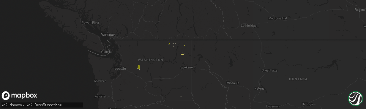
Hail
2,991
Estimated number of impacted properties by a 1.00" hail or larger0
Estimated number of impacted properties by a 1.75" hail or larger0
Estimated number of impacted properties by a 2.50" hail or largerStates Impacted by Hail Map on May 20, 2023
Storm reports
Oregon
| Date | Description |
|---|---|
| 05/20/202312:20 AM CDT | Mesonet station od191 i84 eb at mission mp214. |
| 05/19/20239:00 PM CDT | Social media report. |
| 05/19/20238:57 PM CDT | Occurred between 6:50 pm and 7:02 pm. Damage to automobile. |
| 05/19/20237:38 PM CDT | Time estimated from radar. |
California
| Date | Description |
|---|---|
| 05/19/20239:51 PM CDT | Red mountain raws recorded a peak wind gust of 58 mph. Elevation 3661 feet. |
Nevada
| Date | Description |
|---|---|
| 05/20/20236:15 PM CDT | At 1615 pdt... The arl sord sensor located at area 5 north recorded a thunderstorm wind gust of 64 mph from the nnw. |
| 05/20/20236:15 PM CDT | At 1615 pdt... The arl sord sensor located at area 5 north recorded a thunderstorm wind gust of 64 mph from the nnw. |
| 05/20/20235:45 PM CDT | At 1545... Arl sord station 38 recorded a thunderstorm wind gust of 76 mph. |
| 05/19/20237:00 PM CDT | At 1700 pdt... The arl sord sensor located at area 27 recorded a thunderstorm wind gust of 93 mph from the ese. |
New Mexico
| Date | Description |
|---|---|
| 05/20/20233:45 PM CDT | A local report indicates 1.00 inch wind near 1 NNE SOCORRO |
Washington
| Date | Description |
|---|---|
| 05/20/20236:30 PM CDT | Hail covered the ground on alligator ridge near deadman creek via social media. |
| 05/20/20234:00 PM CDT | Also reporting 0.54 inches of precipitation in the last 45 minutes. |
| 05/19/20239:15 PM CDT | A local report indicates 1.25 inch wind near 1 E CHEWELAH |
| 05/19/20237:00 PM CDT | At big meadow campground via social media. |
Cities Impacted by Hail Map on May 20, 2023
- Republic, WA
- Malo, WA
- Magdalena, NM
- Socorro, NM
- Curlew, WA
- Monterey, LA
- Jonesville, LA
- La Grande, OR
- Long Creek, OR
- Monument, OR
- Prineville, OR
- Pilot Rock, OR
- Heppner, OR
- Culver, OR
- Madras, OR
- Kimberly, OR
- Alturas, CA
- Chewelah, WA
- Adelanto, CA
- Meadview, AZ
- Condon, OR
- Bend, OR
- Sisters, OR
- Boone, CO
- Mountainair, NM
- Saraland, AL
- Mobile, AL
- Satsuma, AL
- Sumpter, OR
- Warm Springs, OR
- Estancia, NM
- Tijeras, NM
- La Pine, OR
- Mitchell, OR
- Post, OR
- Terrebonne, OR
- Maupin, OR
- Pendleton, OR
- Susanville, CA
- Redmond, OR
- Addy, WA
- Ione, WA
- Leavenworth, WA