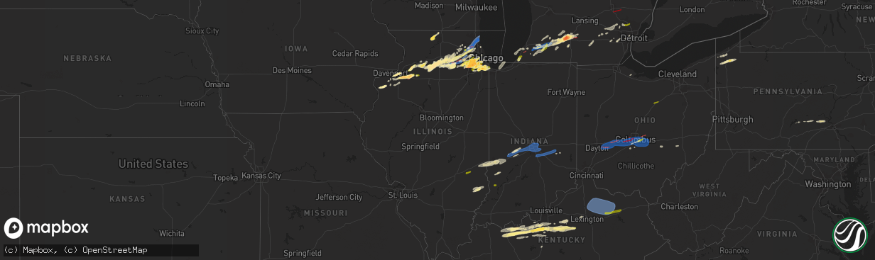
Hail Map in Illinois on February 27, 2024
The weather event in Illinois on February 27, 2024 includes Hail, Wind, and Tornado maps. 8 states and 492 cities were impacted and suffered possible damage. The total estimated number of properties impacted is 337,403.
Hail
Wind
Tornado
337,403
Estimated number of impacted properties by a 1.00" hail or larger54,830
Estimated number of impacted properties by a 1.75" hail or larger0
Estimated number of impacted properties by a 2.50" hail or largerStorm reports in Illinois
Illinois
| Date | Description |
|---|---|
| 02/27/20245:57 PM CST | Ping pong ball sized hail. |
| 02/27/20245:56 PM CST | A high end ef1 tornado formed about 4 miles west of annawan... Il at 656 pm. The tornado initially caused damage to tree limbs before intensifying as it approached high |
| 02/27/20245:56 PM CST | A high end ef1 tornado formed about 4 miles west of annawan... Il at 556 pm. The tornado initially caused damage to tree limbs before intensifying as it approached high |
| 02/27/20245:53 PM CST | A local report indicates a tornado near 3 SW Atkinson |
| 02/27/20245:45 PM CST | Ham radio relay from a spotter. |
| 02/27/20245:40 PM CST | A local report indicates 1.25 inch wind near 1 SSE Geneseo |
| 02/27/20245:38 PM CST | Time estimated from radar. |
| 02/27/20245:28 PM CST | Relayed via mping. |
| 02/27/20245:28 PM CST | Reported hail ranging between the size of a dollar coin and a half dollar. |
| 02/27/20245:15 PM CST | A local report indicates 1.00 inch wind near Colona |
| 02/27/20245:12 PM CST | Social media picture of quarter size hail relayed by media. |
| 02/27/20245:00 PM CST | A local report indicates 1.00 inch wind near 2 N Leon Corners |
| 02/27/20245:00 PM CST | Delayed report. |
| 02/27/20241:12 AM CST | Near red hills state park. Relayed by lawrence co. Ema. |
| 02/26/20248:46 PM CST | Relayed via mping. Time estimated by radar. |
| 02/26/20248:45 PM CST | Trained spotter reports hail up to ping pong ball sized near 155th and long avenue in oak forest. Hail occurred from 840pm to 852pm. |
| 02/26/20248:37 PM CST | Photo relayed by kane county ema shows hail approximately half dollar sized near 162nd street and 88th avenue in orland park. Time estimated by radar. |
| 02/26/20248:37 PM CST | Photo relayed by kane county ema shows hai |
| 02/26/20248:36 PM CST | Relayed via mping. Time estimated by radar. |
| 02/26/20248:36 PM CST | Relayed via mping. Time estimated by radar. |
| 02/26/20248:30 PM CST | Quarter size hail from 830pm to 835pm. Peak wind 41 mph. |
| 02/26/20248:13 PM CST | Relayed via mping. Time estimated by radar. |
| 02/26/20248:13 PM CST | Rel |
| 02/26/20248:12 PM CST | A local report indicates 1.00 inch wind near Homer Glen |
| 02/26/20248:11 PM CST | A local report indicates 1.00 inch wind near Lockport |
| 02/26/20248:10 PM CST | Relayed via mping. Time estimated by radar. |
| 02/26/20248:09 PM CST | Nws employee observed quarter sized hail in lockport. Time estimated by radar. |
| 02/26/20248:09 PM CST | Relayed via mping. Time estimated by radar. |
| 02/26/20248:09 PM CST | Relayed via mping. Time estimated by radar. (lot |
| 02/26/20248:06 PM CST | Relayed via mping. Time estimated by radar. |
| 02/26/20248:01 PM CST | Public report of half dollar sized hail in eastern bolingbrook. Time estimated by radar. |
| 02/26/20248:00 PM CST | Photo shared via social media shows hail up to hen egg size between downers grove and darien. Time estimated by radar. |
| 02/26/20248:00 PM CST | Quarter sized hail reported in south downers grove. |
| 02/26/20247:57 PM CST | Photo shared via broadcast media showed golf ball sized hail in north romeoville. Time estimated by radar. |
| 02/26/20247:56 PM CST | Nickel to quarter size hail near washington and 87th. |
| 02/26/20247:55 PM CST | *** 1 inj *** an nws damage survey confirmed that a brief ef-1 tornado with estimated peak winds of 110 mph impacted mundelein... Where it removed a portion of an apart |
| 02/26/20247:52 PM CST | Social media report and photos of snapped softwood trees. Time estimated by radar. |
| 02/26/20247:51 PM CST | Will county ema reported hail up to quarter sized in west bolingbrook. Time estimated by radar. |
| 02/26/20247:50 PM CST | A local report indicates 1.50 inch wind near 3 N Plainfield |
| 02/26/20247:49 PM CST | Quarter sized hail near 87th street and naper boulevard in naperville. Time estimated by radar. |
| 02/26/20247:49 PM CST | Private weather station kilpalat112 reported 82 mph gust northwest of palatine. |
| 02/26/20247:47 PM CST | Nws employee reports hail up to 1.5 inch diameter in plainfield. Time estimated by radar. |
| 02/26/20247:40 PM CST | Private weather station kilpalat43 reported 62 mph gust near hoffman estates. |
| 02/26/20247:39 PM CST | Private weather station kilpalat92 reported a 65 mph gust near palatine. |
| 02/26/20247:38 PM CST | Estimated quarter size hail near eola and ogden. |
| 02/26/20247:37 PM CST | Damage to roof of house and gazebo near freeman road and huntington boulevard in hoffman estates. Possible tornado. Time estimated by radar. |
| 02/26/20247:36 PM CST | Report of a possible tornado north of i-90 in schaumburg. Time estimated by radar. |
| 02/26/20247:36 PM CST | An nws damage survey confirmed that an ef-1 tornado with estimated peak winds of 90 mph... A path length of 0.4 miles... And a maximum width of 100 yards impacted the n |
| 02/26/20247:34 PM CST | Relayed via mping. Time estimated by radar. |
| 02/26/20247:33 PM CST | An nws damage survey confirmed that an ef-0 tornado with estimated peak winds of 85 mph... A path length of 1.1 miles... And a maximum width of 105 yards impacted south |
| 02/26/20247:32 PM CST | An nws damage survey confirmed that an ef-0 tornado with estimated peak winds of 80 mph... A path length of 0.7 miles... And a maximum width of 100 yards impacted hoffm |
| 02/26/20247:30 PM CST | Relayed via mping. Time estimated by radar. |
| 02/26/20247:26 PM CST | A local report indicates 1.50 inch wind near 3 ENE Pecatonica |
| 02/26/20247:24 PM CST | Measured gust to 53 knots at kdpa. |
| 02/26/20247:17 PM CST | An nws damage survey confirmed that an ef-1 tornado with estimated peak winds of 95 mph... A path length of 0.9 miles... And a maximum width of 125 yards impacted the w |
| 02/26/20247:15 PM CST | Mobile office trailer within a construction site in the jewell osco parking lot flipped on its side. Shopping cart corrals also blown around. |
| 02/26/20247:06 PM CST | Relayed via mping. |
| 02/26/20247:06 PM CST | An nws damage survey confirmed that an ef-1 tornado with estimated peak winds of 95 mph... A path length of 8.2 miles... And a maximum width of 125 yards tracked from s |
| 02/26/20247:05 PM CST | Peak gust 55 knots at karr. |
| 02/26/20247:05 PM CST | Reports of damage to trees... Power poles... And fencing at waubonsee community college likely associated with a tornado. |
| 02/26/20247:05 PM CST | Relayed via mping. Time estimated by radar. |
| 02/26/20247:01 PM CST | Near intersection of council rd and suydam rd. |
| 02/26/20246:58 PM CST | An nws damage survey confirmed that an ef-0 tornado with estimated peak winds of 80 mph... A path length of 5.9 miles... And a maximum width of 125 yards touched down b |
| 02/26/20246:57 PM CST | Photo shared of a tornado near hinckley. |
| 02/26/20246:54 PM CST | An nws damage survey confirmed that an ef-0 tornado with estimated peak winds of 85 mph... A path length of 4.8 miles... And a maximum width of 175 yards touched down s |
| 02/26/20246:52 PM CST | Public report of quarter sized hail in huntley. |
| 02/26/20246:30 PM CST | Corrects previous tornado report from 2 ne waterman. Trained spotter reports a tornado on the ground 2 miles northeast of waterman. |
| 02/26/20246:30 PM CST | An nws damage survey confirmed that a brief ef-0 tornado with estimated peak winds of 65 mph touched down northeast of waterman and caused minor damage to a farmstead. |
| 02/26/20246:16 PM CST | Photo of estimated golf ball size hail. Time estimated. |
| 02/26/20246:15 PM CST | An nws damage survey confirmed that a brief ef-0 tornado with estimated peak winds of 70 mph touched down northeast of compton and caused roof damage to a farm outbuild |
| 02/26/20246:09 PM CST | Semi truck rollover on interstate 80 at mile marker 31.5. Possible tornado damage. |
| 02/26/20246:06 PM CST | Relayed via ham radio operator. At least golf ball sized hail. |
| 02/26/20246:05 PM CST | Delayed report via social media with pictures. |
| 02/26/20246:01 PM CST | Corrects previous tstm wnd dmg report from 2 nw annawan. Semi truck rollover on interstate 80 at mile marker 31.5. Possible tornado damage. Time estimated from radar. |
| 02/26/20246:00 PM CST | Via social media pictures. |
All States Impacted by Hail Map on February 27, 2024
Cities Impacted by Hail Map on February 27, 2024
- Prophetstown, IL
- Aledo, IL
- Coal Valley, IL
- Moline, IL
- East Moline, IL
- Silvis, IL
- Colona, IL
- Tampico, IL
- Carbon Cliff, IL
- Rock Falls, IL
- Joy, IL
- Hillsdale, IL
- Sublette, IL
- Amboy, IL
- Harmon, IL
- Geneseo, IL
- Osco, IL
- Atkinson, IL
- New Windsor, IL
- Lynn Center, IL
- Dixon, IL
- West Brooklyn, IL
- Compton, IL
- Annawan, IL
- Steward, IL
- Mineral, IL
- Lee, IL
- Shabbona, IL
- Waterman, IL
- Malta, IL
- Dekalb, IL
- Sheffield, IL
- Walnut, IL
- Paw Paw, IL
- Earlville, IL
- Manlius, IL
- Somonauk, IL
- Sandwich, IL
- Hinckley, IL
- Big Rock, IL
- Sugar Grove, IL
- Leland, IL
- Plano, IL
- Aurora, IL
- North Aurora, IL
- Maple Park, IL
- Elburn, IL
- Saint Charles, IL
- Winnebago, IL
- Pecatonica, IL
- Wayne, IL
- Bartlett, IL
- Elgin, IL
- Rockford, IL
- Batavia, IL
- Geneva, IL
- West Chicago, IL
- Rockton, IL
- South Beloit, IL
- Beloit, WI
- Hoffman Estates, IL
- Barrington, IL
- Dundee, IL
- Streamwood, IL
- Palatine, IL
- Schaumburg, IL
- Hanover Park, IL
- Rolling Meadows, IL
- Lake Zurich, IL
- Oswego, IL
- Montgomery, IL
- Naperville, IL
- Arlington Heights, IL
- Mundelein, IL
- Lake Forest, IL
- Vernon Hills, IL
- Lincolnshire, IL
- Libertyville, IL
- Buffalo Grove, IL
- Plainfield, IL
- Bolingbrook, IL
- Romeoville, IL
- Lake Bluff, IL
- Great Lakes, IL
- North Chicago, IL
- Wheaton, IL
- Lisle, IL
- Glen Ellyn, IL
- Lombard, IL
- Villa Park, IL
- Lockport, IL
- Lemont, IL
- Waukegan, IL
- Homer Glen, IL
- Orland Park, IL
- Palos Park, IL
- La Grange, IL
- Western Springs, IL
- Westchester, IL
- La Grange Park, IL
- Hines, IL
- Broadview, IL
- Brookfield, IL
- Maywood, IL
- Riverside, IL
- Darien, IL
- Woodridge, IL
- Downers Grove, IL
- Forest Park, IL
- Willowbrook, IL
- Willow Springs, IL
- Palos Heights, IL
- Hinsdale, IL
- Chicago Ridge, IL
- Palos Hills, IL
- Worth, IL
- Oak Lawn, IL
- Hometown, IL
- Chicago, IL
- Tinley Park, IL
- Oak Forest, IL
- Crestwood, IL
- Midlothian, IL
- Markham, IL
- Robbins, IL
- Harvey, IL
- Posen, IL
- Blue Island, IL
- South Holland, IL
- Calumet City, IL
- Riverdale, IL
- Hammond, IN
- Dolton, IL
- Hickory Hills, IL
- Bridgeview, IL
- Justice, IL
- Burbank, IL
- Whiting, IN
- Hazel Crest, IL
- Glendale Heights, IL
- Carol Stream, IL
- Deer Grove, IL
- Warrenville, IL
- Alpha, IL
- Ophiem, IL
- Cambridge, IL
- Andover, IL
- Orion, IL
- Milan, IL
- Ohio, IL
- La Moille, IL
- Mooseheart, IL
- Medinah, IL
- Winfield, IL
- Addison, IL
- Bloomingdale, IL
- Itasca, IL
- Clarendon Hills, IL
- Oak Brook, IL
- Westmont, IL
- Sycamore, IL
- Franklin Grove, IL
- Cortland, IL
- New Boston, IL
- Elmwood Park, IL
- Yorkville, IL
- Bristol, IL
- Elmhurst, IL
- Hillside, IL
- Hampshire, IL
- Gilberts, IL
- Huntley, IL
- Lake In The Hills, IL
- Crystal Lake, IL
- Algonquin, IL
- Carpentersville, IL
- South Elgin, IL
- Sterling, IL
- Wasco, IL
- Ashton, IL
- Mount Prospect, IL
- Elk Grove Village, IL
- East Chicago, IN
- Alsip, IL
- Berrien Springs, MI
- Saint Joseph, MI
- Sodus, MI
- Sawyer, MI
- Three Oaks, MI
- Bridgman, MI
- Baroda, MI
- New Troy, MI
- Buchanan, MI
- Marcellus, MI
- Lawton, MI
- Decatur, MI
- Schoolcraft, MI
- Mattawan, MI
- Kalamazoo, MI
- Battle Creek, MI
- Bellevue, MI
- Marshall, MI
- Albion, MI
- Hidalgo, IL
- Jewett, IL
- Greenup, IL
- Columbus, OH
- Reynoldsburg, OH
- Grand Blanc, MI
- Climax, MI
- Pataskala, OH
- Davison, MI
- Goodrich, MI
- Lapeer, MI
- Mansfield, OH
- Ashland, OH
- Dowagiac, MI
- Paw Paw, MI
- Portage, MI
- Cloverdale, IN
- Greencastle, IN
- Reelsville, IN
- Coatesville, IN
- Putnamville, IN
- Fillmore, IN
- Clayton, IN
- Stilesville, IN
- Amo, IN
- Danville, IN
- Plainfield, IN
- Avon, IN
- Indianapolis, IN
- Beech Grove, IN
- New Palestine, IN
- Whiteland, IN
- Greenwood, IN
- Franklin, IN
- Boggstown, IN
- Fairland, IN
- Needham, IN
- Waterford, MI
- Pontiac, MI
- Bloomfield Hills, MI
- Keego Harbor, MI
- Auburn Hills, MI
- Rochester, MI
- Shelbyville, IN
- Oaktown, IN
- Edwardsport, IN
- Freelandville, IN
- Bicknell, IN
- Morristown, IN
- Fountaintown, IN
- Sumner, IL
- Bridgeport, IL
- Rushville, IN
- Arlington, IN
- Gwynneville, IN
- Carthage, IN
- Pinckney, MI
- Whitmore Lake, MI
- Dexter, MI
- Hartford, MI
- Benton Harbor, MI
- Watervliet, MI
- Vicksburg, MI
- Mendon, MI
- Detroit, MI
- Burlington, MI
- Tekonsha, MI
- Galesburg, MI
- Riley, IN
- Marshall, IL
- West Terre Haute, IN
- Brazil, IN
- Terre Haute, IN
- Honey Grove, PA
- East Waterford, PA
- Dowling, MI
- Delton, MI
- Hickory Corners, MI
- Augusta, MI
- Belleville, MI
- Canton, MI
- Ypsilanti, MI
- Jackson, MI
- Michigan Center, MI
- Summit Argo, IL
- Northbrook, IL
- Glencoe, IL
- Winnetka, IL
- Portage, IN
- New Bloomfield, PA
- Shermans Dale, PA
- Loysville, PA
- Elliottsburg, PA
- Landisburg, PA
- Duncannon, PA
- Ceresco, MI
- Scotts, MI
- Olivet, MI
- East Leroy, MI
- Mokena, IL
- Cassopolis, MI
- Gobles, MI
- Eau Claire, MI
- River Forest, IL
- Claremont, IL
- Lawrence, MI
- Casey, IL
- Gary, IN
- Chesterton, IN
- Chelsea, MI
- Gregory, MI
- Oak Park, IL
- Martinsville, IL
- Dennison, IL
- Staunton, IN
- Bellwood, IL
- Thornton, IL
- Stockbridge, MI
- Prospect Heights, IL
- Hawesville, KY
- Philpot, KY
- Cloverport, KY
- Reynolds Station, KY
- Hardinsburg, KY
- Whitesville, KY
- Fordsville, KY
- Falls Of Rough, KY
- Westview, KY
- Harned, KY
- Radcliff, KY
- Rineyville, KY
- Elizabethtown, KY
- Lebanon Junction, KY
- Boston, KY
- Fairborn, OH
- Xenia, OH
- Yellow Springs, OH
- Cedarville, OH
- Springfield, OH
- South Charleston, OH
- South Vienna, OH
- London, OH
- Dayton, OH
- Enon, OH
- South Solon, OH
- West Jefferson, OH
- Galloway, OH
- Mount Sterling, OH
- Grove City, OH
- Orient, OH
- Hilliard, OH
- Cynthiana, KY
- Paris, KY
- Sadieville, KY
- Georgetown, KY
- Lexington, KY
- Carlisle, KY
- Mount Olivet, KY
- Berry, KY
- Lockbourne, OH
- Millersburg, KY
- Ewing, KY
- Mayslick, KY
- Groveport, OH
- Ashville, OH
- Pickerington, OH
- Blacklick, OH
- Canal Winchester, OH
- Carroll, OH
- Lithopolis, OH
- Millersport, OH
- Etna, OH
- Baltimore, OH
- Mount Sterling, KY
- Moorefield, KY
- Sharpsburg, KY
- Wallingford, KY
- Flemingsburg, KY
- Hillsboro, KY
- Owingsville, KY
- Hebron, OH
- Kirkersville, OH
- Vine Grove, KY
- West Point, KY
- Bardstown, KY
- Springfield, KY
- Garfield, KY
- Irvington, KY
- Custer, KY
- Willisburg, KY
- Harrodsburg, KY
- Morehead, KY
- Nicholasville, KY
- Richmond, KY
- Mapleton Depot, PA
- Lewisport, KY
- Glenwood, IN
- Ickesburg, PA
- Bloomfield, KY
- Mount Eden, KY
- Lawrenceburg, KY
- Saegertown, PA
- Cambridge Springs, PA
- Waterford, PA
- Conneautville, PA
- Venango, PA
- Meadville, PA
- Brandenburg, KY
- Owensboro, KY
- Clarklake, MI
- New Carlisle, OH
- Nashville, MI
- Commerce Township, MI
- Walled Lake, MI
- Centerpoint, IN
- Union City, PA
- Hodgenville, KY
- Taylorsville, KY
- Olney, IL
- West Bloomfield, MI
- Fort Knox, KY
- Donnelsville, OH
- Cecilia, KY
- Eastview, KY
- Glendale, KY
- Brighton, MI
- Jasonville, IN
- Cory, IN
- Albion, PA
- Utica, KY
- Cranesville, PA
- Cottage Grove, TN
- McDaniels, KY
- Sullivan, IN
- Guston, KY
- Flat Rock, IL
- Edinboro, PA
- Leroy, MI
- Cadillac, MI
- Tustin, MI
- Ekron, KY
- Medway, OH
- Coxs Creek, KY
- Milford, MI
- McVeytown, PA
- Hudson, KY
- Oak Harbor, OH
- Martin, TN
- Palmersville, TN
- Dukedom, TN
- Dresden, TN
- Huntingdon, PA
- New Haven, KY
- Muldraugh, KY
- Maceo, KY
- Clermont, KY
- Shepherdsville, KY
- Webster, KY
- Howell, MI
- Highland, MI
- White Lake, MI
- Berrien Center, MI
- Springport, MI
- Charlotte, MI
- Orbisonia, PA
- McKean, PA
- Girard, PA
- Homewood, IL
- Shelburn, IN
- Leitchfield, KY
- Ann Arbor, MI
- Versailles, KY
- Cumberland, OH
- Bonnieville, KY
- Viola, IL
- Mackville, KY
- Midway, KY
- Reynolds, IL
- Dearborn Heights, MI
- South Fulton, TN
- Somerset, OH
- New Lexington, OH
- Roseville, OH
- Caldwell, OH
- Chaplin, KY
- Paris, TN
- Alexandria, OH
- Granville, OH
- Country Club Hills, IL


