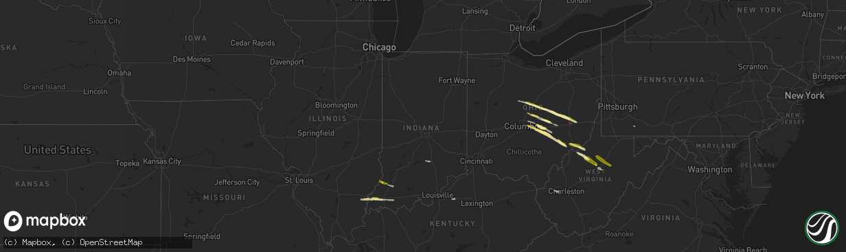
Hail Map in Indiana on March 30, 2024
The weather event in Indiana on March 30, 2024 includes Hail, Wind, and Tornado maps. 7 states and 125 cities were impacted and suffered possible damage. The total estimated number of properties impacted is 1,545.
Hail
Wind
Tornado
1,545
Estimated number of impacted properties by a 1.00" hail or larger0
Estimated number of impacted properties by a 1.75" hail or larger0
Estimated number of impacted properties by a 2.50" hail or largerStorm reports in Indiana
Indiana
| Date | Description |
|---|---|
| 03/29/20249:27 PM CDT | A local report indicates 1.00 inch wind near Poseyville |
| 03/29/20248:35 PM CDT | Dubois county em reported a tree down blocking the road at state road 56 and 750 w. Time estimated from radar. |
| 03/29/20248:02 PM CDT | A local report indicates 1.00 inch wind near 5 NE Decker |
| 03/29/20247:57 PM CDT | A local report indicates 1.00 inch wind near 4 NNW Decker |
All States Impacted by Hail Map on March 30, 2024
Cities Impacted by Hail Map on March 30, 2024
- Marion, OH
- Mount Gilead, OH
- Cardington, OH
- Edison, OH
- Fredericktown, OH
- Chesterville, OH
- Mount Vernon, OH
- Gambier, OH
- Howard, OH
- Walhonding, OH
- Sunbury, OH
- Warsaw, OH
- Coshocton, OH
- Croton, OH
- Johnstown, OH
- Utica, OH
- Newark, OH
- Columbus, OH
- Pataskala, OH
- New Albany, OH
- Blacklick, OH
- Newcomerstown, OH
- Kimbolton, OH
- Cambridge, OH
- Plainfield, OH
- Granville, OH
- Heath, OH
- West Lafayette, OH
- Reynoldsburg, OH
- Pickerington, OH
- Baltimore, OH
- Nashport, OH
- Hebron, OH
- Buckeye Lake, OH
- Thornville, OH
- Millersport, OH
- Lore City, OH
- Salesville, OH
- Glenford, OH
- Pleasantville, OH
- Rushville, OH
- Somerset, OH
- Thurston, OH
- Zanesville, OH
- New Lexington, OH
- Junction City, OH
- Lowell, OH
- Roseville, OH
- Mount Perry, OH
- Whipple, OH
- Marietta, OH
- Reno, OH
- Newport, OH
- New Matamoras, OH
- Saint Marys, WV
- Crooksville, OH
- Corning, OH
- Malta, OH
- Stockport, OH
- Friendly, WV
- Waterford, OH
- Vincent, OH
- Chesterhill, OH
- Mill Run, PA
- New Milton, WV
- Fleming, OH
- Cairo, WV
- Harrisville, WV
- Waverly, WV
- Petroleum, WV
- Berea, WV
- Pullman, WV
- Auburn, WV
- Salem, WV
- Jane Lew, WV
- Weston, WV
- Camden, WV
- Buckhannon, WV
- Horner, WV
- Pennsboro, WV
- West Union, WV
- Coxs Mills, WV
- Troy, WV
- Smithville, WV
- Linn, WV
- Glenville, WV
- Alum Bridge, WV
- Vincennes, IN
- Decker, IN
- Petersburg, IN
- Quaker City, OH
- Orlando, WV
- Walkersville, WV
- Burnsville, WV
- Winslow, IN
- Crossville, IL
- Carmi, IL
- Enfield, IL
- Monroe City, IN
- Hazleton, IN
- Poseyville, IN
- New Harmony, IN
- Haubstadt, IN
- Cynthiana, IN
- Wadesville, IN
- Evansville, IN
- Barboursville, WV
- Boonville, IN
- Sod, WV
- Hurricane, WV
- Saint Albans, WV
- Chandler, IN
- Elberfeld, IN
- Ellenboro, WV
- Lancaster, OH
- Tennyson, IN
- Tornado, WV
- Finchville, KY
- Shelbyville, KY
- Otwell, IN
- Columbus, IN
- Freetown, IN
- Seymour, IN
- Flagler, CO
- Hugo, CO


