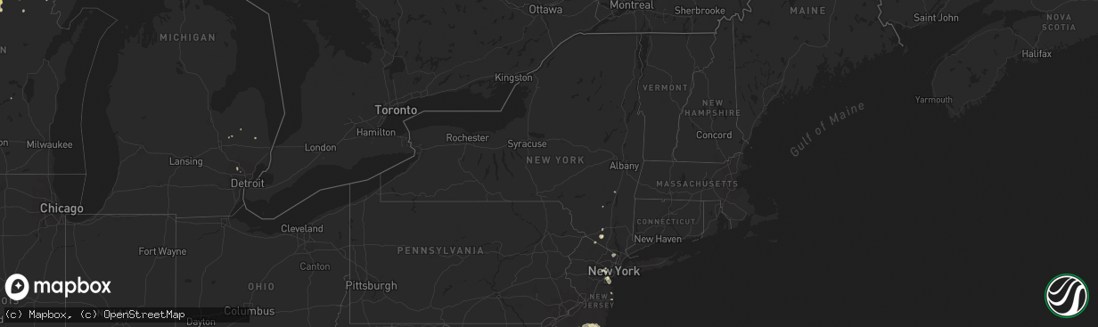
Hail Map in New York on June 8, 2021
The weather event in New York on June 8, 2021 includes Hail, Wind, and Tornado maps. 27 states and 374 cities were impacted and suffered possible damage. The total estimated number of properties impacted is 0.
Hail
Wind
Tornado
0
Estimated number of impacted properties by a 1.00" hail or larger0
Estimated number of impacted properties by a 1.75" hail or larger0
Estimated number of impacted properties by a 2.50" hail or largerStorm reports in New York
New York
| Date | Description |
|---|---|
| 06/08/20214:52 PM CDT | Tree down on road near exit 84 ny17. |
| 06/08/20213:57 PM CDT | Large tree limb fell down onto suv causing damage on atlantic ave in oceanside. |
| 06/08/20213:43 PM CDT | Trees reported down across queens with tree service requested. |
| 06/08/20213:20 PM CDT | Downed trees reported across the bronx with tree service requested with time estimated by radar. |
| 06/08/20213:14 PM CDT | A tree snapped and fell on a car... Taking down wires on 31st drive. |
| 06/08/20212:26 PM CDT | Tree reported down on ny 303 northbound between campbell avenue and oak tree road in orangetown with partial blockage of one lane. |
| 06/08/20212:09 PM CDT | Large branches reported down. |
| 06/08/20211:02 PM CDT | Multiple trees down along camby road. |
| 06/08/202112:50 PM CDT | Tree down |
| 06/08/202112:32 PM CDT | Trees reported down on a house in chester. |
| 06/08/202112:28 PM CDT | Tree down. |
| 06/08/202112:19 PM CDT | Downed tree on 17a... Just past greenwich ave and us6. |
| 06/08/202112:00 PM CDT | Numerous trees down into wires... Almost entire city without power. |
| 06/08/202111:30 AM CDT | Large tree down in front of the port jervis fire department. |
| 06/07/20219:58 PM CDT | At 258 PM EDT, a severe thunderstorm was located over Teterboro, or over Ridgefield, moving northeast at 15 mph. HAZARD...60 mph wind gusts. SOURCE...Radar indicated. IMPACT...Expect damage to trees and power lines. Locations impacted include... Hackensack, Bergenfield, Paramus, Ridgefield, Fort Lee, Englewood, Oradell, Teterboro, Teaneck, Garfield, Lodi, Palisades Park, Elmwood Park, Dumont and New Milford. |
| 06/07/20219:07 PM CDT | At 207 PM EDT, a severe thunderstorm was located near Peekskill, moving northeast at 20 mph. HAZARD...60 mph wind gusts and quarter size hail. SOURCE...Radar indicated. IMPACT...Minor hail damage to vehicles is possible. Expect wind damage to trees and power lines. Locations impacted include... Peekskill, Mahopac, Lake Carmel, Brewster, Carmel, Fahnestock State Park, Jefferson Valley and Putnam Valley. |
All States Impacted by Hail Map on June 8, 2021
Cities Impacted by Hail Map on June 8, 2021
- Merrill, WI
- Fe Warren Afb, WY
- Cheyenne, WY
- Winsted, CT
- Pine Bluffs, WY
- Bushnell, NE
- Pelican Lake, WI
- New England, ND
- Timber Lake, SD
- Forsyth, MT
- Rosebud, MT
- Flasher, ND
- McIntosh, SD
- Hettinger, ND
- Lemmon, SD
- Regent, ND
- Fort Peck, MT
- Brockton, MT
- Glendive, MT
- Foster City, MI
- Sturgis, SD
- Piedmont, SD
- Kadoka, SD
- Seney, MI
- Hermosa, SD
- Rapid City, SD
- Caputa, SD
- Paradise, MI
- Lantry, SD
- Dupree, SD
- Bison, SD
- Prairie City, SD
- Frazer, MT
- Wolf Point, MT
- Bowman, ND
- Goshen, AL
- Coffeeville, AL
- Jackson, AL
- Fairview, MT
- Wibaux, MT
- Cartwright, ND
- Beach, ND
- Bloomfield, MT
- Savage, MT
- Froid, MT
- Culbertson, MT
- Richey, MT
- Lambert, MT
- Jamestown, ND
- Carson, ND
- Center, ND
- Keystone, SD
- Ellsworth Afb, SD
- Custer, SD
- Box Elder, SD
- Tappen, ND
- Cohagen, MT
- Brockway, MT
- Circle, MT
- Gleason, WI
- Dickinson, ND
- Lefor, ND
- Gladstone, ND
- Meadow, SD
- Malta, MT
- Elgin, ND
- Glen Ullin, ND
- Long Lake, WI
- Fairfield, ND
- Cleveland, ND
- Medina, ND
- Isabel, SD
- Woodstown, NJ
- Salem, NJ
- Palmer, MI
- Negaunee, MI
- Thief River Falls, MN
- Braddock, ND
- Hazelton, ND
- Rice Lake, WI
- Deerbrook, WI
- Oakfield, GA
- Sagola, MI
- Belle Fourche, SD
- Norway, MI
- Niagara, WI
- Dunbar, WI
- Quinnesec, MI
- Pembine, WI
- Alzada, MT
- Viking, MN
- Argyle, MN
- Barron, WI
- Jordan, MT
- McLaughlin, SD
- Newell, SD
- Mud Butte, SD
- Watauga, SD
- Reva, SD
- Eagle Butte, SD
- Trail City, SD
- Selfridge, ND
- Faith, SD
- Keldron, SD
- Morristown, SD
- Buffalo Gap, SD
- Fairburn, SD
- Dawson, ND
- Kintyre, ND
- Steele, ND
- Linton, ND
- Driscoll, ND
- Moffit, ND
- Wing, ND
- Raleigh, ND
- Hot Springs, SD
- Germfask, MI
- Hinsdale, MT
- Buffalo, SD
- Camp Crook, SD
- Wall, SD
- Wausau, WI
- Phillips, WI
- Valentine, NE
- Westboro, WI
- Medford, WI
- Laona, WI
- Cameron, WI
- Shields, ND
- Big Springs, NE
- Brinson, GA
- Colquitt, GA
- Bainbridge, GA
- Edgemont, SD
- Carbon Hill, AL
- Belfield, ND
- Mott, ND
- Gwinn, MI
- Republic, MI
- Channing, MI
- Champion, MI
- New Underwood, SD
- Butler, AL
- Needham, AL
- Ripon, WI
- Saco, MT
- Pine Ridge, SD
- Enning, SD
- Andersonville, GA
- Americus, GA
- Leary, GA
- Fort Yates, ND
- Cannon Ball, ND
- Solen, ND
- Leesburg, GA
- Smithville, GA
- Antigo, WI
- Ishpeming, MI
- New Leipzig, ND
- Quinn, SD
- Skandia, MI
- Felch, MI
- Elmer, NJ
- Monroeville, NJ
- Nashua, MT
- Sidney, MT
- Armstrong Creek, WI
- Winter, WI
- Three Lakes, WI
- Eagle River, WI
- Chappell, NE
- Staten Island, NY
- Marquette, MI
- Lance Creek, WY
- Tuckerton, NJ
- Egg Harbor City, NJ
- Chatsworth, NJ
- Vincentown, NJ
- Ojibwa, WI
- Lodgepole, NE
- Saugerties, NY
- Catskill, NY
- Montgomery, AL
- Hope Hull, AL
- Rhinelander, WI
- Iron River, MI
- Colebrook, CT
- Norfolk, CT
- Hogansville, GA
- Phelps, WI
- Damascus, GA
- Clifford, MI
- Burns, WY
- Upton, WY
- Elcho, WI
- Iron Mountain, MI
- Tripoli, WI
- Brilliant, AL
- Winfield, AL
- Guin, AL
- Ladysmith, WI
- West Chester, PA
- Kennett Square, PA
- Prentice, WI
- Woodcliff Lake, NJ
- Hillsdale, NJ
- Westwood, NJ
- Dawson, GA
- Howes, SD
- Summit Lake, WI
- Argonne, WI
- Crookston, MN
- Red Lake Falls, MN
- Aladdin, WY
- Alva, WY
- Hulett, WY
- Black Hawk, SD
- Dorchester, WI
- Abbotsford, WI
- Newberry, MI
- Marshall, VA
- Hume, VA
- Park Falls, WI
- Ellaville, GA
- Township Of Washington, NJ
- Park Ridge, NJ
- Harrington Park, NJ
- Emerson, NJ
- Tony, WI
- Cody, WY
- Philip, SD
- Reynolds, GA
- Medora, ND
- Regan, ND
- Baldwin, ND
- Florida, NY
- Chester, NY
- Goshen, NY
- Amidon, ND
- East Orange, NJ
- Newark, NJ
- New Salem, ND
- Stanton, ND
- Crystal Falls, MI
- Poplar, MT
- Terry, MT
- Hawkins, WI
- Mission, SD
- Lusk, WY
- Angela, MT
- Kinsey, MT
- Bronwood, GA
- Plains, GA
- Elko, GA
- Warren, MN
- Fort Monmouth, NJ
- Eatontown, NJ
- Otisville, MI
- Olivebridge, NY
- Ackerman, MS
- Weir, MS
- Newcastle, WY
- Belmar, NJ
- Spring Lake, NJ
- Sundance, WY
- Thorp, WI
- McMillan, MI
- Birmingham, MI
- Vulcan, MI
- Saint Francis, SD
- Marianna, FL
- Cottondale, FL
- Athelstane, WI
- Conowingo, MD
- Hysham, MT
- Sanders, MT
- Glen Flora, WI
- Bloomfield Hills, MI
- Pontiac, MI
- McGehee, AR
- Tillar, AR
- Carpenter, WY
- Irma, WI
- Franklin, AL
- Ainsworth, NE
- Brantwood, WI
- Wanblee, SD
- Millville, MA
- Oglethorpe, GA
- Lac Du Flambeau, WI
- Woodworth, ND
- Pettibone, ND
- Demopolis, AL
- Wabeno, WI
- Manville, WY
- Hammonton, NJ
- Yale, MI
- Melvin, MI
- Columbiaville, MI
- Macon, MS
- Newport, TN
- Franklin, GA
- Tifton, GA
- Ty Ty, GA
- Omega, GA
- New Brockton, AL
- Kyle, SD
- Ogema, WI
- Moorcroft, WY
- Bloomer, WI
- Williamstown, NJ
- Franklinville, NJ
- Brokaw, WI
- Warwick, NY
- Glenwood, NJ
- Vernon, NJ
- Hawkinsville, GA
- Ocilla, GA
- Fitzgerald, GA
- Kingsford, MI
- Douglas, MA
- Middletown, NY
- Montgomery, NY
- Shreve, OH
- Wisdom, MT
- Swiftwater, PA
- Mount Pocono, PA
- Carteret, NJ
- Irvington, NJ
- Vauxhall, NJ
- Springfield, NJ
- Elizabeth, NJ
- Maplewood, NJ
- Millburn, NJ
- Hillside, NJ
- Union, NJ
- Hazen, ND
- Beulah, ND
- Shawnee, WY
- Tuttle, ND
- Douglas, WY
- Livermore, CO
- Alvarado, MN
- Meridian, MS
- Collinston, LA
- West Monroe, LA
- Columbia, LA
- Monroe, LA
- Mangham, LA
- Rayville, LA
- Oak Ridge, LA
- Williston, ND
- Bainville, MT
- Trenton, ND
- Lost Springs, WY
- Hillsdale, WY
- Patoka, IN
- Little Eagle, SD
- Wakpala, SD
- Glencross, SD
- Spearfish, SD
- Nisland, SD
- Saint Onge, SD
- Beulah, WY
- Deadwood, SD
- Nemo, SD
- Owanka, SD
- Wasta, SD
- Scenic, SD
- Belvidere, SD
- Interior, SD
- Tyler, TX
- Reklaw, TX
- Whitewater, MT


