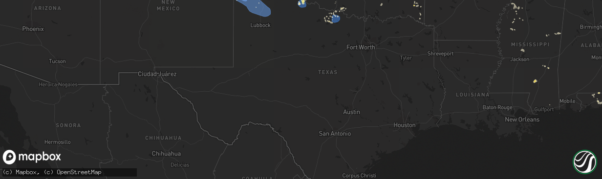
Hail Map in Texas on July 5, 2023
The weather event in Texas on July 5, 2023 includes Wind, Hail, and Tornado maps. 26 states and 637 cities were impacted and suffered possible damage. The total estimated number of properties impacted is 1,290.
Wind
Hail
Tornado
1,290
Estimated number of impacted properties by a 1.00" hail or larger182
Estimated number of impacted properties by a 1.75" hail or larger81
Estimated number of impacted properties by a 2.50" hail or largerStorm reports in Texas
Texas
| Date | Description |
|---|---|
| 07/05/20236:26 PM CDT | A local report indicates 1.00 inch wind near 6 NE Kellerville |
| 07/05/20236:20 PM CDT | A local report indicates 1.00 inch wind near 1 NNE Mclean |
| 07/05/20235:25 PM CDT | Measured by a west texas mesonet. |
| 07/05/20235:02 PM CDT | Storm chaser reported a few very large hail stones as he traveled south on highway 83. Hail appeared to be wrapping around the rear flank down downdraft of a supercell |
| 07/05/20234:10 PM CDT | A local report indicates 1.75 inch wind near 3 NE Miami |
| 07/05/20233:47 PM CDT | Measured by west texas mesonet. |
| 07/05/20233:45 PM CDT | Picture sent via social media. Location estimated by radar. |
| 07/05/20234:44 AM CDT | A local report indicates 60 MPH wind near 10 E Miami |
| 07/05/20234:29 AM CDT | A local report indicates 59 MPH wind near 2 ESE Pampa |
| 07/05/20233:15 AM CDT | A local report indicates 60 MPH wind near 3 ENE Perryton |
| 07/05/20233:12 AM CDT | A local report indicates 64 MPH wind near 6 E New Deal |
| 07/05/20232:04 AM CDT | A local report indicates 64 MPH wind near 6 E New Deal |
| 07/05/20231:47 AM CDT | A local report indicates 67 MPH wind near 3 WSW Aiken |
| 07/05/20231:35 AM CDT | A local report indicates 58 MPH wind near 1 S Plainview |
| 07/05/20231:28 AM CDT | A local report indicates 59 MPH wind near 1 S Plainview |
| 07/05/20231:08 AM CDT | A local report indicates 61 MPH wind near 6 S Olton |
| 07/05/20231:00 AM CDT | Potential wake low. Gusts in excess of 58 mph from 1:00am pm to 1:10 am with peak occurring at 1:00 am. |
| 07/05/202312:37 AM CDT | Potential wake low. Gusts in excess of 58 mph from 1237 pm to 1248 pm with peak occurring at 1241 pm. |
| 07/05/202312:37 AM CDT | Corrects previous tstm wnd gst report from 3 se pantex. Potential wake low. Gusts in excess of 58 mph from 1237 am to 1248 am with peak occurring at 1241 am. |
| 07/04/202311:56 PM CDT | Tree limb down near midwestern state university. |
| 07/04/202311:51 PM CDT | Sustained 56 mph. Severe wind gusts from 58 to 78 mph from 1150 pm through 1155 pm. Measured by the west texas mesonet. |
| 07/04/202311:50 PM CDT | Sustained 50 mph. Measured by the west texas mesonet. |
| 07/04/202311:18 PM CDT | A local report indicates 70 MPH wind near 11 WNW Bootleg |
| 07/04/20239:25 PM CDT | Hail mostly peas to marbles... But a few larger stones up to quarter size. |
| 07/04/20239:09 PM CDT | A local report indicates 67 MPH wind near 3 W Goodlett |
| 07/04/20238:59 PM CDT | A local report indicates 58 MPH wind near 3 W Goodlett |
| 07/04/20237:20 PM CDT | Snapped tree limbs and power pole down along highway 83. Chaser reported possible tornado. |
| 07/04/20237:10 PM CDT | Wind measured by west texas mesonet. Several large trees reported down near fm 1547. Large branches are blocking fm 3143. |
All States Impacted by Hail Map on July 5, 2023
Cities Impacted by Hail Map on July 5, 2023
- Madison, WI
- Oregon, WI
- Verona, WI
- Stoughton, WI
- Cambridge, WI
- Edgerton, WI
- Longs, SC
- Little River, SC
- Wade, NC
- Fayetteville, NC
- Columbus, WI
- Waterloo, WI
- Norfork, AR
- Chester, AR
- Sainte Genevieve, MO
- Lake Mills, WI
- Canadian, TX
- Miami, TX
- Trinidad, CO
- Newport, AR
- Amagon, AR
- Weiner, AR
- Cash, AR
- Trinchera, CO
- Briscoe, TX
- Springer, NM
- Gould, OK
- Hollis, OK
- Vinson, OK
- Palmer Lake, CO
- Monument, CO
- Colorado Springs, CO
- Sedalia, CO
- Lake George, CO
- Atkinson, IL
- Bradford, IL
- Toulon, IL
- Lowndes, MO
- Greenville, MO
- Paw Paw, IL
- Buffalo, IL
- Vossburg, MS
- Paulding, MS
- Sycamore, IL
- Wappapello, MO
- Lena, IL
- De Land, IL
- Staunton, IL
- Edinburg, IL
- Amorita, OK
- Bryant, IA
- Preston, IA
- Miles, IA
- Clinton, IA
- Glasford, IL
- Canton, IL
- Manito, IL
- Grand Bay, AL
- Burlington, IA
- Placida, FL
- Clare, IL
- Malta, IL
- Geneva, AL
- Westville, FL
- Dalton City, IL
- Mt Zion, IL
- Decatur, IL
- Macomb, IL
- Sheridan, IL
- Leland, IL
- Teutopolis, IL
- Jefferson, WI
- Emmet, AR
- Lithia, FL
- Pocahontas, AR
- Imboden, AR
- Black Rock, AR
- Black, AL
- Bonifay, FL
- French Village, MO
- Bloomsdale, MO
- Warm Springs, AR
- Couch, MO
- Midlothian, IL
- Alsip, IL
- Blue Island, IL
- Posen, IL
- Robbins, IL
- Orlando, FL
- Kissimmee, FL
- Cuba, IL
- Lewistown, IL
- Colchester, IL
- Tennessee, IL
- Plymouth, IL
- Huntington, AR
- Mansfield, AR
- Effingham, IL
- Goose Lake, IA
- Charlotte, IA
- De Witt, IA
- Jacksonville, NC
- Defuniak Springs, FL
- Meddybemps, ME
- Chicago, IL
- Bay Minette, AL
- New Athens, IL
- Red Bud, IL
- Sarasota, FL
- Dix, IL
- Davenport, FL
- Farmington, MO
- Roosevelt, OK
- Lone Wolf, OK
- Farmer City, IL
- Belgium, WI
- Higgins, TX
- Savanna, IL
- Saint Mary, MO
- Sebring, FL
- Lorida, FL
- Hudson, IL
- Lexington, IL
- Gridley, IL
- Random Lake, WI
- Fredonia, WI
- Hector, AR
- Jerusalem, AR
- Booneville, AR
- Prairie Du Rocher, IL
- Evansville, IL
- Witt, IL
- Irving, IL
- Nokomis, IL
- Maple Hill, NC
- Shreveport, LA
- Lincoln, IL
- Rose Hill, NC
- Magnolia, NC
- El Dorado, AR
- Vancleave, MS
- Tavares, FL
- Astatula, FL
- Mascoutah, IL
- Bowling Green, FL
- Pachuta, MS
- Dennysville, ME
- Pembroke, ME
- New Smyrna Beach, FL
- Osteen, FL
- Geneva, FL
- Arkadelphia, AR
- Sorento, IL
- New Douglas, IL
- Conway, SC
- Watertown, WI
- Reeseville, WI
- Mammoth Spring, AR
- Atkins, AR
- Hardtner, KS
- Roscoe, IL
- Caledonia, IL
- South Beloit, IL
- Milton, FL
- Baker, FL
- Fort Knox, KY
- Vine Grove, KY
- Wing, AL
- Saline, LA
- Goldonna, LA
- Hobart, OK
- Mount Sterling, IL
- Sheboygan Falls, WI
- Plymouth, WI
- Oswego, IL
- Montgomery, IL
- Aurora, IL
- Bristol, IL
- Zolfo Springs, FL
- Monroe, LA
- Smithville, AR
- Powhatan, AR
- Highland, IL
- Marine, IL
- Freeburg, IL
- Violet Hill, AR
- Brockwell, AR
- Franklin, AR
- Groveland, FL
- Mascotte, FL
- Baileyville, ME
- Greenbush, MI
- Oscoda, MI
- De Queen, AR
- Mechanicsburg, IL
- Mount Auburn, IL
- Whitewater, WI
- Fort Atkinson, WI
- Trenton, IL
- Lebanon, IL
- Summerfield, IL
- New Baden, IL
- Elgin, IL
- Dundee, IL
- Carpentersville, IL
- Cisco, IL
- Argenta, IL
- Clinton, IL
- Dewitt, IL
- Eglin Afb, FL
- Marshall, WI
- Holt, FL
- Crestview, FL
- Piggott, AR
- Wimauma, FL
- Riverview, FL
- Moweaqua, IL
- McCrory, AR
- Bailey, CO
- Shawnee, CO
- Hoxie, AR
- Alicia, AR
- Walnut Ridge, AR
- Maroa, IL
- Winnabow, NC
- Elizabeth, AR
- Geneva, IL
- Williford, AR
- Ipava, IL
- Smithfield, IL
- Table Grove, IL
- Vermont, IL
- Sabula, IA
- Spragueville, IA
- Teeds Grove, IA
- Hanover, IL
- Bellevue, IA
- Virginia Beach, VA
- Chesapeake, VA
- Walshville, IL
- Rochelle, IL
- Esmond, IL
- Kingston, IL
- Perryville, MO
- Alton, MO
- Arcadia, FL
- Leslie, AR
- Clinton, AR
- Alhambra, IL
- Mountain View, AR
- Marissa, IL
- Lenzburg, IL
- Baldwin, IL
- Sparta, IL
- Five Points, AL
- Strong, AR
- Mcfarland, WI
- Louin, MS
- Sedgewickville, MO
- Towanda, IL
- Taylorville, IL
- Owaneco, IL
- Linden, NC
- Port Byron, IL
- Witts Springs, AR
- Woodland Park, CO
- Amity, AR
- Mena, AR
- Viola, AR
- Rector, AR
- Brooklyn, WI
- Crete, IL
- Strawberry, AR
- Interlachen, FL
- Saint Matthews, SC
- Miami, NM
- Marshall, AR
- Big Clifty, KY
- Cerro Gordo, IL
- Monticello, IL
- Milmine, IL
- West Monroe, LA
- Mount Judea, AR
- Butler, GA
- Reynolds, GA
- Ideal, GA
- Oak Ridge, MO
- Friedheim, MO
- Daisy, MO
- Millersville, MO
- Washington, LA
- Hampshire, IL
- Burlington, OK
- Everton, AR
- Western Grove, AR
- Fults, IL
- Ruston, LA
- Simsboro, LA
- Elkhart Lake, WI
- Sheboygan, WI
- New Orleans, LA
- Mount Erie, IL
- Donnellson, IL
- Hillsboro, IL
- Panama, IL
- Hillsdale, IL
- Roseboro, NC
- Mason City, IL
- Liverpool, IL
- Ponce De Leon, FL
- Mountain Home, AR
- Gassville, AR
- Poplar Bluff, MO
- Vredenburgh, AL
- Franklin, AL
- Johnson Creek, WI
- Fredericktown, MO
- Kiowa, KS
- Mamou, LA
- Elburn, IL
- Sugar Grove, IL
- Sullivan, WI
- Helenville, WI
- Earlville, IL
- Mclean, TX
- Shamrock, TX
- Clarendon, TX
- Wellington, TX
- Quail, TX
- Wagon Mound, NM
- Roy, NM
- Solano, NM
- Conchas Dam, NM
- West Memphis, AR
- Memphis, TN
- Lake Cormorant, MS
- Walls, MS
- Horn Lake, MS
- Germantown, TN
- Cordova, TN
- Southaven, MS
- Collierville, TN
- Olive Branch, MS
- Proctor, AR
- Byhalia, MS
- Hernando, MS
- Nesbit, MS
- Marion, AR
- Erick, OK
- Calhan, CO
- Yoder, CO
- Model, CO
- Quanah, TX
- Mosquero, NM
- Boone, CO
- La Junta, CO
- Childress, TX
- Paducah, TX
- Mangum, OK
- Dodson, TX
- Tucumcari, NM
- Rush, CO
- Olney Springs, CO
- Peetz, CO
- Sidney, NE
- Grady, NM
- Mcalister, NM
- Adrian, TX
- Hereford, TX
- Richfield, KS
- Johnson, KS
- Rolla, KS
- Hugoton, KS
- Rocky Ford, CO
- Manzanola, CO
- Ordway, CO
- Las Animas, CO
- Goodwell, OK
- Gruver, TX
- Cheraw, CO
- Sugar City, CO
- Crowley, CO
- Swink, CO
- Texico, NM
- San Jon, NM
- Broadview, NM
- Bovina, TX
- Friona, TX
- Farwell, TX
- Wildorado, TX
- Amarillo, TX
- Canyon, TX
- Vega, TX
- Guymon, OK
- Hooker, OK
- Wichita Falls, TX
- Henrietta, TX
- Holliday, TX
- Iowa Park, TX
- Sheppard Afb, TX
- Scotland, TX
- Springfield, CO
- Kim, CO
- Pritchett, CO
- Dimmitt, TX
- Muleshoe, TX
- Summerfield, TX
- Earth, TX
- Happy, TX
- Dekalb, IL
- Wilmington, IL
- Pine, CO
- Two Dot, MT
- Eldorado, OK
- Oak Brook, IL
- Batavia, IL
- Riverdale, IL
- Calumet City, IL
- Palos Park, IL
- Downsville, LA
- South Holland, IL
- Chicago Heights, IL
- Lansing, IL
- Munster, IN
- Toponas, CO
- Louisville, MS
- Larkspur, CO
- Rupert, GA
- Kempton, IL
- Cabery, IL
- Cullom, IL
- Oak Forest, IL
- Orland Park, IL
- Palos Heights, IL
- Markham, IL
- Crestwood, IL
- Harvey, IL
- Brooksville, MS
- Portia, AR
- Rainbow City, AL
- Gadsden, AL
- Ohatchee, AL
- Nahunta, GA
- Country Club Hills, IL
- Mobeetie, TX
- Riverside, IL
- La Grange Park, IL
- La Grange, IL
- Hines, IL
- Broadview, IL
- Forest Park, IL
- Lyons, IL
- Brookfield, IL
- Maywood, IL
- Lambert, MS
- Marks, MS
- Barrington, IL
- Burbank, IL
- Moorhead, MS
- Indianola, MS
- Inverness, MS
- Texola, OK
- Pampa, TX
- Industry, IL
- Greenwell Springs, LA
- Baker, LA
- Baton Rouge, LA
- Dyer, IN
- Mills, NM
- Burlington, ME
- Dieterich, IL
- Hinsdale, IL
- Willowbrook, IL
- Western Springs, IL
- Cameron, SC
- Shiloh, NC
- Camden, NC
- Townsend, GA
- Mickleton, NJ
- Swedesboro, NJ
- Gibbstown, NJ
- Brunswick, GA
- Darien, GA
- Electra, TX
- Slater, CO
- Craig, CO
- Hattieville, AR
- Eau Claire, MI
- Dowagiac, MI
- Seminary, MS
- Sumrall, MS
- Hattiesburg, MS
- Rossville, TN
- Coahoma, MS
- Calico Rock, AR
- Scotland, AR
- Franktown, CO
- Castle Rock, CO
- Gladstone, NM
- Melbourne, AR
- Waycross, GA
- Homewood, IL
- Hazel Crest, IL
- Okeechobee, FL
- Shawboro, NC
- Itta Bena, MS
- Canton, MS
- Yemassee, SC
- Green Pond, SC
- Hazelton, KS
- Moselle, MS
- Walsh, CO
- Campo, CO
- Boise City, OK
- Manter, KS
- Panhandle, TX
- Claude, TX
- Nazareth, TX
- Hart, TX
- Amherst, TX
- Fieldton, TX
- Olton, TX
- Littlefield, TX
- Springlake, TX
- Plainview, TX
- Kress, TX
- Hale Center, TX
- Tulia, TX
- Wheeler, TX
- Lockney, TX
- Abernathy, TX
- Petersburg, TX
- Floydada, TX
- Hardesty, OK
- Stratford, TX
- Keyes, OK
- Dalhart, TX
- Texhoma, OK
- Durham, OK
- Crawford, OK
- Cheyenne, OK
- Reydon, OK
- Sweetwater, OK
- Elk City, OK
- Hammon, OK
- Sayre, OK
- Leedey, OK
- Arnett, OK
- Palisade, NE
- Wauneta, NE
- Enders, NE
- Hayes Center, NE
- Gate, OK
- Perryton, TX
- Hillside, IL
- Walden, CO
- Follett, TX
- Shattuck, OK
- Watson, OK
- Potterville, MI
- New Raymer, CO
- Booker, TX
- Plains, KS
- Sublette, KS
- Lodgepole, NE
- Broken Bow, OK
- Clovis, NM
- Okemah, OK
- Bethel, OK
- Holly, CO
- Turpin, OK
- Coalgate, OK
- Centrahoma, OK
- Haworth, OK
- Ada, OK
- Stonewall, OK
- Stoneham, CO
- Padroni, CO
- Atoka, OK
- Coleman, OK
- Laverne, OK
- Ulysses, KS
- Weleetka, OK
- Liberal, KS
- Kismet, KS
- Minter City, MS
- Tupelo, OK
- Allen, OK
- Bridgeport, NJ
- Arlington, CO
- Charleston, MS
- Philipp, MS
- Courtland, MS
- Batesville, MS
- Willow, OK
- Wallace, NE
- Elsie, NE
- Lyon, MS
- Tutwiler, MS
- Madrid, NE
- Pearl, MS
- Florence, MS
- Wapanucka, OK
- Macon, MS
- Denham Springs, LA
- Tyrone, OK
- Doddsville, MS
- Ruleville, MS
- Holcomb, MS
- Ogden, AR
- Ashdown, AR
- Rohwer, AR
- Paden, OK
- Depew, OK
- Hartley, TX
- Wickes, AR
- Prague, OK
- Stigler, OK
- Byers, TX
- South Boardman, MI
- Stroud, OK
- Sparks, OK
- Beaver, OK
- Howe, OK
- Gillham, AR
- Randlett, OK
- Chandler, OK
- Mccurtain, OK
- Waurika, OK
- Temple, OK
- Hastings, OK
- Walters, OK
- Vance, MS
- Eufaula, OK
- Crawfordsville, AR
- Balko, OK
- Granite, OK


