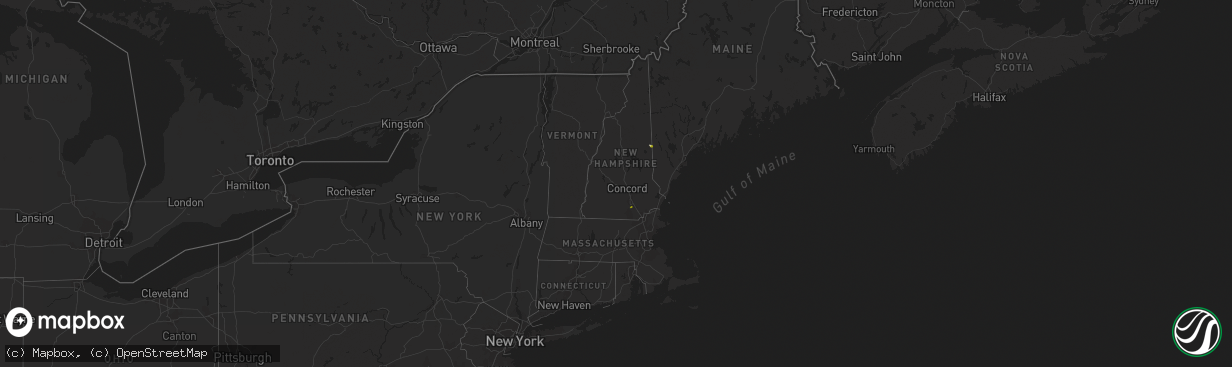
Hail Map in New Hampshire on August 7, 2022
The weather event in New Hampshire on August 7, 2022 includes Wind and Hail maps. 14 states and 163 cities were impacted and suffered possible damage. The total estimated number of properties impacted is 3.
Wind
Hail
3
Estimated number of impacted properties by a 1.00" hail or larger0
Estimated number of impacted properties by a 1.75" hail or larger0
Estimated number of impacted properties by a 2.50" hail or largerStorm reports in New Hampshire
New Hampshire
| Date | Description |
|---|---|
| 08/07/20226:08 PM CDT | Large tree down on idlewild road. Home weather station clocked wind gust to 63mph. Time estimated by radar. |
| 08/07/20226:04 PM CDT | Wind gusts ripped down branches on west shore of second connecticut lake. Time estimated by radar. |
| 08/07/20224:22 PM CDT | Reports of trees down around the area. |
| 08/07/20224:22 PM CDT | Observed 1-1.25 inch hail on south end of conway lake. Very strong winds knocked down several branches. Reports of trees down around the area. Time estimated by radar. |
| 08/07/20224:22 PM CDT | Social media reports of trees and branches down on davis hill rd. Time estimated by radar. |
| 08/07/20223:46 PM CDT | Social media photo and report of quarter-sized hail on the west side of conway. Hail fell very briefly and was accompanied by strong winds. Time estimated by radar. |
| 08/07/20222:37 PM CDT | Several reports of down tree limbs and penny size hail in the parrish hill neighborhood on the west end of nashua. Time estimated by radar. |
| 08/07/20222:32 PM CDT | 10-inch diameter tree down on a garage. No injuries. Time estimated by radar. |
| 08/07/20222:27 PM CDT | Large tree down across hwy 130. |
| 08/07/20222:27 PM CDT | Social media reports of tree limbs scattered across nh hwy 136 near the lake. Time estimated by radar. |
| 08/07/20222:04 PM CDT | Hail and strong winds knocked down numerous tree branches south of bennington. Hail measured between 3/4-1 inch; fell for about 6 minutes. Time estimated by radar. |
| 08/07/20221:35 PM CDT | Strong winds knocked down a few trees on the east end of harrisville pond. Kestrel-measured at 46mph. |
| 08/07/202212:20 AM CDT | At 520 PM EDT, a severe thunderstorm was located near Conway, moving east at 20 mph. HAZARD...60 mph wind gusts and half dollar size hail. SOURCE...Radar indicated. IMPACT...Hail damage to vehicles is expected. Expect wind damage to roofs, siding, and trees. Locations impacted include... Conway, Bridgton, Fryeburg, Naples, Ossipee, Buxton, Hollis, Hiram, Effingham, Cornish, Standish, Raymond, Waterboro, Casco, Limington, Limerick, Madison, Brownfield, Freedom and Denmark. |
| 08/06/202210:22 PM CDT | At 321 PM EDT, a severe thunderstorm was located over New Boston, or 11 miles west of Manchester, moving east at 35 mph. HAZARD...60 mph wind gusts and quarter size hail. SOURCE...Radar indicated. IMPACT...Hail damage to vehicles is expected. Expect wind damage to roofs, siding, and trees. Locations impacted include... Manchester, Concord, Derry, Henniker, Merrimack, Northwood, Bedford, Milford, Hooksett, Amherst, Litchfield, Epping, Hopkinton, New Boston, Epsom, Brentwood, Mont Vernon, Lyndeborough, Francestown and Raymond.This includes the following highways... Interstate 293 between mile markers 1 and 11. Interstate 89 between mile markers 0 and 10. Interstate 93 between mile markers 10 and 40. |
All States Impacted by Hail Map on August 7, 2022
Cities Impacted by Hail Map on August 7, 2022
- Ute, IA
- Southside, TN
- Arab, AL
- Florence, CO
- Coal Creek, CO
- Sharon Springs, KS
- Las Animas, CO
- Walsenburg, CO
- Tombstone, AZ
- Cochise, AZ
- Pearce, AZ
- Casey, IA
- Guthrie Center, IA
- Hasty, CO
- La Junta, CO
- Prescott, AZ
- San Simon, AZ
- Lumber City, GA
- Quitman, MS
- Melvin, AL
- Sugar City, CO
- Ordway, CO
- Arlington, CO
- West Des Moines, IA
- Des Moines, IA
- Windsor Heights, IA
- Trinidad, CO
- Lamar, CO
- Maplesville, AL
- Plantersville, AL
- Elfrida, AZ
- Winterset, IA
- Benson, AZ
- Surprise, AZ
- Model, CO
- Fort Huachuca, AZ
- Hereford, AZ
- Sierra Vista, AZ
- Longmont, CO
- Williams, AZ
- Mount Pleasant, TN
- Huachuca City, AZ
- Elgin, AZ
- Penrose, CO
- Lewisburg, KY
- Montgomery, AL
- Wetumpka, AL
- Lynnville, TN
- Culleoka, TN
- Holbrook, AZ
- Dexter, IA
- Earlham, IA
- Camilla, GA
- Tribune, KS
- Talladega, AL
- Livermore, CO
- Bisbee, AZ
- Monroe, IA
- Patagonia, AZ
- Lyons, CO
- Berthoud, CO
- Manzanola, CO
- Commerce City, CO
- Kit Carson, CO
- Rockford, AL
- Willcox, AZ
- Columbia, TN
- Decatur, AL
- Somerville, AL
- Mayer, AZ
- Hartselle, AL
- Saint James, LA
- Santa Fe, NM
- Denver, CO
- Audubon, IA
- Irwin, IA
- Kimballton, IA
- Kirkman, IA
- Hamlin, IA
- Exira, IA
- Chino Valley, AZ
- Kim, CO
- Pueblo, CO
- Des Arc, MO
- Annapolis, MO
- Franklin, KY
- Elk Horn, IA
- Brayton, IA
- Harlan, IA
- Aurora, CO
- Westminster, CO
- Chambers, AZ
- Adair, IA
- Anita, IA
- Dunmor, KY
- Johnston, IA
- Clive, IA
- Urbandale, IA
- Alexander City, AL
- Prairie City, IA
- Vinemont, AL
- Cullman, AL
- Ashland City, TN
- Nashville, TN
- Starkville, MS
- Crown King, AZ
- Animas, NM
- Winslow, AZ
- Clio, SC
- Sulligent, AL
- Gattman, MS
- Morris, GA
- Leoti, KS
- Lyles, TN
- Andalusia, AL
- Mapleton, IA
- Soldier, IA
- Dadeville, AL
- Eutaw, AL
- Florissant, CO
- Kirkland, AZ
- Van Meter, IA
- Adel, IA
- Booneville, IA
- Cumming, IA
- De Soto, IA
- Norwalk, IA
- Madison, TN
- Kellyton, AL
- Ganado, AZ
- Madison, NH
- Equality, AL
- Munford, AL
- Canon City, CO
- Boulder, CO
- Lafayette, CO
- Clarkson, KY
- Rodeo, NM
- Weskan, KS
- Tuscaloosa, AL
- Northport, AL
- Mitchellville, IA
- Runnells, IA
- Crescent, IA
- Danville, AL
- Wallace, KS
- Paulden, AZ
- Centerville, TN
- Lincoln, AL
- Eastaboga, AL
- Cumberland Furnace, TN
- Charlotte, TN
- Clanton, AL
- Billingsley, AL
- Trinchera, CO
- Gilman, IA
- Tama, IA
- Malcom, IA
- Laurel, IA
- Grinnell, IA
- Chelsea, IA
- Colfax, IA
- Newton, IA


