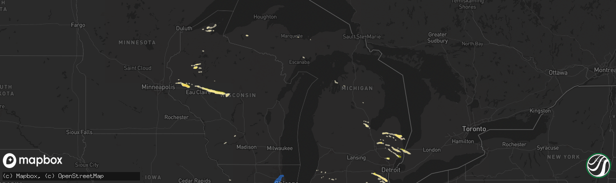
Hail Map in Michigan on July 14, 2023
The weather event in Michigan on July 14, 2023 includes Hail, Wind, and Tornado maps. 32 states and 1,546 cities were impacted and suffered possible damage. The total estimated number of properties impacted is 29,603.
Hail
Wind
Tornado
29,603
Estimated number of impacted properties by a 1.00" hail or larger3,733
Estimated number of impacted properties by a 1.75" hail or larger0
Estimated number of impacted properties by a 2.50" hail or largerStorm reports in Michigan
Michigan
| Date | Description |
|---|---|
| 07/14/20234:58 PM CDT | Wires down. Time estimated by radar. |
| 07/14/20234:57 PM CDT | Trees down. Time estimated by radar. |
| 07/14/20234:20 PM CDT | A local report indicates 1.00 inch wind near Crump |
| 07/14/20233:46 PM CDT | A local report indicates 1.75 inch wind near 2 NE Newport |
| 07/14/20233:40 PM CDT | A local report indicates 1.00 inch wind near 1 S Wadhams |
| 07/14/20233:36 PM CDT | Reports of downed trees and powerlines. |
| 07/14/20233:30 PM CDT | A local report indicates 1.25 inch wind near 1 S Carleton |
| 07/14/20233:25 PM CDT | Large tree branches down. |
| 07/14/20233:14 PM CDT | A local report indicates 1.00 inch wind near Rochester |
| 07/14/20233:09 PM CDT | A local report indicates 1.25 inch wind near 1 N Whittaker |
| 07/14/20233:06 PM CDT | Large tree and powerlines reported down. |
| 07/14/20233:06 PM CDT | A local report indicates 1.25 inch wind near 1 N Whittaker |
| 07/14/20232:46 PM CDT | A local report indicates 1.00 inch wind near 1 NNW Pittsfield |
| 07/14/20232:42 PM CDT | Power line down resulted in a small fire. Nickel size hail also observed. |
| 07/14/20232:38 PM CDT | Trees down. Time estimated by radar. |
| 07/14/20232:35 PM CDT | Trees and powerlines reported down. Hail damage and shredded crops... Size unknown. |
| 07/14/20232:35 PM CDT | Wind-driven hail resulted in vinyl siding being completely punched in to at least one structure. |
| 07/14/20232:35 PM CDT | Possible tornado with large trees uprooted and trees blocking roads. Estimated winds at least 65-70 mph. |
| 07/14/20232:30 PM CDT | Possible tornado with large trees uprooted and trees blocking roads. Estimated winds at least 65-70 mph. |
| 07/14/20232:10 PM CDT | Golfball size hail reported. |
| 07/14/20232:07 PM CDT | Trees down at intersection of m-24 and burnside road. Time estimated by radar. |
| 07/14/20232:06 PM CDT | Trees down at intersection of skelton and miller lake roads. Time estimated by radar. |
| 07/14/202312:57 PM CDT | Trees down. Time estimated by radar. |
| 07/14/202312:52 PM CDT | Trees down. Time estimated by radar. |
| 07/13/20238:30 PM CDT | A couple of large trees were blown down. One tree fell onto a house and caused extensive roof damage. |
All States Impacted by Hail Map on July 14, 2023
Cities Impacted by Hail Map on July 14, 2023
- West Alexander, PA
- Valley Grove, WV
- Claysville, PA
- Avella, PA
- Washington, PA
- Lebanon, PA
- Myerstown, PA
- Marshalltown, IA
- Albion, IA
- Gilman, IA
- Ferguson, IA
- Grinnell, IA
- Kellogg, IA
- Roland, OK
- Muldrow, OK
- Van Buren, AR
- Fort Smith, AR
- Arkoma, OK
- Greenwood, AR
- Lavaca, AR
- Barling, AR
- Huntington, AR
- Hackett, AR
- Mansfield, AR
- Hartford, AR
- Waldron, AR
- Booneville, AR
- Clayton, NM
- Dalhart, TX
- Felt, OK
- Texline, TX
- Hartley, TX
- Skellytown, TX
- Borger, TX
- Pampa, TX
- Charleston, AR
- Alma, AR
- Magazine, AR
- Branch, AR
- Mullen, NE
- Tryon, NE
- North Platte, NE
- Stapleton, NE
- Maxwell, NE
- Brady, NE
- Keystone, NE
- Paxton, NE
- Sutherland, NE
- Hershey, NE
- Gothenburg, NE
- Callaway, NE
- Whitman, NE
- Maywood, NE
- Curtis, NE
- Hayes Center, NE
- McCook, NE
- Cambridge, NE
- Eustis, NE
- Stockville, NE
- Moorefield, NE
- Holbrook, NE
- Arapahoe, NE
- Bartley, NE
- Indianola, NE
- Hendley, NE
- Stamford, NE
- Norton, KS
- Edison, NE
- Beaver City, NE
- Wilsonville, NE
- Lebanon, NE
- Almena, KS
- Oxford, NE
- Long Island, KS
- Prairie View, KS
- Phillipsburg, KS
- Plainville, KS
- Ellis, KS
- Glade, KS
- Hays, KS
- Victoria, KS
- Walker, KS
- Franklin, WV
- Hill City, KS
- Penokee, KS
- Barnes, KS
- Waterville, KS
- Randolph, KS
- Olsburg, KS
- Blue Rapids, KS
- Westmoreland, KS
- Abbeville, MS
- Oxford, MS
- Thaxton, MS
- Etta, MS
- Ecru, MS
- Pontotoc, MS
- New Albany, MS
- Wakeeney, KS
- Ogallah, KS
- Hoxie, KS
- Morland, KS
- Palco, KS
- Manhattan, KS
- Saint George, KS
- Wamego, KS
- Onaga, KS
- Kirwin, KS
- Alton, KS
- Woodston, KS
- Gaylord, KS
- Stockton, KS
- Portis, KS
- Osborne, KS
- Cedar, KS
- Agra, KS
- Blue Springs, MS
- La Crosse, KS
- Schoenchen, KS
- Pfeifer, KS
- Bison, KS
- Lexington, NE
- Haddam, KS
- Big Springs, WV
- Grantsville, WV
- Scandia, KS
- Wallace, NE
- Elsie, NE
- Frankfort, KS
- Republic, KS
- Birch Tree, MO
- Alma, NE
- Orleans, NE
- Mahopac, NY
- Arthur, NE
- Bogue, KS
- Damar, KS
- Clifton, KS
- Clyde, KS
- Cutler, OH
- Webber, KS
- Courtland, KS
- Superior, NE
- Hardy, NE
- Gorham, KS
- Dickens, NE
- Ogallala, NE
- Russell, KS
- Belleville, WV
- Washington, WV
- Coolville, OH
- Lewellen, NE
- Norcatur, KS
- Palmer, KS
- Linn, KS
- Saint Louis, MO
- East Carondelet, IL
- Oberlin, KS
- Danbury, NE
- Farmington, CT
- Bristol, CT
- Plainville, CT
- Wolcott, CT
- Unionville, CT
- Kensington, KS
- Morrowville, KS
- Sylvan Grove, KS
- Kewadin, MI
- Belleville, KS
- Concordia, KS
- Guysville, OH
- Mineral Wells, WV
- Little Hocking, OH
- Parkersburg, WV
- Greenleaf, KS
- Sarah, MS
- Elwood, NE
- Wellfleet, NE
- Doniphan, MO
- Alton, MO
- Walker, WV
- Petroleum, WV
- Bertrand, NE
- Black Oak, AR
- Mammoth Spring, AR
- Dresden, KS
- Selden, KS
- Republican City, NE
- Natoma, KS
- Rison, AR
- Guide Rock, NE
- Logan, KS
- Farnam, NE
- Reedsville, OH
- Athens, OH
- Green, KS
- Lenora, KS
- Osceola, AR
- Etowah, AR
- Randolph, MS
- Myrtle, MS
- West Plains, MO
- Paxico, KS
- Belvue, KS
- Alma, KS
- Maple Hill, KS
- Capon Bridge, WV
- Gore, VA
- Cross Junction, VA
- Kanopolis, KS
- Ellsworth, KS
- Wilson, KS
- Lorraine, KS
- Beverly, KS
- Lincoln, KS
- Olmitz, KS
- Hoisington, KS
- Great Bend, KS
- St John, KS
- Albert, KS
- Otis, KS
- Hudson, KS
- Ellinwood, KS
- Winchester, VA
- Auburn, KS
- Harveyville, KS
- Topeka, KS
- Soldier, KS
- Holton, KS
- Havensville, KS
- Mayetta, KS
- Delia, KS
- Circleville, KS
- Saint Marys, KS
- Emmett, KS
- Spruce Creek, PA
- Pennsylvania Furnace, PA
- Claflin, KS
- Holyrood, KS
- Bushton, KS
- Chase, KS
- Raymond, KS
- Lyons, KS
- Geneseo, KS
- Little River, KS
- Alden, KS
- Sterling, KS
- Sylvia, KS
- Brookville, KS
- Silver Lake, KS
- Rossville, KS
- Overbrook, KS
- Wakarusa, KS
- Carbondale, KS
- Berryton, KS
- Tecumseh, KS
- Lecompton, KS
- Perry, KS
- Grantville, KS
- Lawrence, KS
- Otisville, MI
- Otter Lake, MI
- Millington, MI
- Sandusky, MI
- Carsonville, MI
- Deckerville, MI
- Port Sanilac, MI
- Hoyt, KS
- Valley Falls, KS
- Meriden, KS
- Ozawkie, KS
- Oskaloosa, KS
- McLouth, KS
- Winchester, KS
- Abbyville, KS
- Nickerson, KS
- Hutchinson, KS
- Partridge, KS
- Plevna, KS
- Mcpherson, KS
- Windom, KS
- Inman, KS
- Lindsborg, KS
- Salina, KS
- Gypsum, KS
- Assaria, KS
- Abilene, KS
- Saline, MI
- Ann Arbor, MI
- Baldwin City, KS
- Tonganoxie, KS
- Rochester, MI
- Auburn Hills, MI
- Ypsilanti, MI
- Milan, MI
- Willis, MI
- Belleville, MI
- Eskridge, KS
- Linwood, KS
- Easton, KS
- Lansing, KS
- Bonner Springs, KS
- Leavenworth, KS
- Eudora, KS
- Basehor, KS
- Gardner, KS
- Shawnee, KS
- Kansas City, KS
- New Century, KS
- De Soto, KS
- Lenexa, KS
- Edgerton, KS
- Olathe, KS
- Burrton, KS
- Buhler, KS
- Halstead, KS
- Hesston, KS
- Galva, KS
- Moundridge, KS
- Newton, KS
- Sedgwick, KS
- Bentley, KS
- Turon, KS
- Arlington, KS
- New Boston, MI
- Carleton, MI
- Utica, MI
- Redwood Falls, MN
- Morton, MN
- Franklin, MN
- Morgan, MN
- Glenrock, WY
- Wellsville, KS
- Spring Hill, KS
- Prairie Village, KS
- Stilwell, KS
- Leawood, KS
- Paola, KS
- Overland Park, KS
- Mission, KS
- Bucyrus, KS
- Kansas City, MO
- Marquette, KS
- Falun, KS
- Lehigh, KS
- Canton, KS
- Durham, KS
- Roxbury, KS
- Tampa, KS
- Hillsboro, KS
- Marion, KS
- Hope, KS
- Ramona, KS
- Lincolnville, KS
- Lost Springs, KS
- Goessel, KS
- Peabody, KS
- North Newton, KS
- Walton, KS
- Whitewater, KS
- Greenwich, KS
- Wichita, KS
- Valley Center, KS
- Benton, KS
- Kechi, KS
- Towanda, KS
- El Dorado, KS
- Elbing, KS
- Andover, KS
- Burns, KS
- Potwin, KS
- Pretty Prairie, KS
- Haven, KS
- Newport, MI
- South Rockwood, MI
- Louisburg, KS
- Belton, MO
- Grandview, MO
- Cleveland, MO
- Peculiar, MO
- Raymore, MO
- Lees Summit, MO
- Independence, MO
- Oak Grove, MO
- Riverside, MO
- Sibley, MO
- Buckner, MO
- Greenwood, MO
- Grain Valley, MO
- Blue Springs, MO
- Napoleon, MO
- Pleasant Hill, MO
- Florence, KS
- Cassoday, KS
- Leon, KS
- Rosalia, KS
- Eureka, KS
- Augusta, KS
- Hamilton, KS
- Mount Hope, KS
- Cheney, KS
- Garden Plain, KS
- Goddard, KS
- Andale, KS
- Jay Em, WY
- Lake Harmony, PA
- White Haven, PA
- Blakeslee, PA
- Monmouth, IA
- Baldwin, IA
- Lost Nation, IA
- Viola, KS
- Colwich, KS
- Clearwater, KS
- Peck, KS
- Haysville, KS
- Virgil, KS
- Toronto, KS
- Neal, KS
- Yates Center, KS
- Gridley, KS
- Bates City, MO
- Lone Jack, MO
- Harrisonville, MO
- Strasburg, MO
- Odessa, MO
- East Lynne, MO
- Leeton, MO
- Holden, MO
- Centerview, MO
- Warrensburg, MO
- Chilhowee, MO
- Wellington, MO
- Kingsville, MO
- Garden City, MO
- Mayview, MO
- Higginsville, MO
- North Street, MI
- Smiths Creek, MI
- Port Huron, MI
- Reston, VA
- Sterling, VA
- Vienna, VA
- Ashburn, VA
- Chantilly, VA
- Herndon, VA
- Fairfax, VA
- Oakton, VA
- Maquoketa, IA
- Delmar, IA
- Wellington, KS
- Derby, KS
- Belle Plaine, KS
- Mayfield, KS
- Mulvane, KS
- Oxford, KS
- Udall, KS
- Fredonia, KS
- Fall River, KS
- Severy, KS
- Blairstown, MO
- Creighton, MO
- Urich, MO
- Clinton, MO
- Linwood, MI
- New Haven, MI
- Richmond, MI
- Casco, MI
- East China, MI
- Glenwood City, WI
- Downing, WI
- Boyceville, WI
- Knapp, WI
- Cadott, WI
- Chippewa Falls, WI
- Windsor, MO
- Calhoun, MO
- Knob Noster, MO
- Concordia, MO
- Whiteman Air Force Base, MO
- Frederick, IL
- Beardstown, IL
- South Haven, KS
- Arkansas City, KS
- Geuda Springs, KS
- Winfield, KS
- La Monte, MO
- Warsaw, MO
- Lincoln, MO
- Green Ridge, MO
- Sweet Springs, MO
- Chanute, KS
- Benedict, KS
- Buffalo, KS
- Galesburg, KS
- Erie, KS
- Piqua, KS
- Humboldt, KS
- Savonburg, KS
- Colony, KS
- Le Roy, KS
- Iola, KS
- Neosho Falls, KS
- Menomonie, WI
- Colfax, WI
- Wheeler, WI
- Saint Paul, KS
- Elsmore, KS
- La Harpe, KS
- Moran, KS
- Stark, KS
- Walnut, KS
- Ionia, MO
- Cole Camp, MO
- Arlington, VA
- Fort Myer, VA
- Washington, DC
- Medford, OK
- Caldwell, KS
- May, OK
- Laverne, OK
- Buffalo, OK
- Braman, OK
- Newkirk, OK
- Ponca City, OK
- Maple City, KS
- Burden, KS
- Dexter, KS
- Nardin, OK
- Blackwell, OK
- Edwards, MO
- Sedalia, MO
- Stover, MO
- Uniontown, KS
- Hepler, KS
- Girard, KS
- Pittsburg, KS
- Farlington, KS
- McCune, KS
- Frontenac, KS
- Garland, KS
- Arma, KS
- Franklin, KS
- Bronson, KS
- Arcadia, KS
- Fort Scott, KS
- Mulberry, KS
- Redfield, KS
- Wheatland, MO
- Boyd, WI
- Stanley, WI
- Augusta, WI
- Thorp, WI
- Greenwood, WI
- Jefferson City, MO
- Loose Creek, MO
- Bonnots Mill, MO
- Cross Timbers, MO
- Kaw City, OK
- Shidler, OK
- Fargo, OK
- Willard, WI
- Loyal, WI
- Tebbetts, MO
- Arapahoe, WY
- Riverton, WY
- Cherokee, KS
- Carl Junction, MO
- Galena, KS
- Weir, KS
- Scammon, KS
- Columbus, KS
- Mindenmines, MO
- Asbury, MO
- Liberal, MO
- Opolis, KS
- Lamar, MO
- Deerfield, MO
- Bronaugh, MO
- Moundville, MO
- Webb City, MO
- Oronogo, MO
- Carthage, MO
- Purcell, MO
- Alba, MO
- Jasper, MO
- Neck City, MO
- Golden City, MO
- Sheldon, MO
- Fort Supply, OK
- Mills, NM
- Springer, NM
- Spencer, WI
- Unity, WI
- Joplin, MO
- Carterville, MO
- Lockwood, MO
- Lander, WY
- Jeffrey City, WY
- Fulton, MO
- Woodward, OK
- Reeds, MO
- Avilla, MO
- Sarcoxie, MO
- Miller, MO
- La Russell, MO
- Mount Vernon, MO
- Greenfield, MO
- South Greenfield, MO
- Ramona, OK
- Talala, OK
- Collinsville, OK
- Nowata, OK
- Mayville, MI
- Pinconning, MI
- Middleburgh, NY
- Avoca, MI
- Bentley, MI
- Rhodes, MI
- Hazleton, IA
- Independence, IA
- Henderson, KY
- Corydon, KY
- Robards, KY
- Green Isle, MN
- Raton, NM
- Clear Brook, VA
- Stephenson, VA
- Belle Plaine, MN
- Kinnear, WY
- Caro, MI
- Kingston, MI
- Casper, WY
- Attica, KS
- Zenda, KS
- Medicine Lodge, KS
- Almont, MI
- Allenton, MI
- Madison, KS
- Deerton, MI
- Marquette, MI
- Quapaw, OK
- Island, KY
- Calhoun, KY
- Rumsey, KY
- Hartville, WY
- Vassar, MI
- Fostoria, MI
- Washburn, WI
- Henderson, MN
- Gaylord, MN
- Arlington, MN
- Martinsburg, WV
- Kearneysville, WV
- Inwood, WV
- Sanford, NC
- Rockingham, NC
- Fort Plain, NY
- Freeman, MO
- Evansville, WY
- Stafford, KS
- Fort Riley, KS
- Ogden, KS
- Junction City, KS
- Bowling Green, MO
- Lapeer, MI
- Ellsworth, NE
- Cunningham, KS
- Galivants Ferry, SC
- Aynor, SC
- Harpers Ferry, WV
- Bluemont, VA
- Round Hill, VA
- Glendo, WY
- Lamont, OK
- Enterprise, KS
- North Branch, MI
- Imlay City, MI
- Columbiaville, MI
- Attica, MI
- Mount Morris, MI
- Clio, MI
- Rushville, NE
- Lake Orion, MI
- Applegate, MI
- Conway Springs, KS
- Germantown, MD
- Poolesville, MD
- Mount Sterling, IL
- Versailles, IL
- Le Sueur, MN
- Le Center, MN
- McLeansboro, IL
- Enfield, IL
- Fairfax, MN
- Sleepy Eye, MN
- Houston, MS
- Silverwood, MI
- Clifford, MI
- Petersburg, PA
- Paradise, KS
- Gerrardstown, WV
- Bingham, NE
- Hawk Springs, WY
- Wheatland, WY
- Chugwater, WY
- Bee, VA
- Denver, IA
- Waverly, IA
- Romney, WV
- Bartlesville, OK
- Nashville, KS
- Cascade, IA
- Center Junction, IA
- Onslow, IA
- Wyoming, IA
- Monticello, IA
- Memphis, MI
- Yale, MI
- Capac, MI
- Goodells, MI
- Emmett, MI
- Milton, KS
- Danville, KS
- Argonia, KS
- Hazelton, KS
- Waldron, KS
- Cass City, MI
- Deford, MI
- Douglas, WY
- Hamilton, VA
- Purcellville, VA
- Leesburg, VA
- Cheraw, SC
- Bay City, MI
- Boyds, MD
- Solomon, KS
- Wabasso, MN
- Cherry Valley, NY
- Jordanville, NY
- Mill Creek, WV
- Alexandria, PA
- Marysville, MI
- Ryan, IA
- Manchester, IA
- Midland, NC
- Drexel, MO
- Amsterdam, MO
- La Cygne, KS
- Aldie, VA
- Middleburg, VA
- Nichols, SC
- Mullins, SC
- Aaronsburg, PA
- Huntingdon, PA
- University Park, PA
- Spring Mills, PA
- Rebersburg, PA
- State College, PA
- Millheim, PA
- Centre Hall, PA
- Boalsburg, PA
- Tyrone, PA
- Pine Grove Mills, PA
- Lemont, PA
- Coburn, PA
- Noxapater, MS
- Williamsport, PA
- Roanoke, VA
- Walnut Hill, IL
- Centralia, IL
- Bayfield, WI
- Centreville, VA
- Manassas, VA
- Chadron, NE
- Hay Springs, NE
- Atalissa, IA
- Moscow, IA
- Marlette, MI
- Sharon, KS
- Cogan Station, PA
- Walker, IA
- Coggon, IA
- Wood Lake, MN
- Echo, MN
- Belview, MN
- Hamilton, AL
- Guin, AL
- Milan, KS
- Norwich, KS
- Kiowa, KS
- Catharine, KS
- Great Falls, VA
- Millboro, VA
- Pine Ridge, SD
- Berryville, VA
- High View, WV
- Lick Creek, KY
- Mouthcard, KY
- New Richmond, WI
- Bellefonte, PA
- Dayton, VA
- Bridgewater, VA
- Charles Town, WV
- Plainfield, IA
- Shell Rock, IA
- Janesville, IA
- Clarksville, IA
- Amboy, MN
- Vernon Center, MN
- Mapleton, MN
- Berkeley Springs, WV
- Potomac, MD
- Gaithersburg, MD
- Rockville, MD
- Jackson, MO
- Bernard, IA
- Kingman, KS
- Kawkawlin, MI
- Midland, MI
- Rapid River, MI
- Lebanon, IL
- O'Fallon, IL
- Hacker Valley, WV
- Pickens, WV
- De Kalb, MS
- Fork, SC
- Wilton, IA
- Edgerton, MO
- Smithville, MO
- Platte City, MO
- Birchleaf, VA
- Haysi, VA
- Pawhuska, OK
- Bruce, MS
- Houlka, MS
- Banner, MS
- Masonville, IA
- Winthrop, IA
- Gresham, SC
- Lowden, IA
- Lexington, MI
- Decker, MI
- Snover, MI
- Croswell, MI
- Barnsdall, OK
- Skiatook, OK
- Augusta, WV
- Yellow Spring, WV
- Stephens City, VA
- Fairfax Station, VA
- Clifton, VA
- Shanks, WV
- McCracken, KS
- Armada, MI
- Bunker Hill, WV
- Great Cacapon, WV
- Paw Paw, WV
- Oak Ridge, MO
- Altenburg, MO
- Ochelata, OK
- Dewey, OK
- Bunker Hill, KS
- Hamlet, NC
- Hopkinton, IA
- Garrett, WY
- Murdock, KS
- Bluff City, KS
- Frankford, MO
- Cheyenne, WY
- Ottawa, KS
- Dryden, MI
- Bristol, VA
- Paris, MS
- Laurel Hill, NC
- Berwind, WV
- Boyce, VA
- Marion, NC
- Peck, MI
- Munising, MI
- Muscatine, IA
- Clinchco, VA
- Dante, VA
- Oologah, OK
- Granite City, IL
- Sublette, IL
- La Moille, IL
- Mendota, IL
- Earlville, IL
- Ohio, IL
- Amboy, IL
- Harmon, IL
- Walnut, IL
- Van Orin, IL
- Deer Grove, IL
- Triumph, IL
- Bradford, IL
- Wyoming, IL
- Henry, IL
- Sparland, IL
- Kewanee, IL
- Toulon, IL
- Neponset, IL
- Paw Paw, IL
- Compton, IL
- Fairview, OK
- Sharon, OK
- Diamond, MO
- Duenweg, MO
- Neosho, MO
- Powell, MO
- Rocky Comfort, MO
- Stella, MO
- Stark City, MO
- Goodman, MO
- Granby, MO
- Verona, MO
- Stotts City, MO
- Exeter, MO
- Purdy, MO
- Butterfield, MO
- Pierce City, MO
- Aurora, MO
- Wentworth, MO
- Freistatt, MO
- Fairview, MO
- Monett, MO
- Cassville, MO
- Wheaton, MO
- Ash Grove, MO
- Crane, MO
- Everton, MO
- Marionville, MO
- Billings, MO
- Anderson, MO
- Seligman, MO
- Washburn, MO
- Branson, MO
- Blue Eye, MO
- Cape Fair, MO
- Hollister, MO
- Shell Knob, MO
- Ridgedale, MO
- Golden, MO
- Galena, MO
- Reeds Spring, MO
- Kimberling City, MO
- Eagle Rock, MO
- Lampe, MO
- Leland, IL
- Sheridan, IL
- Sandwich, IL
- Waterman, IL
- Somonauk, IL
- Hinckley, IL
- Shabbona, IL
- Kirbyville, MO
- Omaha, AR
- Oak Grove, AR
- Mutual, OK
- Vici, OK
- Newark, IL
- Millbrook, IL
- Yorkville, IL
- Big Rock, IL
- Plano, IL
- Wagoner, OK
- Sugar Grove, IL
- Aurora, IL
- Bristol, IL
- Cedarcreek, MO
- Lead Hill, AR
- Camargo, OK
- Montgomery, IL
- Oswego, IL
- Warrenville, IL
- North Aurora, IL
- Naperville, IL
- Batavia, IL
- Wheaton, IL
- Glen Ellyn, IL
- Lisle, IL
- Winfield, IL
- West Chicago, IL
- Taloga, OK
- Eureka, IL
- Congerville, IL
- Bella Vista, AR
- Pineville, MO
- Noel, MO
- Cave Springs, AR
- Bentonville, AR
- Fayetteville, AR
- Prairie Grove, AR
- Lincoln, AR
- Farmington, AR
- Springdale, AR
- Gentry, AR
- Rogers, AR
- Garfield, AR
- Lowell, AR
- Pea Ridge, AR
- Gravette, AR
- Siloam Springs, AR
- Decatur, AR
- Hiwasse, AR
- Centerton, AR
- Summers, AR
- Sulphur Springs, AR
- West Fork, AR
- Eureka Springs, AR
- Thornfield, MO
- Peel, AR
- Protem, MO
- Kissee Mills, MO
- Yellville, AR
- Theodosia, MO
- Winslow, AR
- Rueter, MO
- Bradleyville, MO
- Powersite, MO
- Braggs, OK
- Muskogee, OK
- Isabella, MO
- Gore, OK
- Putnam, OK
- Maxwell, NM
- Schaumburg, IL
- Roselle, IL
- Bloomingdale, IL
- Carol Stream, IL
- Elk Grove Village, IL
- Glendale Heights, IL
- Medinah, IL
- Itasca, IL
- Hanover Park, IL
- Lombard, IL
- Addison, IL
- Villa Park, IL
- Bensenville, IL
- Elmhurst, IL
- Franklin Park, IL
- Wood Dale, IL
- Rolling Meadows, IL
- Des Plaines, IL
- Arlington Heights, IL
- Mount Prospect, IL
- Prospect Heights, IL
- Wheeling, IL
- Park Ridge, IL
- Glenview, IL
- Northbrook, IL
- Schiller Park, IL
- Lexington, IL
- Gridley, IL
- Hudson, IL
- El Paso, IL
- Evansville, AR
- Morrow, AR
- Natural Dam, AR
- Stilwell, OK
- Canehill, AR
- Rudy, AR
- Cedarville, AR
- Uniontown, AR
- Chester, AR
- Pontiac, MO
- Gainesville, MO
- Niles, IL
- Glencoe, IL
- Winnetka, IL
- Deerfield, IL
- Highland Park, IL
- Thomas, OK
- Weatherford, OK
- Geary, OK
- Berryville, AR
- Alpena, AR
- Jasper, AR
- Green Forest, AR
- Harrison, AR
- Compton, AR
- Marble Falls, AR
- Hasty, AR
- Vendor, AR
- Pelsor, AR
- Leslie, AR
- Clinton, AR
- Center Ridge, AR
- Tilly, AR
- Jerusalem, AR
- Scotland, AR
- Marshall, AR
- Cleveland, AR
- Western Grove, AR
- Saint Joe, AR
- Hector, AR
- Mount Judea, AR
- Witts Springs, AR
- Dennard, AR
- Everton, AR
- Gilbert, AR
- Pindall, AR
- Deer, AR
- Hydro, OK
- Bee Branch, AR
- Cimarron, NM
- Russellville, AR
- Dover, AR
- Atkins, AR
- Springfield, AR
- Solgohachia, AR
- Hattieville, AR
- Morrilton, AR
- Mount Vernon, AR
- Greenbrier, AR
- Enola, AR
- Choctaw, AR
- Damascus, AR
- Quitman, AR
- Guy, AR
- Fairfield Bay, AR
- Higden, AR
- Shirley, AR
- Fox, AR
- Edgemont, AR
- Pottsville, AR
- Plumerville, AR
- New Berlin, NY
- Edmeston, NY
- Garrattsville, NY
- Burlington Flats, NY
- West Burlington, NY
- Hartwick, NY
- West Winfield, NY
- Richfield Springs, NY
- Conway, AR
- Wooster, AR
- Vilonia, AR
- Mohawk, NY
- Pocono Lake, PA
- Rice Lake, WI
- Mikana, WI
- Birchwood, WI
- Little Falls, NY
- Little Rock, AR
- North Little Rock, AR
- Scott, AR
- England, AR
- Keo, AR
- Hensley, AR
- Redfield, AR
- Jefferson, AR
- Sheridan, AR
- White Hall, AR
- South New Berlin, NY
- Saint Johnsville, NY
- Pine Bluff, AR
- Grady, AR
- Star City, AR
- Yorktown, AR
- Tucumcari, NM
- Wilmar, AR
- Dumas, AR
- Gould, AR
- East Saint Louis, IL
- Burlington, IA
- Andover, NJ
- Stanhope, NJ
- Deer Park, WI
- Edna, KS
- Weyerhaeuser, WI
- Bruce, WI
- Little York, IL
- New Bloomfield, MO
- Holts Summit, MO
- Cornucopia, WI
- Dixon, IL
- Aurora, IA
- Gladstone, IL
- Herbster, WI
- Angola, IN
- Baldwin, WI
- Shoshoni, WY
- Colfax, IL
- Cooksville, IL
- Clifton Forge, VA
- Alcova, WY
- West Branch, MI
- Coldwater, KS
- Protection, KS
- Elkville, IL
- Murphysboro, IL
- Vergennes, IL
- Lamar, AR
- Clarksville, AR
- Welch, OK
- Mokane, MO
- Mulberry Grove, IL
- Greenville, IL
- Fillmore, IL
- Coffeen, IL
- Newfoundland, NJ
- West Milford, NJ
- Butler, NJ
- Briggsdale, CO
- Hermitage, MO
- Preston, MO
- Quincy, MO
- East Stroudsburg, PA
- Columbia, NJ
- Delaware Water Gap, PA
- Stroudsburg, PA
- Columbia, MO
- Hallsville, MO
- Seaton, IL
- Aledo, IL
- Viola, IL
- Alexis, IL
- Leakesville, MS
- Grand Mound, IA
- Wheatland, IA
- Calamus, IA
- De Witt, IA
- Fairview Heights, IL
- Belleville, IL
- London, AR
- Maybee, MI
- Chelsea, OK
- Claremore, OK
- Illinois City, IL
- Taylor Ridge, IL
- Preston, IA
- Marion, SC
- Marshall, MO
- Alva, OK
- Bushnell, NE
- Pine Bluffs, WY
- Carpenter, WY
- Wetmore, MI
- Rye, NY
- Lagrange, WY
- Montoursville, PA
- Trout Run, PA
- Martelle, IA
- Anamosa, IA
- New Boston, IL
- Joy, IL
- Ewing, MO
- Lewistown, MO
- Aline, OK
- Newton, NJ
- Winnebago, MN
- Granada, MN
- Truman, MN
- Bloomer, WI
- Freedom, OK
- Macedonia, IL
- Perryville, MO
- Collinsville, IL
- Scott Air Force Base, IL
- Troy, IL
- Albers, IL
- Aviston, IL
- Mascoutah, IL
- Caseyville, IL
- Trenton, IL
- Summerfield, IL
- New Baden, IL
- Germantown, IL
- Marshfield, WI
- Florissant, MO
- Kingdom City, MO
- Cedar Vale, KS
- Ault, CO
- Lowpoint, IL
- Metamora, IL
- Washburn, IL
- Benson, IL
- Minonk, IL
- Roanoke, IL
- Concord, NC
- Pocahontas, IL
- Bingham, IL
- Ramsey, IL
- Drew, MS
- Parchman, MS
- Tutwiler, MS
- Bethesda, MD
- Sussex, NJ
- Seiling, OK
- Hudson, IN
- Gladstone, NM
- Cleveland, OK
- Bennett, IA
- Donahue, IA
- Dixon, IA
- Spragueville, IA
- Long Grove, IA
- Oxford Junction, IA
- Isabella, OK
- Okeene, OK
- Blue Grass, IA
- Davenport, IA
- Hawley, PA
- Middlebrook, VA
- Raphine, VA
- Durham, CT
- Middlefield, CT
- Baxter Springs, KS
- Seneca, MO
- Mendon, MI
- Three Rivers, MI
- Benton, IL
- Sesser, IL
- Arnett, OK
- Schroon Lake, NY
- Waterloo, IN
- Butler, IN
- Chester, OK
- Mooreland, OK
- Custer City, OK
- Rockaway, NJ
- Hibernia, NJ
- Serena, IL
- Sarona, WI
- Burbank, OK
- Monroe, MI
- Minneola, KS
- Wesley, AR
- Elkins, AR
- Cooperstown, NY
- Nebo, IL
- Hayward, WI
- Galesburg, IL
- Elburn, IL
- Edwardsville, IL
- Carmel, NY
- Yorktown Heights, NY
- Granite Springs, NY
- Jefferson Valley, NY
- Somers, NY
- Baldwin Place, NY
- Manchester, PA
- York, PA
- Dale, IL
- Bluffs, IL
- Tripoli, IA
- Sperry, IA
- Mediapolis, IA
- Keosauqua, IA
- Lexington, VA
- Lake Pleasant, NY
- Lagrange, IN
- Wilmore, KS
- Lamont, IA
- Oelwein, IA
- Fayette, IA
- Stanley, IA
- Delavan, MN
- Blue Earth, MN
- Easton, MN
- Fay, OK
- Ringwood, OK
- Centertown, KY
- Vinita, OK
- Broughton, IL
- Ozark, AR
- Bangor, PA
- Pen Argyl, PA
- Nazareth, PA
- Easton, PA
- Phillipsburg, NJ
- Fort Lawn, SC
- Chouteau, OK
- Inola, OK
- Pryor, OK
- Catoosa, OK
- Independence, KS
- Anoka, MN
- Elk River, MN
- Loganville, GA
- Pine Island, NY
- Westtown, NY
- Vernon, NJ
- Deer Creek, OK
- Anthony, KS
- Chesterfield, SC
- Ashland, KS
- Falls Church, VA
- McLean, VA
- Orland, IN
- Morrow, GA
- Mulkeytown, IL
- Tonkawa, OK
- Delhi, IA
- Clara City, MN
- Exeland, WI
- Good Thunder, MN
- Blairstown, NJ
- Ashley, IN
- Portland, PA
- Mount Bethel, PA
- Deer Creek, IL
- Goodfield, IL
- Washington, IL
- Adair, OK
- Towanda, IL
- Nunn, CO
- Grover, CO
- Arnold, MO
- Rock Springs, WI
- North Freedom, WI
- East Springfield, NY
- Ewen, MI
- Livermore, KY
- Buffalo, IA
- Deepwater, MO
- Marland, OK
- Red Rock, OK
- Montpelier, IA
- Andalusia, IL
- Berne, NY
- Burlington, CT
- Avoca, WI
- Lone Rock, WI
- Centralia, MO
- Dardanelle, AR
- Galatia, IL
- Eldorado, IL
- Raleigh, IL
- Scheller, IL
- Ponca, AR
- Parthenon, AR
- Spivey, KS
- Lake City, AR
- Arrowsmith, IL
- Secor, IL
- Carlock, IL
- Copan, OK
- Thomson, IL
- Fairbank, IA
- Oran, IA
- Peru, KS
- Hennessey, OK
- Pleasant Lake, IN
- Lackawaxen, PA
- Harper, KS
- Cleveland, NC
- Yarmouth, IA
- Mount Wolf, PA
- Ashland, MO
- Adrian, MI
- Deansboro, NY
- Madison, NY
- Bouckville, NY
- Oriskany Falls, NY
- Hamilton, NY
- Gilman, WI
- Far Hills, NJ
- Hamburg, NJ
- Saint Clair, MI
- Channing, TX
- Mcalister, NM
- Rankin, IL
- Woodward, PA
- Madisonburg, PA
- Hinton, OK
- Woodlawn, IL
- Mansfield, IL
- De Land, IL
- Hereford, TX
- McLean, IL
- Heyworth, IL
- Shirley, IL
- Lawrence, MI
- Mendham, NJ
- Morristown, NJ
- Howe, IN
- Denville, NJ
- Boonton, NJ
- Thomasboro, IL
- Urbana, IL
- Penfield, IL
- Ogden, IL
- Saint Joseph, IL
- Paw Paw, MI
- Edinburg, IL
- Rochester, IL
- Covert, MI
- Dowagiac, MI
- Decatur, MI
- Monticello, IL
- West Lebanon, IN
- Williamsport, IN
- Chenoa, IL
- Oakwood, OK
- Canadian, TX
- Saybrook, IL
- Anchor, IL
- Chapin, IL
- Bismarck, IL
- Veedersburg, IN
- Cassville, NY
- Waterville, NY
- Dover, NJ
- Warriors Mark, PA
- Stockland, IL
- Milford, IL
- Donnellson, IL
- Clements, MN
- Corn, OK
- Bloomington, IL
- Armstrong, IL
- Ashland, IL
- Alexander, IL
- Pleasant Plains, IL
- New Berlin, IL
- Loganton, PA
- Greeley, PA
- Osage, OK
- Springfield, IL
- Chatham, IL
- Glenarm, IL
- Le Roy, IL
- Alvin, IL
- Wildorado, TX
- Vega, TX
- Ellsworth, IL
- Stinnett, TX
- Auburn, IL
- Pawnee, IL
- Hartman, AR
- Jacksonville, IL
- Waltonville, IL
- Colony, OK
- Cordell, OK
- Normal, IL
- Clintonville, WI
- Bear Creek, WI
- Marcellus, MI
- Northport, MI
- Amarillo, TX
- Dix, IL
- Masterson, TX
- Mancelona, MI


