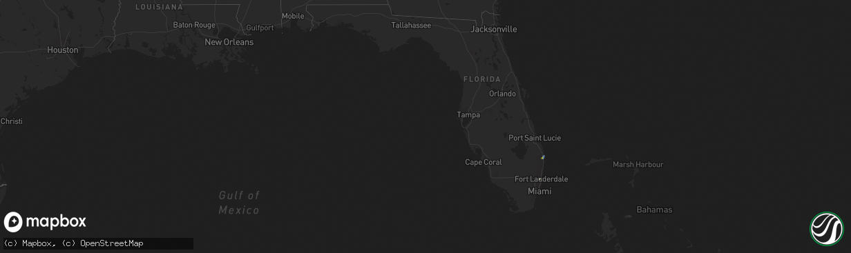
Hail Map in Florida on August 17, 2023
The weather event in Florida on August 17, 2023 includes Hail and Wind maps. 16 states and 203 cities were impacted and suffered possible damage. The total estimated number of properties impacted is 3,047.
Hail
Wind
3,047
Estimated number of impacted properties by a 1.00" hail or larger0
Estimated number of impacted properties by a 1.75" hail or larger0
Estimated number of impacted properties by a 2.50" hail or largerStorm reports in Florida
Florida
| Date | Description |
|---|---|
| 08/17/20233:20 PM CDT | Newspaper employee reports on social media of a large tree branch blocking south olive avenue north of avila road in west palm beach after a severe thunderstorm moved t |
| 08/17/20233:20 PM CDT | Trained spotter reported quarter-size hail for a duration of 5-10 minutes at the intersection of village blvd and palm beach lakes blvd at 4:20pm as a severe thundersto |
| 08/17/20233:16 PM CDT | Broadcast meteorologist reported several large trees uprooted/fallen over in howard park on social media. This occurred in association with a severe thunderstorm that m |
| 08/17/20233:15 PM CDT | Broadcast media reported that a tree fell on a school bus as a severe thunderstorm moved through the area. No injuries were reported at the time of the report. This occ |
| 08/17/20233:15 PM CDT | Earthnetworks mesonet wpbfo west palm beach fire station reported a wind gust of 74mph at 4:15pm as a severe thunderstorm moved through the area. |
| 08/17/20232:08 PM CDT | Asos station kopf miami opa locka reported a wind gust of 60mph at 3:08pm as a strong storm moved through the area. |
| 08/17/20231:33 PM CDT | Earthnetworks mesowest seminole tribe headquarters reported a wind gust of 59mph at 2:33pm as a strong thunderstorm moved through the area. |
| 08/17/202311:56 AM CDT | Mesonet station ar664 frostproof. |
All States Impacted by Hail Map on August 17, 2023
Cities Impacted by Hail Map on August 17, 2023
- Macomb, IL
- Bushnell, IL
- Marietta, IL
- Smithfield, IL
- Table Grove, IL
- Adair, IL
- Steamboat Rock, IA
- Groton, SD
- Zahl, ND
- Wapello, IA
- Bristol, SD
- Marengo, IA
- Lehr, ND
- Columbia, SD
- Windom, MN
- Waubay, SD
- Eldora, IA
- Westbrook, MN
- Iowa Falls, IA
- Braddock, ND
- Williamsburg, IA
- Oakville, IA
- Latimer, IA
- Wilton, ND
- Oquawka, IL
- Dows, IA
- Rowan, IA
- Frederick, SD
- Gladbrook, IA
- Columbus Junction, IA
- Burlington, IA
- Florence, SD
- Roseville, IL
- Andover, SD
- Ivanhoe, MN
- Ashley, ND
- Fenton, IA
- Beaman, IA
- Wellman, IA
- Balaton, MN
- Corwith, IA
- Alden, IA
- Clarion, IA
- Goodwin, SD
- Hazen, ND
- Ainsworth, IA
- Forbes, ND
- Webster, SD
- Parnell, IA
- Riverside, IA
- Morning Sun, IA
- Napoleon, ND
- Clear Lake, SD
- Prairie City, IL
- Grundy Center, IA
- Garrison, ND
- Kalona, IA
- Jackson, MN
- Toledo, IA
- Center, ND
- Armstrong, IA
- Belmond, IA
- Stanton, ND
- Grenora, ND
- Lone Rock, IA
- New Town, ND
- Russell, MN
- Wishek, ND
- Dunnell, MN
- Hendricks, MN
- Alpha, MN
- Chelsea, IA
- Houghton, SD
- Biggsville, IL
- Avon, IL
- Burt, IA
- Ray, ND
- Sterling, ND
- Bancroft, IA
- Dolliver, IA
- Parshall, ND
- Sherburn, MN
- Conrad, IA
- Mediapolis, IA
- Currie, MN
- Slayton, MN
- Kanawha, IA
- Belle Plaine, IA
- Garvin, MN
- Wesley, IA
- Watertown, SD
- Smithshire, IL
- Tracy, MN
- Westby, MT
- Baldwin, ND
- Ridgedale, MO
- Seymour, MO
- Bruner, MO
- Lebanon, MO
- Saint Paul, AR
- Chamois, MO
- Freeburg, MO
- Chadwick, MO
- Meta, MO
- Linn, MO
- Richland, MO
- Rhineland, MO
- Crocker, MO
- Waynesville, MO
- Huntsville, AR
- Bowling Green, MO
- Montgomery City, MO
- Barry, IL
- Hollister, MO
- Versailles, IL
- Charleston, AR
- Chambersburg, IL
- Garrison, MO
- Middletown, MO
- New Salem, IL
- Mount Sterling, IL
- Dixon, MO
- Bellflower, MO
- Brinktown, MO
- Rockport, IL
- Louisiana, MO
- Laquey, MO
- Vermont, IL
- Hartville, MO
- Baylis, IL
- Forsyth, MO
- Green Forest, AR
- Grovespring, MO
- Berryville, AR
- Branson, MO
- Rushville, IL
- New Florence, MO
- Vienna, MO
- Ipava, IL
- Sparland, IL
- Lacon, IL
- Bardolph, IL
- Bradford, IL
- Ellisville, IL
- Lewistown, IL
- Mason City, IL
- San Jose, IL
- Sciota, IL
- Cuba, IL
- Blandinsville, IL
- Liverpool, IL
- Colchester, IL
- Good Hope, IL
- Greenview, IL
- Seneca, IL
- Verona, IL
- West Palm Beach, FL
- Palm Beach, FL
- Magna, UT
- Salt Lake City, UT
- Huntington, IN
- Roanoke, IN
- Wabash, IN
- La Fontaine, IN
- Warren, IN
- Andrews, IN
- Van Buren, IN
- Marion, IN
- Morris, IL
- Warsaw, IN
- Pierceton, IN
- Larwill, IN
- South Whitley, IN
- Ransom, IL
- Randolph, UT
- Laketown, UT
- Columbia City, IN
- Henry, IL
- Fort Lauderdale, FL
- Winona Lake, IN
- Claypool, IN
- Etna Green, IN
- Atwood, IN
- Maryneal, TX
- Sweetwater, TX
- Roscoe, TX
- Warren, OH
- Cortland, OH
- Fowler, OH
- Burghill, OH
- Kinsman, OH
- Farmdale, OH
- Vienna, OH
- Canton, IL
- Tooele, UT
- Bancroft, ID
- Willcox, AZ
- Breckenridge, TX
- Hartford City, IN
- San Tan Valley, AZ
- Idaho Springs, CO
- Georgetown, CO
- Grantsville, UT


