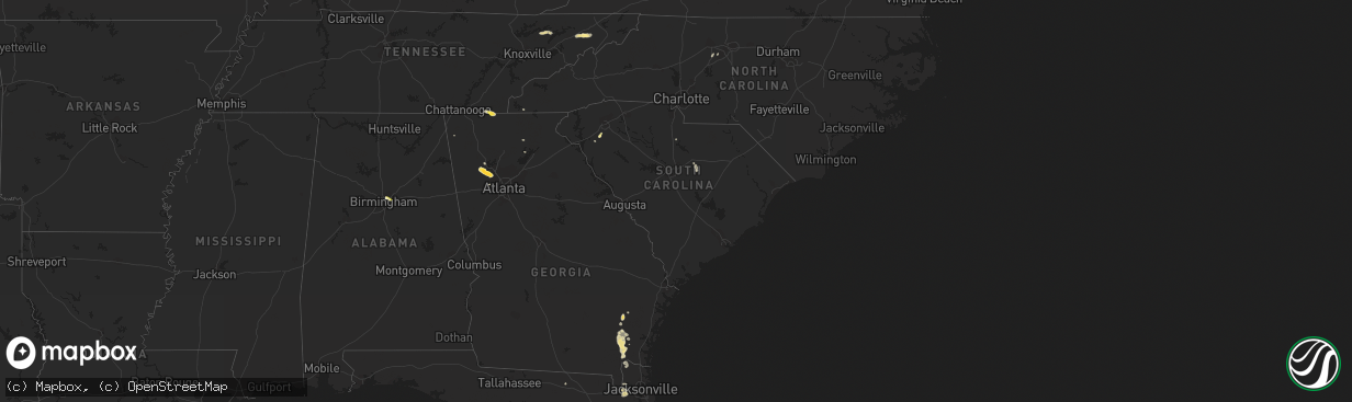
Hail Map in South Carolina on September 12, 2023
The weather event in South Carolina on September 12, 2023 includes Hail and Wind maps. 12 states and 97 cities were impacted and suffered possible damage. The total estimated number of properties impacted is 549.
Hail
Wind
549
Estimated number of impacted properties by a 1.00" hail or larger0
Estimated number of impacted properties by a 1.75" hail or larger0
Estimated number of impacted properties by a 2.50" hail or largerStorm reports in South Carolina
South Carolina
| Date | Description |
|---|---|
| 09/12/20234:40 PM CDT | Multiple downed trees at the intersection of whitmire hwy and beattys bridge rd. |
| 09/12/20233:57 PM CDT | At least one tree was blown down along with several large limbs. A limb was leaning or hanging on a power line but did not bring the power line down. |
| 09/12/20233:05 PM CDT | Spotter reports several trees blown down on walkingstick way. |
| 09/12/20232:45 PM CDT | 911 call center reported numerous trees down across the williamston and belton area. |
| 09/12/20232:16 PM CDT | Powerline down. Time estimated from radar. |
| 09/12/20231:35 PM CDT | Metal awning blew off and damaged part of the union high school roof. Also some large limbs down. |
| 09/12/20231:34 PM CDT | Social media report with photos and video showing garage door to a steel warehouse building blown down. Several slabs of granite also damaged on the loading dock. |
| 09/12/20231:30 PM CDT | Trees down and a trampoline launched onto a roof at residence on peachtree rd. |
| 09/12/20231:30 PM CDT | Multiple trees down around peachtree road... With minor damage to outdoor structures. |
| 09/12/202312:39 AM CDT | Colleton county emergency manager reported a tree down blocking both lanes at 1600 charleston highway. This was associated with the passage of a thunderstorm outflow. T |
| 09/12/202312:39 AM CDT | Colleton county emergency manager reported a tree down blocking both lanes at 1600 charleston highway. This was assoc |
| 09/11/202311:15 PM CDT | Colleton county emergency manager reported a tree down blocking one lane at the intersection of lumber road and sleepy hollow road. This was associated with the passage |
All States Impacted by Hail Map on September 12, 2023
Cities Impacted by Hail Map on September 12, 2023
- Alum Creek, WV
- Gainesville, GA
- Dahlonega, GA
- Belton, SC
- Williamston, SC
- Pelzer, SC
- Afton, TN
- Greeneville, TN
- Dallas, GA
- Acworth, GA
- Kennesaw, GA
- Powder Springs, GA
- Marietta, GA
- Chandler, AZ
- Cisco, GA
- Bisbee, AZ
- Saint Cloud, FL
- Chuckey, TN
- Dawsonville, GA
- Farmville, VA
- Brookneal, VA
- Nathalie, VA
- Rutledge, TN
- Mosheim, TN
- Crandall, GA
- Old Fort, TN
- Washburn, TN
- Douglasville, GA
- Lithia Springs, GA
- Elgin, AZ
- Vail, AZ
- Jesup, GA
- Screven, GA
- Odum, GA
- Limestone, TN
- Sonoita, AZ
- Cartersville, GA
- Emerson, GA
- Nahunta, GA
- Apalachicola, FL
- Brasstown, NC
- Jasper, FL
- Thomasville, NC
- Birmingham, AL
- Mesa, AZ
- Apache Junction, AZ
- Middle River, MD
- Essex, MD
- Aragon, NM
- Reserve, NM
- Jacksonville, FL
- Webster, FL
- Great Falls, SC
- Winston Salem, NC
- Lexington, NC
- Hilliard, FL
- Red Oak, VA
- Randolph, VA
- Saxe, VA
- Truth Or Consequences, NM
- Rembert, SC
- Kensington, MD
- Silver Spring, MD
- Chevy Chase, MD
- Bethesda, MD
- Bryceville, FL
- Palatka, FL
- Patterson, GA
- Folkston, GA
- Hoboken, GA
- Pamplin, VA
- Prospect, VA
- Scottsdale, AZ
- White Oak, GA
- La Fayette, GA
- Buckeye, AZ
- Blackshear, GA
- Interlachen, FL
- Easton, MD
- Black Canyon City, AZ
- Florence, AZ
- Phoenix, AZ
- Cordova, MD
- Prescott, AZ
- Casa Grande, AZ
- Mayer, AZ
- Coolidge, AZ
- Tempe, AZ
- Cave Creek, AZ
- Dalzell, SC
- Peoria, AZ
- Litchfield Park, AZ
- Congress, AZ
- Cabin John, MD
- Globe, AZ
- Peridot, AZ
- Glen Echo, MD


