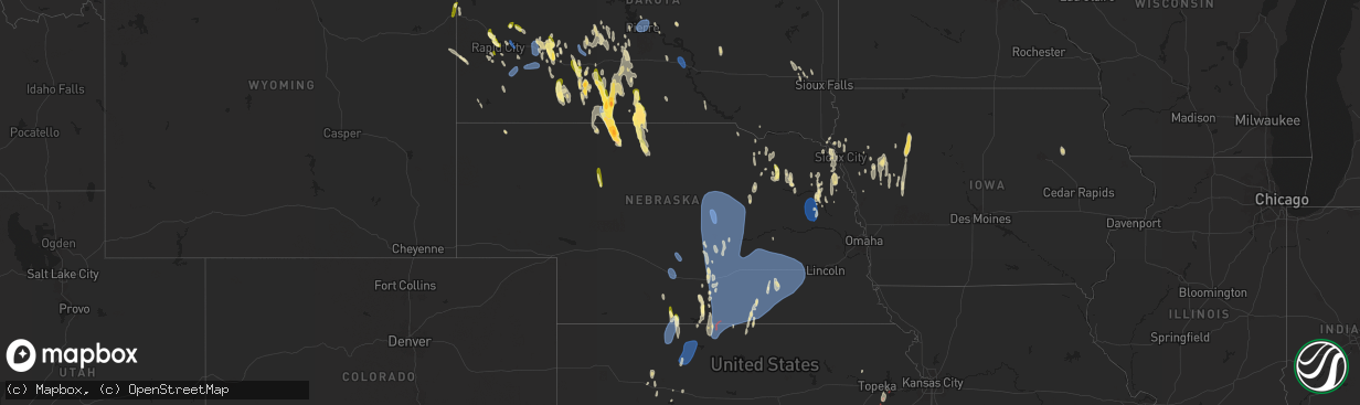
Hail Map in Nebraska on April 15, 2024
The weather event in Nebraska on April 15, 2024 includes Hail, Wind, and Tornado maps. 15 states and 620 cities were impacted and suffered possible damage. The total estimated number of properties impacted is 1,021.
Hail
Wind
Tornado
1,021
Estimated number of impacted properties by a 1.00" hail or larger213
Estimated number of impacted properties by a 1.75" hail or larger0
Estimated number of impacted properties by a 2.50" hail or largerStorm reports in Nebraska
Nebraska
| Date | Description |
|---|---|
| 04/15/20246:23 PM CDT | Time estimated from radar. |
| 04/15/20246:20 PM CDT | Via social media. |
| 04/15/20245:55 PM CDT | Time estimated from radar. |
| 04/15/20245:58 AM CDT | Personal weather station reported a 70 mph wind gust between 555 and 600 am. Time estimated based on radar. |
| 04/15/20245:54 AM CDT | Measured on personal weather station during the time between 545 and 600 am. Time estimated based on radar. |
| 04/15/20243:51 AM CDT | A local report indicates 75 MPH wind near Ord Airport |
| 04/15/20243:51 AM CDT | A local report indicates 59 MPH wind near 8 WSW Ord |
| 04/15/20243:40 AM CDT | A local report indicates 62 MPH wind near 4 NNW Strang |
| 04/15/20243:35 AM CDT | A local report indicates 63 MPH wind near 6 NNE Sherman Reservoir |
| 04/15/20243:30 AM CDT | Photo relayed via the emergency manager of a trampoline on top of the roof of a home. |
| 04/15/20243:20 AM CDT | Report of minor outbuilding damage via facebook. Time estimated from radar. |
| 04/15/20243:10 AM CDT | Report of minor damage at city ballfield and roof damage of nearby metal outbuilding via facebook. Time estimated from radar. |
| 04/15/20243:02 AM CDT | A local report indicates 60 MPH wind near Wood River |
| 04/15/20243:02 AM CDT | Delayed report via personal weather station. |
| 04/15/20243:02 AM CDT | Emergency management reported a grain bin damaged at the local ethanol plant... As well as at least 13 irrigation pivots overturned north of wood river. Broadcast media |
| 04/15/20242:58 AM CDT | A local report indicates 67 MPH wind near 8 S Poole |
| 04/15/20242:58 AM CDT | A local report indicates 61 MPH wind near 6 NNW Shelton |
| 04/15/20242:55 AM CDT | A local report indicates 66 MPH wind near Hastings Airport |
| 04/15/20242:54 AM CDT | Large tree fell onto a garage... Damaging the roof. Time estimated from radar. |
| 04/15/20242:53 AM CDT | A local report indicates 62 MPH wind near 3 NNW Alma |
| 04/15/20242:50 AM CDT | This is a correction to the previous report from 4 se gibbon...clarified location. Report of damaged outbuildings from nw of kenesaw. Time estimated from radar. |
| 04/15/20242:50 AM CDT | Report of damaged outbuildings from 9 nw kenesaw via facebook. Time estimated from radar. |
| 04/15/20242:48 AM CDT | A local report indicates 58 MPH wind near 2 W Gibbon |
| 04/15/20242:48 AM CDT | Via davis personal weather station. Mesovortex passed directly over this location at the time of the severe gust. |
| 04/15/20242:45 AM CDT | A local report indicates 63 MPH wind near 4 NNW Bostwick |
| 04/15/20242:38 AM CDT | A local report indicates 65 MPH wind near 1 W Heartwell |
| 04/15/20242:32 AM CDT | Report of downed power pole and flipped section of pivot via facebook. Time estimated from radar. |
| 04/15/20242:30 AM CDT | Multiple tree branches down... Some large. |
| 04/15/20242:28 AM CDT | A brief ef-0 rated tornado occurred northwest of cowles along highway 281. Damage was very minimal. Peak wind estimated at 65 mph. |
| 04/15/20242:06 AM CDT | A local report indicates 63 MPH wind near 1 SW Eddyville |
| 04/15/20241:37 AM CDT | A local report indicates 59 MPH wind near Lexington Airport |
| 04/15/202412:55 AM CDT | Quarter to half dollar size hail. Hail almost covering the ground. A couple windows broken out on south side of house. Estimated wind gusts of at least 60 mph. |
| 04/14/20247:20 PM CDT | A local report indicates 1.00 inch wind near Wood Lake |
All States Impacted by Hail Map on April 15, 2024
Cities Impacted by Hail Map on April 15, 2024
- Fairmont, WV
- Winchester, VA
- High View, WV
- Berryville, VA
- Stephenson, VA
- Purcellville, VA
- Lovettsville, VA
- Waterford, VA
- Leesburg, VA
- Paeonian Springs, VA
- Dickerson, MD
- Wardensville, WV
- Beallsville, MD
- Poolesville, MD
- Boyds, MD
- Woodstock, VA
- Germantown, MD
- Coalton, WV
- Ellamore, WV
- Gaithersburg, MD
- Middleburg, VA
- Buckhannon, WV
- Carolina, WV
- Farmington, WV
- Worthington, WV
- Mabie, WV
- Norton, WV
- Beverly, WV
- Elkins, WV
- Aldie, VA
- Ashburn, VA
- Sterling, VA
- Glady, WV
- Herndon, VA
- Reston, VA
- Vienna, VA
- Oakton, VA
- Chantilly, VA
- Warrenton, VA
- French Creek, WV
- Tallmansville, WV
- Dunn Loring, VA
- Falls Church, VA
- Arlington, VA
- Adrian, WV
- Horner, WV
- Fort Myer, VA
- Midland, VA
- Catlett, VA
- Street, MD
- Pylesville, MD
- Whiteford, MD
- Washington, DC
- Round Hill, VA
- Bluemont, VA
- Amissville, VA
- Marshall, VA
- Gardners, PA
- Biglerville, PA
- Aspers, PA
- Darlington, MD
- Port Deposit, MD
- Conowingo, MD
- East Berlin, PA
- New Oxford, PA
- York Springs, PA
- Gettysburg, PA
- Abbottstown, PA
- Perryville, MD
- Havre De Grace, MD
- Alexandria, VA
- North East, MD
- Charlestown, MD
- Hanover, PA
- Spring Grove, PA
- Fort Washington, MD
- Temple Hills, MD
- Stafford, VA
- Mill Creek, WV
- Valley Bend, WV
- Elkton, MD
- Chesapeake City, MD
- Middletown, DE
- Nokesville, VA
- Nanjemoy, MD
- Quantico, VA
- Triangle, VA
- Jeffersonton, VA
- Remington, VA
- Parkton, MD
- New Freedom, PA
- White Hall, MD
- Freeland, MD
- Grantsville, WV
- Seven Valleys, PA
- Glen Rock, PA
- Washington, VA
- Barboursville, VA
- Ruckersville, VA
- Welcome, MD
- Charlottesville, VA
- Stewartstown, PA
- Shrewsbury, PA
- Newark, DE
- Normantown, WV
- Circleville, WV
- Bartow, WV
- Arnoldsburg, WV
- Bealeton, VA
- Cedarville, WV
- Gassaway, WV
- Exchange, WV
- Gordonsville, VA
- Rosedale, WV
- King George, VA
- Oxon Hill, MD
- Blue Grass, VA
- Franklin, WV
- Naval Anacost Annex, DC
- Taylors Island, MD
- Madison, MD
- Newburg, MD
- Goldvein, VA
- Fredericksburg, VA
- Railroad, PA
- Dahlgren, VA
- Glenville, PA
- Sumerduck, VA
- Richardsville, VA
- Huttonsville, WV
- Sutton, WV
- Flatwoods, WV
- Colonial Beach, VA
- Issue, MD
- Church Creek, MD
- Louisa, VA
- Woolford, MD
- Durbin, WV
- Spotsylvania, VA
- Lignum, VA
- Elkwood, VA
- Diana, WV
- Cowen, WV
- Fawn Grove, PA
- New Park, PA
- Garden City, TX
- Cobb Island, MD
- Montross, VA
- Cambridge, MD
- Crapo, MD
- Mineral, VA
- Big Spring, TX
- Port Royal, VA
- Woodford, VA
- Rappahannock Academy, VA
- Webster Springs, WV
- Colorado City, TX
- Westbrook, TX
- Vienna, MD
- Keswick, VA
- Nanticoke, MD
- Princess Anne, MD
- Tyaskin, MD
- Slatyfork, WV
- Valley Head, WV
- Bergoo, WV
- Bumpass, VA
- Bivalve, MD
- Palmyra, VA
- Scottsville, VA
- Snyder, TX
- Hermleigh, TX
- Coahoma, TX
- Montpelier, VA
- Bremo Bluff, VA
- Glen Allen, VA
- Quantico, MD
- Rockville, VA
- Beaverdam, VA
- Fork Union, VA
- Columbia, VA
- Goochland, VA
- Kents Store, VA
- Whitman, NE
- Aspermont, TX
- Hermosa, SD
- Sundance, WY
- Beulah, WY
- Sandy Hook, VA
- Gum Spring, VA
- Earlysville, VA
- Old Glory, TX
- Valentine, NE
- Kilgore, NE
- Crookston, NE
- Paducah, TX
- Custer, SD
- Charlestown, IN
- Thermopolis, WY
- Edgemont, SD
- Mullen, NE
- Aladdin, WY
- Belle Fourche, SD
- Wanblee, SD
- Kadoka, SD
- Saint Francis, SD
- Hill City, SD
- Cody, NE
- Cartersville, VA
- Goshen, KY
- Westport, KY
- La Grange, KY
- Newcastle, WY
- Hot Springs, SD
- Rapid City, SD
- Seymour, TX
- Crowell, TX
- Piedmont, SD
- Long Valley, SD
- Black Hawk, SD
- Parmelee, SD
- Keystone, SD
- Spearfish, SD
- Norris, SD
- White River, SD
- Sturgis, SD
- Powhatan, VA
- Quanah, TX
- Box Elder, SD
- Ellsworth Afb, SD
- Wall, SD
- Quinn, SD
- Chillicothe, TX
- Eldorado, OK
- Wood Lake, NE
- Wasta, SD
- Buckner, KY
- Tuthill, SD
- Moseley, VA
- Cyclone, WV
- Philip, SD
- Olustee, OK
- Altus, OK
- Glen Fork, WV
- Brenton, WV
- Pineville, WV
- Jesse, WV
- Oceana, WV
- Matheny, WV
- Elmer, OK
- Davin, WV
- Martin, SD
- Mission, SD
- Crestwood, KY
- Belvidere, SD
- Saulsville, WV
- New Richmond, WV
- Herndon, WV
- Williamstown, KY
- Dry Ridge, KY
- Ransom, KY
- Phelps, KY
- Allen, SD
- Jonesville, KY
- New Underwood, SD
- Owenton, KY
- Wood, SD
- Midland, SD
- Shelbyville, KY
- Simpsonville, KY
- Scenic, SD
- Northfork, WV
- Welch, WV
- Timber Lake, SD
- Fairburn, SD
- Anawalt, WV
- Murdo, SD
- Corinth, KY
- Kimper, KY
- Pinsonfork, KY
- Owanka, SD
- Buffalo Gap, SD
- Hurley, VA
- Draper, SD
- Caputa, SD
- Hanston, KS
- Jetmore, KS
- Falmouth, KY
- Ness City, KS
- Cynthiana, KY
- Sadieville, KY
- Fort Pierre, SD
- Pierre, SD
- Pierce, NE
- Osmond, NE
- Plainview, NE
- Mount Sterling, KY
- Okaton, SD
- Royal, NE
- Winnetoon, NE
- Orchard, NE
- Collyer, KS
- Hoxie, KS
- Creighton, NE
- Verdigre, NE
- Morland, KS
- Quinter, KS
- Bloomfield, NE
- Norton, KS
- Lenora, KS
- Almena, KS
- Chadron, NE
- Long Island, KS
- Prairie View, KS
- Beaver City, NE
- Stamford, NE
- Oxford, NE
- Center, NE
- Hayes, SD
- Dighton, KS
- Montrose, SD
- Ogallah, KS
- Waukomis, OK
- Watonga, OK
- Edison, NE
- Ellis, KS
- Damar, KS
- Stockton, KS
- Arapahoe, NE
- Kingfisher, OK
- Omega, OK
- Loyal, OK
- Humboldt, SD
- Bogue, KS
- Logan, KS
- Phillipsburg, KS
- Glade, KS
- Hoskins, NE
- Norfolk, NE
- Pender, NE
- Walthill, NE
- Enid, OK
- Rosalie, NE
- Salem, SD
- Randolph, NE
- Drummond, OK
- Wakefield, NE
- Wayne, NE
- Niobrara, NE
- Wisner, NE
- Canova, SD
- Winfred, SD
- Winnebago, NE
- Thurston, NE
- Bancroft, NE
- Beemer, NE
- Hunter, OK
- Kremlin, OK
- Hartford, SD
- Burke, SD
- Emerson, NE
- Hubbard, NE
- Avon, SD
- Lamont, OK
- Medford, OK
- Hennessey, OK
- Bison, OK
- Lexington, NE
- Elwood, NE
- Cozad, NE
- Naponee, NE
- Tyndall, SD
- Jackson, NE
- South Sioux City, NE
- Sioux City, IA
- North Sioux City, SD
- Douglas, OK
- Kensington, KS
- Homer, NE
- Jefferson, SD
- Dakota City, NE
- Republican City, NE
- Smith Center, KS
- Riverton, NE
- Wilcox, NE
- Hildreth, NE
- Bloomington, NE
- Franklin, NE
- Holdrege, NE
- Merrill, IA
- Athol, KS
- Inavale, NE
- Lebanon, KS
- Red Cloud, NE
- Campbell, NE
- Bladen, NE
- Upland, NE
- Alva, OK
- Freedom, OK
- Coldwater, KS
- Lake City, KS
- Hornick, IA
- Westfield, IA
- Axtell, NE
- Funk, NE
- Colome, SD
- Winner, SD
- Blue Hill, NE
- Roseland, NE
- Holstein, NE
- Ayr, NE
- Minden, NE
- Sumner, NE
- Eddyville, NE
- Oconto, NE
- Danbury, IA
- Mapleton, IA
- Smithland, IA
- Oto, IA
- Hinton, IA
- Anthon, IA
- Superior, NE
- Lawrence, NE
- Guide Rock, NE
- Glenvil, NE
- Nelson, NE
- Deweese, NE
- Hastings, NE
- Fairfield, NE
- Juniata, NE
- Edgar, NE
- Oak, NE
- Clay Center, NE
- Inland, NE
- Correctionville, IA
- Battle Creek, IA
- Gibbon, NE
- Kearney, NE
- Charter Oak, IA
- Denison, IA
- Eagle Butte, SD
- Davenport, NE
- Harvard, NE
- Trumbull, NE
- Gettysburg, SD
- Ida Grove, IA
- Pleasanton, NE
- Kingsley, IA
- Pierson, IA
- Schleswig, IA
- Otis, KS
- Bison, KS
- Saronville, NE
- Ong, NE
- Carleton, NE
- Kenesaw, NE
- Heartwell, NE
- Riverdale, NE
- Shelton, NE
- Alda, NE
- Wood River, NE
- Doniphan, NE
- Chapman, NE
- Ravenna, NE
- Cairo, NE
- Grand Island, NE
- Phillips, NE
- Loup City, NE
- Hazard, NE
- Dannebrog, NE
- Boelus, NE
- Ashton, NE
- Farwell, NE
- Litchfield, NE
- Saint Libory, NE
- Rockville, NE
- Giltner, NE
- Aurora, NE
- Geneva, NE
- Shickley, NE
- Sutton, NE
- Kennebec, SD
- Wessington Springs, SD
- Bruning, NE
- Strang, NE
- Saint Paul, NE
- Hampton, NE
- Marquette, NE
- Central City, NE
- Henderson, NE
- Grafton, NE
- Palmer, NE
- Elba, NE
- Arcadia, NE
- Scotia, NE
- North Loup, NE
- Archer, NE
- Wolbach, NE
- Ord, NE
- Holstein, IA
- Wessington, SD
- Manilla, IA
- Elk Point, SD
- Cushing, IA
- Corsicana, TX
- Westside, IA
- Vail, IA
- Lebanon, SD
- Fairmont, NE
- McCool Junction, NE
- York, NE
- Bradshaw, NE
- Ohiowa, NE
- Hordville, NE
- Greeley, NE
- Olpe, KS
- Emporia, KS
- Neosho Rapids, KS
- Breda, IA
- Onida, SD
- Kiron, IA
- Deloit, IA
- Tobias, NE
- Exeter, NE
- Milligan, NE
- Clarks, NE
- Polk, NE
- Elyria, NE
- Burwell, NE
- Comstock, NE
- Spalding, NE
- Primrose, NE
- Ericson, NE
- Wall Lake, IA
- Piedmont, KS
- Odebolt, IA
- Lincolnville, KS
- Eureka, KS
- Bartlett, NE
- Beaver Crossing, NE
- Garland, NE
- Crete, NE
- Milford, NE
- Seward, NE
- Malcolm, NE
- Waco, NE
- Dorchester, NE
- Benedict, NE
- Gresham, NE
- Lincoln, NE
- Western, NE
- Utica, NE
- Pleasant Dale, NE
- Stromsburg, NE
- Staplehurst, NE
- Friend, NE
- Goehner, NE
- Cordova, NE
- Denton, NE
- Bee, NE
- Harrold, SD
- Petersburg, NE
- Early, IA
- Lake View, IA
- Highmore, SD
- Holabird, SD
- Storm Lake, IA
- Elgin, NE
- Clearwater, NE
- Alta, IA
- Nemaha, IA
- Sac City, IA
- Lynch, NE
- Newell, IA
- Tolstoy, SD
- Onaka, SD
- Hoven, SD
- Bowdle, SD
- Roscoe, SD
- Albert City, IA
- Neligh, NE
- Burr Oak, KS
- Meadow Grove, NE
- Marathon, IA
- Mankato, KS
- Hazleton, IA
- Fairbank, IA
- Independence, IA
- Reliance, SD
- Lower Brule, SD
- Brunswick, NE
- Oelwein, IA
- Dodge, NE
- Lyons, NE
- West Point, NE
- Onawa, IA
- Ponca, NE
- Lebo, KS
- Oakland, NE
- Carbondale, KS
- Overbrook, KS
- Reading, KS
- Osage City, KS
- Melvern, KS
- Lyndon, KS
- Scranton, KS
- Vassar, KS
- Scribner, NE
- Berryton, KS
- Stanton, NE
- Lecompton, KS
- Howells, NE
- Rogers, NE
- Schuyler, NE
- Clarkson, NE
- Pilger, NE
- Silver Creek, NE
- Delia, KS
- Le Mars, IA
- Capon Bridge, WV


