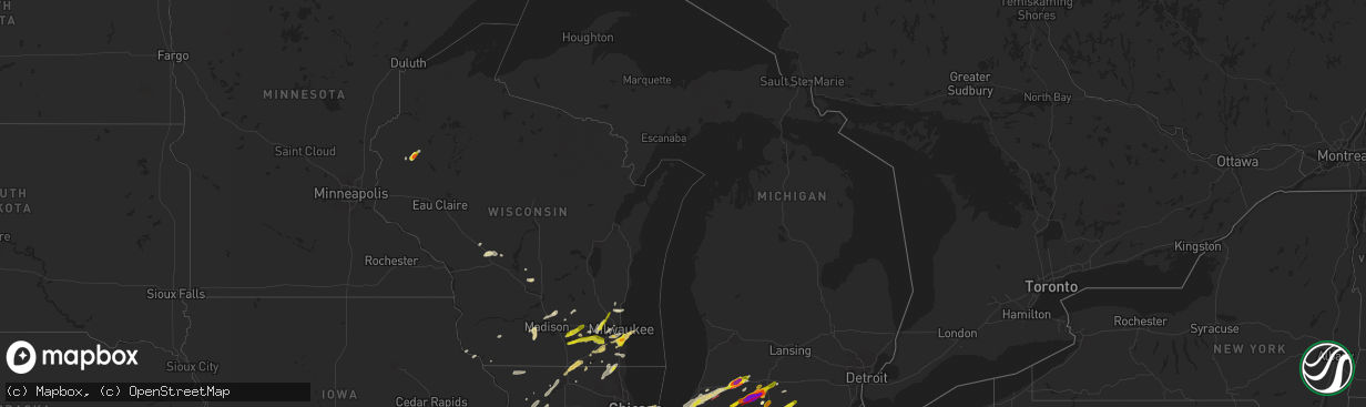
Hail Map in Michigan on May 7, 2024
The weather event in Michigan on May 7, 2024 includes Hail, Wind, and Tornado maps. 19 states and 876 cities were impacted and suffered possible damage. The total estimated number of properties impacted is 72,236.
Hail
Wind
Tornado
72,236
Estimated number of impacted properties by a 1.00" hail or larger48,349
Estimated number of impacted properties by a 1.75" hail or larger6,571
Estimated number of impacted properties by a 2.50" hail or largerStorm reports in Michigan
Michigan
| Date | Description |
|---|---|
| 05/07/20246:43 PM CDT | Time estimated from radar. |
| 05/07/20246:22 PM CDT | Time estimated by radar. |
| 05/07/20246:18 PM CDT | Two trained spotters reporting a tornado touchdown in portage. |
| 05/07/20246:13 PM CDT | Multiple trees and power lines down across road. Possible tornado. |
| 05/07/20245:45 PM CDT | Trained spotter recorded video of a large cone tornado in colon. Time given by spotter. |
| 05/07/20245:17 PM CDT | A local report indicates 1.50 inch wind near Coldwater |
| 05/07/20245:14 PM CDT | Numerous trees and wires down in tekonsha. Time is estimated via radar. |
| 05/07/20245:14 PM CDT | Numerous trees and wires down in tekonsha. Time is estimated via radar. 0 to 60 feet high. |
| 05/07/20245:11 PM CDT | Picture shared on twitter of hail stone measuring upwards of 4 inches. |
| 05/07/20245:08 PM CDT | Photo on x/twitter shows a 4 inch diameter hailstone!. |
| 05/07/20245:07 PM CDT | A brief ef-1 tornado developed southwest of union city... Mi as larger tornado dissipated to the northwest |
| 05/07/20245:06 PM CDT | Estimated 3 foot diameter trees down. Estimated time via radar. |
| 05/07/20245:06 PM CDT | Fed ex building damaged. Possible tornado. |
| 05/07/20245:05 PM CDT | *** 1 inj *** a lady taking cover from possible tornado was hit by debris as she got out of her car. Her leg is broken. |
| 05/07/20245:01 PM CDT | A local report indicates 2.00 inch wind near 2 NW Portage |
| 05/07/20245:00 PM CDT | Radar confirmed tornado. Time estimated via radar. |
| 05/07/20245:00 PM CDT | Tree damage near glenwood. |
| 05/07/20245:00 PM CDT | Tree damage reported in leonidas by broadcast media. |
| 05/07/20245:00 PM CDT | Pictures shared of up to tennis ball size hail. |
| 05/07/20245:00 PM CDT | Tornado damage in sherwood along arney road relayed by trained spotters. Trees snapped and damage to at least one house. Time estimated from radar. |
| 05/07/20245:00 PM CDT | Video of debris being lofted in sherwood. Time estimated by tds on radar. Relayed by trained spotter. |
| 05/07/20245:00 PM CDT | Photo of a tornado in mendon and time of occurrence relayed by broadcast media. Several photos from x/twitter show a large tornado on the ground in and near mendon mi. |
| 05/07/20244:56 PM CDT | A local report indicates 1.75 inch wind near 2 NNW Fairfax |
| 05/07/20244:55 PM CDT | Large trees down... Power lines down... Shingles scattered around. Possible tornado. Time estimated based on radar. |
| 05/07/20244:55 PM CDT | The ef2 tornado touched down near the intersection of south 10th street and west r avenue and traveled east/northeast for around 11 miles until it lifted north of east |
| 05/07/20244:53 PM CDT | Reports of trees down and farm damage on farrand rd... West of the roundabout. |
| 05/07/20244:53 PM CDT | Corrects previous tstm wnd dmg report from 1 wnw colon. Reports of trees down and farm damage on farrand rd... West of the roundabout. |
| 05/07/20244:52 PM CDT | Trees snapped near colon... Likely from a tornado. Photos sent in by a trained spotter. Confirmed tds on radar. Time estimated by radar. |
| 05/07/20244:50 PM CDT | A local report indicates a tornado near 3 ESE Mendon |
| 05/07/20244:50 PM CDT | Report from mping: quarter |
| 05/07/20244:50 PM CDT | Corrects time of previous tornado report from colon. Trained spotter recorded video of a large cone tornado in colon. |
| 05/07/20244:50 PM CDT | Damage to a home and trees snapped in colon. Time estimated by tds on radar. |
| 05/07/20244:43 PM CDT | Photo on facebook of a large tornado on the ground between centreville and colon... Just north of nottawa. Time estimated by radar. |
| 05/07/20244:42 PM CDT | Video on facebook shows tornado on the ground near centreville mi. Time estimated from radar. |
| 05/07/20244:41 PM CDT | A tornado touched down in st. Joseph county on the south side of centreville and then tracked northeast... Passing north of colon... Crossing into branch county near ha |
| 05/07/20244:32 PM CDT | Chaser provided photos of several trees uprooted and snapped just south of decatur. Time is estimated by radar. |
| 05/07/20244:30 PM CDT | Delayed report. Time estimated by radar. |
| 05/07/20244:15 PM CDT | Photos on facebook show heavy tree damage near twin lakes... Just northeast of dowagiac. Numerous trees of varying sizes snapped or uprooted. Time estimated by radar. |
| 05/07/20244:15 PM CDT | Time estimated by radar. Facebook photo shows two center pivots flipped and damaged. At the intersection of atwood road and gage street. |
| 05/07/20244:11 PM CDT | An ef-1 tornado with maximum wind speeds of 95 mph occurred in the early evening of may 7th in cass county... Mi. The tornado touched down in a field just north of the |
| 05/07/20244:00 PM CDT | Delayed report. |
| 05/07/20243:38 PM CDT | A local report indicates 1.00 inch wind near New Buffalo |
| 05/06/20248:43 PM CDT | St. Clair county dispatch relayed a report of fence and property damage to a home along ruskin ave. |
| 05/06/20248:38 PM CDT | Damage to a garage door and exterier wall occurred. |
| 05/06/20248:28 PM CDT | Measured at m-18 midot site |
| 05/06/20248:28 PM CDT | Boat storage structure blown down at a marina in harrison township. |
| 05/06/20248:28 PM CDT | Measured at m-18 midot site. |
| 05/06/20248:23 PM CDT | Tree downed on house near harvard shore dr and jefferson ave. |
All States Impacted by Hail Map on May 7, 2024
Cities Impacted by Hail Map on May 7, 2024
- Alma, AR
- Mulberry, AR
- Ozark, AR
- Melvin, TX
- Mount Washington, KY
- Prophetstown, IL
- Milledgeville, IL
- Polo, IL
- Sterling, IL
- Rock Falls, IL
- Lyndon, IL
- Dixon, IL
- Baileyville, IL
- Oregon, IL
- Mount Morris, IL
- Leaf River, IL
- Kinsman, IL
- Verona, IL
- Morris, IL
- Mazon, IL
- Winnebago, IL
- Byron, IL
- Channahon, IL
- Wilmington, IL
- Coal City, IL
- Minooka, IL
- Joliet, IL
- Rockford, IL
- Elwood, IL
- Shorewood, IL
- Forreston, IL
- Alsip, IL
- Homer Glen, IL
- Franklin Grove, IL
- Machesney Park, IL
- Roscoe, IL
- Loves Park, IL
- Clinton, WI
- Plainfield, IL
- Chicago, IL
- New Lenox, IL
- Manhattan, IL
- Mokena, IL
- Lockport, IL
- Evergreen Park, IL
- Orland Park, IL
- Lemont, IL
- Waukesha, WI
- Wales, WI
- Delafield, WI
- Oak Lawn, IL
- Caledonia, IL
- South Beloit, IL
- Poplar Grove, IL
- Tinley Park, IL
- Belvidere, IL
- Garden Prairie, IL
- Janesville, WI
- Romeoville, IL
- Beloit, WI
- Dousman, WI
- Capron, IL
- Harvard, IL
- Crest Hill, IL
- Morehead, KY
- Oak Forest, IL
- Palos Heights, IL
- Palos Park, IL
- Frankfort, IL
- Crestwood, IL
- Midlothian, IL
- Whitewater, WI
- Avalon, WI
- Delavan, WI
- Sharon, WI
- Darien, WI
- Pewaukee, WI
- Palos Hills, IL
- Worth, IL
- Chicago Ridge, IL
- Robbins, IL
- Blue Island, IL
- Riverdale, IL
- Verona, WI
- Owingsville, KY
- Salt Lick, KY
- Hickory Hills, IL
- Lyons, IL
- La Grange, IL
- Brookfield, IL
- Sussex, WI
- Hartland, WI
- Belleville, WI
- Walworth, WI
- Mount Horeb, WI
- Bridgeview, IL
- Willow Springs, IL
- Marengo, IL
- Cross Plains, WI
- Williams Bay, WI
- Cedar Lake, IN
- Elkhorn, WI
- Lake Geneva, WI
- Fontana, WI
- Hometown, IL
- La Grange Park, IL
- Burbank, IL
- Hobart, IN
- Portage, IN
- Merrillville, IN
- Menomonee Falls, WI
- Colgate, WI
- Valparaiso, IN
- Germantown, WI
- Richfield, WI
- Chesterton, IN
- Eagle, WI
- Martinsville, IL
- Panther, WV
- Casey, IL
- Burlington, WI
- Crown Point, IN
- Mohawk, WV
- Marshall, IL
- East Troy, WI
- Rochester, WI
- Waterford, WI
- Springfield, WI
- Hebron, IL
- Beverly Shores, IN
- Michigan City, IN
- Markham, IL
- Westville, IN
- Mukwonago, WI
- Mchenry, IL
- Iaeger, WV
- Ringwood, IL
- Spring Grove, IL
- Dennison, IL
- West Terre Haute, IN
- Franklin, WI
- Ingleside, IL
- Fox Lake, IL
- New Buffalo, MI
- Trevor, WI
- Salem, WI
- Round Lake, IL
- Antioch, IL
- Lake Villa, IL
- Franksville, WI
- Muskego, WI
- Oak Creek, WI
- Caledonia, WI
- Terre Haute, IN
- Union Pier, MI
- Dobson, NC
- Racine, WI
- South Milwaukee, WI
- Cudahy, WI
- Lakeside, MI
- Jesup, IA
- Clinton, IN
- La Porte, IN
- Bridgman, MI
- Baroda, MI
- Buchanan, MI
- Sawyer, MI
- Kenosha, WI
- Rutherfordton, NC
- Bristol, WI
- Gary, IN
- Sturtevant, WI
- Three Oaks, MI
- Downers Grove, IL
- Lisle, IL
- Woodridge, IL
- Union Grove, WI
- Berrien Springs, MI
- Brazil, IN
- Independence, IA
- Homewood, IL
- Country Club Hills, IL
- Harvey, IL
- Matteson, IL
- Hazel Crest, IL
- Flossmoor, IL
- New Troy, MI
- Staunton, IN
- Turtle Lake, WI
- Almena, WI
- Hillsdale, IN
- Darlington, IN
- Berrien Center, MI
- Eau Claire, MI
- Charleston, IL
- Reidsville, NC
- Harmony, IN
- Reelsville, IN
- Sodus, MI
- White Pigeon, MI
- Constantine, MI
- Dowagiac, MI
- Westfield, IL
- South Holland, IL
- Clarks Hill, IN
- Colfax, IN
- Frankfort, IN
- Dolton, IL
- Cumberland, WI
- Comstock, WI
- Calumet City, IL
- Knightsville, IN
- Saint Joseph, MI
- Benton Harbor, MI
- Union, MI
- Edwardsburg, MI
- Winthrop, IA
- Ferguson, NC
- Crawfordsville, IN
- Greencastle, IN
- Jones, MI
- Millers Creek, NC
- Wilkesboro, NC
- Decatur, MI
- Hartford, MI
- Lenoir, NC
- Boomer, NC
- Colfax, WI
- Wheeler, WI
- New Berlin, WI
- Michigantown, IN
- Vandalia, MI
- Cassopolis, MI
- Cloverdale, IN
- Osseo, WI
- Three Rivers, MI
- Mendon, MI
- Fillmore, IN
- North Wilkesboro, NC
- Hebron, IN
- Taylorsville, NC
- Highland, IN
- Hammond, IN
- Griffith, IN
- Masonville, IA
- Centreville, MI
- Tipton, IN
- Kempton, IN
- Forest, IN
- Paris, IL
- Carbon, IN
- Rosedale, IN
- Paw Paw, MI
- Lawton, MI
- Lake Station, IN
- Jamestown, IN
- Russiaville, IN
- Leonidas, MI
- Fulton, MI
- Putnamville, IN
- Coatesville, IN
- Colon, MI
- Athens, MI
- Sherwood, MI
- Union City, MI
- Kalamazoo, MI
- Jacksonville, NC
- Dundee, IA
- Whitestown, IN
- Lebanon, IN
- Mattawan, MI
- Calmar, IA
- Peru, IN
- Manchester, IA
- Stilesville, IN
- Sharpsville, IN
- Burlington, MI
- Portage, MI
- Tekonsha, MI
- North Manchester, IN
- Laketon, IN
- Camp Lejeune, NC
- Roann, IN
- Wabash, IN
- Denver, IN
- Westfield, IN
- Sheridan, IN
- Decorah, IA
- Tomah, WI
- Warrens, WI
- West Union, IL
- Harbert, MI
- Windfall, IN
- Greentown, IN
- Farmersburg, IN
- Shelburn, IN
- Elkin, NC
- Angola, IN
- Coldwater, MI
- Greenwood, IN
- Indianapolis, IN
- Mooresville, IN
- Ceresco, MI
- East Leroy, MI
- Liberty Mills, IN
- Claypool, IN
- South Whitley, IN
- State Road, NC
- Climax, MI
- Scotts, MI
- Galesburg, MI
- Marshall, MI
- Vicksburg, MI
- Pimento, IN
- Lewis, IN
- Martinsville, IN
- Stevensville, MI
- West Newton, IN
- Camby, IN
- Columbia City, IN
- Pierceton, IN
- Larwill, IN
- Jonesboro, IN
- Fairmount, IN
- Fairbanks, IN
- Whitehall, MI
- Montague, MI
- Battle Creek, MI
- Urbana, IN
- Lagro, IN
- Greeley, IA
- Edgewood, IA
- Churubusco, IN
- Albion, IN
- Huntington, IN
- Morgantown, IN
- Clay City, IN
- Trafalgar, IN
- Homer, MI
- Earlville, IA
- Dyersville, IA
- New Vienna, IA
- Poland, IN
- Cassville, WI
- Monrovia, IN
- Marion, IN
- Gas City, IN
- Upland, IN
- Avilla, IN
- Kendallville, IN
- Corunna, IN
- Waterloo, IN
- Hudson, IN
- Ashley, IN
- Siloam, NC
- Pinnacle, NC
- Watervliet, MI
- Laotto, IN
- Garrett, IN
- Albion, MI
- Franklin, IN
- Bargersville, IN
- Quincy, IN
- Beech Grove, IN
- Clayton, IN
- Cory, IN
- Coal City, IN
- Bowling Green, IN
- Durango, IA
- Dubuque, IA
- Peosta, IA
- Patricksburg, IN
- Plainfield, IN
- Shelbyville, IN
- Edinburgh, IN
- King, NC
- Pilot Mountain, NC
- Ronda, NC
- Silver Lake, IN
- Linden, WI
- Livingston, WI
- Montfort, WI
- Avon, IN
- Cascade, VA
- Axton, VA
- Danville, VA
- Brooklyn, IN
- Rice Lake, WI
- Stony Point, NC
- Ellettsville, IN
- Bloomington, IN
- Gosport, IN
- Sherrill, IA
- Spencer, IN
- Greenfield, IN
- Auburn, IN
- Dodgeville, WI
- Pleasant Lake, IN
- Hamilton, IN
- Wisconsin Dells, WI
- Guttenberg, IA
- Holy Cross, IA
- Manilla, IN
- Waldron, IN
- Germanton, NC
- Walnut Cove, NC
- New Market, AL
- Muncie, IN
- Montgomery, MI
- Fremont, IN
- Hazel Green, AL
- Warsaw, IN
- Whiteland, IN
- Milroy, IN
- Saint Paul, IN
- Schoolcraft, MI
- Cuba City, WI
- Oxford, WI
- Reading, MI
- Camden, MI
- Eden, NC
- Ararat, NC
- Boonville, NC
- Elora, TN
- Hillsdale, MI
- Needham, IN
- Homer, IN
- Boggstown, IN
- Fairland, IN
- Rushville, IN
- Richland, MI
- Augusta, MI
- Flintville, TN
- Edon, OH
- Osseo, MI
- North Adams, MI
- Jerome, MI
- Saint Meinrad, IN
- Ferdinand, IN
- Bristow, IN
- Evanston, IN
- Winchester, IN
- Farmland, IN
- Ruffin, NC
- Glenwood, IN
- Birdseye, IN
- Connersville, IN
- Wolcottville, IN
- Union City, IN
- Camp Douglas, WI
- Stockton, IL
- Laurel, IN
- Black River Falls, WI
- Rome City, IN
- Topeka, IN
- Nineveh, IN
- Greensburg, IN
- Coldwater, OH
- Fort Recovery, OH
- Dry Fork, VA
- Monroeville, IN
- Payne, OH
- Deforest, WI
- Waunakee, WI
- Madison, WI
- Lena, IL
- Lagrange, IN
- Flat Rock, IN
- Union City, OH
- Wawaka, IN
- Latty, OH
- Paulding, OH
- Haviland, OH
- Oakwood, OH
- Melrose, OH
- New Bremen, OH
- Saint Marys, OH
- New Knoxville, OH
- Wapakoneta, OH
- Sun Prairie, WI
- Windsor, WI
- Bronson, MI
- English, IN
- Stinesville, IN
- Metamora, IN
- Liberty, IN
- New Palestine, IN
- Westport, IN
- Fort Atkinson, WI
- Jefferson, WI
- Brookville, IN
- Milton, WI
- Edgerton, WI
- Oldenburg, IN
- Louisville, IL
- Cambridge, WI
- Depauw, IN
- Milltown, IN
- Leavenworth, IN
- Unionville, IN
- Columbus, IN
- Rio, WI
- Osgood, IN
- Sulphur, IN
- Johnson Creek, WI
- Helenville, WI
- Watertown, WI
- Sullivan, WI
- Deerfield, WI
- Columbus, WI
- Marshall, WI
- Waterloo, WI
- Ramsey, IN
- Oxford, OH
- Bath, IN
- Cedar Grove, IN
- Ingraham, IL
- Noble, IL
- Clay City, IL
- Palmyra, WI
- West Harrison, IN
- Okeana, OH
- Pittsford, MI
- Sunman, IN
- Batesville, IN
- Lake Mills, WI
- Waldron, MI
- North Prairie, WI
- Reeseville, WI
- Adams, WI
- Menlo, GA
- Concord, MI
- Hanover, MI
- Hope, IN
- Newton, IL
- Corydon, IN
- Big Bend, WI
- Hamilton, OH
- Trion, GA
- Summerville, GA
- Sainte Marie, IL
- Willow Hill, IL
- Oblong, IL
- Robinson, IL
- West Liberty, IL
- La Fayette, GA
- Milwaukee, WI
- Hutsonville, IL
- Sullivan, IN
- Stoy, IL
- West York, IL
- Guilford, IN
- Lawrenceburg, IN
- Elm Grove, WI
- Brookfield, WI
- Middletown, OH
- Fairfield, OH
- West Chester, OH
- Cable, OH
- Urbana, OH
- Trenton, OH
- Morrow, OH
- Lebanon, OH
- Oregonia, OH
- Cedarburg, WI
- Grafton, WI
- Greendale, WI
- Hales Corners, WI
- Cincinnati, OH
- Monroe, OH
- Woodstock, OH
- Mechanicsburg, OH
- Holton, IN
- Harrison, OH
- Kansasville, WI
- Cleves, OH
- South Lebanon, OH
- Clarksville, OH
- Roaring River, NC
- Loveland, OH
- Maineville, OH
- Butlerville, IN
- Mason, OH
- Jasonville, IN
- Ikes Fork, WV
- Lawrenceville, IL
- Irwin, OH
- Milford Center, OH
- Plain City, OH
- Marysville, OH
- Freedom, IN
- Worthington, IN
- Milan, IN
- Saukville, WI
- West Bend, WI
- Paragon, IN
- Riley, IN
- Centerpoint, IN
- Goshen, OH
- Clifford, IN
- Milford, OH
- Pleasant Plain, OH
- Solsberry, IN
- Bloomfield, IN
- Hartsville, IN
- Aurora, IN
- Moores Hill, IN
- Midland, OH
- Blanchester, OH
- Springville, IN
- Lynchburg, OH
- Martinsville, OH
- Jackson, MO
- Batavia, OH
- Fayetteville, OH
- Miamiville, OH
- Nashville, IN
- Makanda, IL
- Hillsboro, OH
- Amelia, OH
- Goreville, IL
- Marion, IL
- New Vienna, OH
- Williamsburg, OH
- Mount Orab, OH
- Bedford, IN
- Carbondale, IL
- Heltonville, IN
- Bridgeport, IL
- Norman, IN
- Creal Springs, IL
- Greenfield, OH
- Bainbridge, OH
- Seymour, IN
- Brownstown, IN
- Freetown, IN
- Pittsburg, IL
- Norris City, IL
- Waverly, OH
- Peebles, OH
- Stonefort, IL
- Carrier Mills, IL
- Mount Vernon, IN
- Chillicothe, OH
- Thompsonville, IL
- New Burnside, IL
- Harrisburg, IL
- Galatia, IL
- Junction, IL
- Equality, IL
- Ozark, IL
- Cairo, IL
- Hammondsville, OH
- Irondale, OH
- New Cumberland, WV
- Toronto, OH
- Chester, WV
- Georgetown, PA
- Weiner, AR
- Shawneetown, IL
- Wellsville, OH
- Eddyville, IL
- Amagon, AR
- Newport, AR
- Herod, IL
- Royal, AR
- Williamsville, MO
- Bonnerdale, AR
- Mound City, IL
- Beaver, PA
- Beaver Falls, PA
- McClure, IL
- Jonesboro, IL
- Jonesboro, AR
- Wappapello, MO
- Greenville, MO
- New Brighton, PA
- Mountain Pine, AR
- Hot Springs National Park, AR
- Sturgis, KY
- Anna, IL
- Pearcy, AR
- Buncombe, IL
- Morganfield, KY
- Advance, MO
- Mounds, IL
- Lewisport, KY
- Russellville, OH
- McGee, MO
- Barlow, KY
- La Center, KY
- Kevil, KY
- Tell City, IN
- Oran, MO
- Metropolis, IL
- Grand Chain, IL
- Stout, OH
- Bismarck, AR
- Hot Springs Village, AR
- Lonsdale, AR
- Burna, KY
- Olmsted, IL
- Golconda, IL
- Villa Ridge, IL
- Angola, NY
- Cannelton, IN
- Benton, AR
- Eden, NY
- Salem, KY
- Marion, KY
- Derby, NY
- Hamburg, NY
- Rome, IN
- Stephensport, KY
- Union Star, KY
- Hardinsburg, KY
- Elizabeth, IN
- Webster, KY
- Alexander, AR
- Penfield, NY
- Fairport, NY
- Macedon, NY
- Paron, AR
- Bryant, AR
- Little Rock, AR
- North Little Rock, AR
- Scott, AR
- Bardstown, KY
- Mabelvale, AR
- Clermont, KY
- Shepherdsville, KY
- Coxs Creek, KY
- Bauxite, AR
- Sherwood, AR
- Brookport, IL
- Cecilia, KY
- Elizabethtown, KY
- Boston, KY
- England, AR
- Rineyville, KY
- Hensley, AR
- Lexington, KY
- Lonoke, AR
- Keo, AR
- Bardwell, KY
- Wickliffe, KY
- Charleston, MO
- Orbisonia, PA
- Shade Gap, PA
- Carlisle, AR
- Humnoke, AR
- Blairs Mills, PA
- Cunningham, KY
- Redfield, AR
- Stuttgart, AR
- Hazen, AR
- Puryear, TN
- Hazel, KY
- Buchanan, TN
- West Paducah, KY
- Sheridan, AR
- Tucker, AR
- Ulm, AR
- New Concord, KY
- Murray, KY
- Cub Run, KY
- Munfordville, KY
- Bonnieville, KY
- Sonora, KY
- Upton, KY
- Magnolia, KY
- Hardin, KY
- Benton, KY
- Kirksey, KY
- Wabbaseka, AR
- Roe, AR
- De Valls Bluff, AR
- Humphrey, AR
- Dover, TN
- Mayfield, KY
- Paducah, KY
- Clarendon, AR
- Brinkley, AR
- Holly Grove, AR
- Almo, KY
- Hodgenville, KY
- Webster Springs, WV
- Big Rock, TN
- Indian Mound, TN
- Dexter, KY
- Cadiz, KY
- Bumpus Mills, TN
- Clarksville, TN
- Trenton, KY
- Woodlawn, TN
- Fort Campbell, KY
- La Fayette, KY
- Allensville, KY
- Guthrie, KY
- Herndon, KY
- Martin, TN
- Fountain Run, KY
- Scottsville, KY
- Oak Grove, KY
- Moro, AR
- Marianna, AR
- Dresden, TN
- Olmstead, KY
- Adairville, KY
- Aubrey, AR
- Russellville, KY
- Wingo, KY
- Adams, TN
- Cedar Hill, TN
- Springfield, TN
- Elkton, KY
- Franklin, KY
- Lebanon Junction, KY
- Greenbrier, TN
- Portageville, MO
- Orlinda, TN
- Cross Plains, TN
- Portland, TN
- Greeley, KS
- Parker, KS
- Lane, KS
- Garnett, KS
- Palmersville, TN
- Farmington, KY
- Paola, KS
- La Cygne, KS
- White House, TN
- Adolphus, KY
- Westmoreland, TN
- Osawatomie, KS
- Bethpage, TN
- Fontana, KS
- Hughes, AR
- Gallatin, TN
- Tiptonville, TN
- New Madrid, MO
- Louisburg, KS
- Drexel, MO
- Adrian, MO
- Amsterdam, MO
- Lilbourn, MO
- Marston, MO
- Hickman, KY
- Hendersonville, TN
- Cottontown, TN
- Sedalia, KY
- Burkesville, KY
- Lafayette, TN
- Albany, KY
- Scalf, KY
- Flat Lick, KY
- Walker, KY
- Harrisonville, MO
- Archie, MO
- Union City, TN
- Troy, TN
- Hornbeak, TN
- Manchester, KY
- Olathe, KS
- Garden City, MO
- Freeman, MO
- Overland Park, KS
- Hartsville, TN
- Ashland City, TN
- Gardner, KS
- Edgerton, KS
- Spring Hill, KS
- Elkhart, IN
- Borden, IN
- Memphis, IN
- Sellersburg, IN


