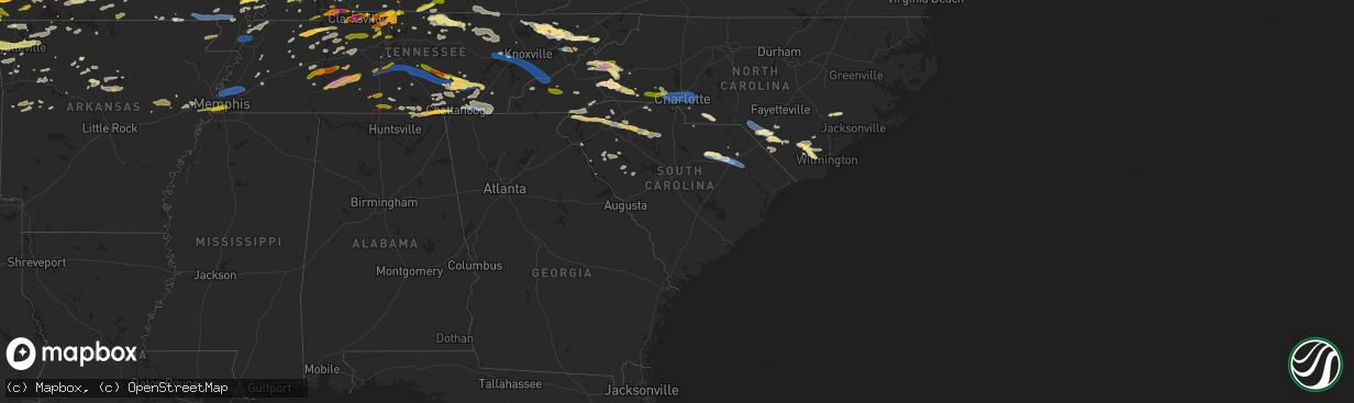
Hail Map in South Carolina on May 8, 2024
The weather event in South Carolina on May 8, 2024 includes Hail, Wind, and Tornado maps. 21 states and 1,905 cities were impacted and suffered possible damage. The total estimated number of properties impacted is 30,658.
Hail
Wind
Tornado
30,658
Estimated number of impacted properties by a 1.00" hail or larger667
Estimated number of impacted properties by a 1.75" hail or larger0
Estimated number of impacted properties by a 2.50" hail or largerStorm reports in South Carolina
South Carolina
| Date | Description |
|---|---|
| 05/08/20246:05 PM CDT | Several trees blown down across the city |
| 05/08/20246:00 PM CDT | Multiple trees down along freedom blvd in south florence |
| 05/08/20245:35 PM CDT | A tree was downed... Taking down a power line... At law st and s heyward st... In bishopville. Time estimated. |
| 05/08/20245:35 PM CDT | A tree was downed on hill rd between anderson hill rd and ashland stokes bridge rd. Time estimated. |
| 05/08/20245:17 PM CDT | Chesterfield county dispatch reported trees down along patrick society hill road. Time estimated by radar. |
| 05/08/20245:05 PM CDT | Chesterfield county dispatch reported trees down along sandy run creek. Time estimated by radar. |
| 05/08/20244:20 PM CDT | Trees and limbs down on power lines on south lake drive. |
| 05/08/20244:12 PM CDT | Sc highway patrol reported a tree in roadway at flat creek road and mccowan lane. Time estimated by radar. |
| 05/08/20244:05 PM CDT | County official reports many trees down across the county. |
| 05/08/20243:50 PM CDT | Spotter report of several trees down along shelly mullis road in indian land. Time estimated by radar. |
| 05/08/20243:45 PM CDT | Corrects previous tstm wnd dmg report from chester. County official reports many trees down across the county. |
| 05/08/20243:39 PM CDT | Social media pictures of at least golf ball size hail in the santuc area. |
| 05/08/20243:35 PM CDT | 8-9 trees blown down near carlisle. |
| 05/08/20243:35 PM CDT | A few trees blown down north of york. |
| 05/08/20243:02 PM CDT | Quarter size hail observed at the tyger river correctional institute. |
| 05/08/20243:00 PM CDT | Corrects time of previous hail report from 5 nne cross anchor. Quarter size hail observed at the tyger river correctional institute. |
| 05/08/20242:30 PM CDT | Along i-85 near i-26 intersection numerous small to somewhat large limbs down in the area. Seems to have caused power outages. Dime sized hail. |
| 05/08/20242:30 PM CDT | Along i-85 near i-26 intersection numerous small to somewhat large limbs down ion jefferson il 3832 8890 trees down power outages. |
| 05/08/20242:00 PM CDT | Golfball size hail. |
| 05/08/20241:55 PM CDT | Got at least 2 reports of quarter sized hail on woodruff road. |
| 05/08/20241:39 PM CDT | Emergency management reported tree down on powerline in landrum. |
| 05/08/20241:25 PM CDT | Hail lasted five minutes. |
| 05/08/20241:04 PM CDT | Report from mping: quarter |
| 05/08/202412:52 PM CDT | Dime to half dollar sized hail. |
| 05/08/202412:50 PM CDT | Several large hail stones in odd shapes. |
| 05/08/202412:35 PM CDT | Social media report of quarter sized hail northern lake keowee. |
| 05/08/202412:26 PM CDT | Employees enroute to storm survey discovered trees down on whitewater falls rd. Time estimated from radar. |
| 05/08/20243:32 AM CDT | Large tree down at corner of galloway town rd and indian branch rd causing two traffic accidents no injuries reported. |
| 05/08/20243:22 AM CDT | Sc dot reports a tree in roadway along i20. Time estimated by radar. |
| 05/08/20243:20 AM CDT | Sumter county dispatch reports a tree down along 378 and north kings highway. Time estimated by radar. |
| 05/08/20242:57 AM CDT | Kershaw county fire reports a tree blocking roadway along hwy 261 at hwy 521. Time estimated based on radar. |
| 05/08/20242:56 AM CDT | Kershaw county dispatch reports numerous trees and powerlines down throughout the county. Time estimated by radar. |
| 05/08/20242:56 AM CDT | Kershaw county fire reported a tree down blocking the road along flat rock rd. Time estimated based on radar. |
| 05/08/20242:53 AM CDT | Kershaw county fire reports a tree down on a home in lugoff. Time estimated based on radar. |
| 05/08/20242:52 AM CDT | Kershaw county fire reports a tree down blocking roadway. Time estimated based on radar. |
| 05/08/20242:49 AM CDT | Kershaw county fire reported a tree down at the intersection of smyrna rd and ashley creek. Time estimated based on radar. |
| 05/08/20242:49 AM CDT | Kershaw county em reported a tree down blocking flat rock rd at the kershaw/lancaster county line. Time estimated based on radar. |
| 05/08/20242:49 AM CDT | Kershaw county em reported a tree down blocking roadway along flat rock rd. |
| 05/08/20242:45 AM CDT | Emergency manager reports a downed tree on smyrna church rd at smyrna rd blocking the roadway. |
| 05/08/20242:38 AM CDT | Sc dept of public safety reported a tree in roadway. Time estimated by radar. |
| 05/08/20242:37 AM CDT | Emergency manager reports a downed tree on singleton creek rd at liberty hill rd blocking the roadway. |
| 05/08/20242:36 AM CDT | Trained spotter reported trees down and heavy damage between ridgeway and the county line. Time estimated by radar. |
| 05/08/20242:34 AM CDT | Report of a tree down and minor damage to a home in ridgeway. Report via social media. Time estimated by radar. |
| 05/08/20242:33 AM CDT | Trained spotter reported numerous trees down along hood rd through the intersection with boney rd. Time estimated from radar. |
| 05/08/20242:31 AM CDT | A national weather service storm survey team confirmed an ef-1 tornado with peak winds of 100 mph in southeastern fairfield county during the early morning hours of may |
| 05/08/20242:30 AM CDT | Sc dept of public safety reported a tree in roadway. Time estimated by radar. |
| 05/08/20242:28 AM CDT | Sc dept of public safety reported a tree in roadway. Time estimated by radar. |
| 05/08/20242:20 AM CDT | Sc department of public safety reported a tree down in roadway. Time estimated based on radar. |
| 05/08/20242:17 AM CDT | Fairfield county dispatch reported trees down in the 7489 block of hwy 213. Time estimated by radar. |
| 05/08/20242:12 AM CDT | Newberry county em reported a tree down on wheeland & mill rd. Time estimated by radar. |
| 05/08/20242:12 AM CDT | A national weather service storm survey team confirmed a brief ef-0 tornado with peak winds of 80 mph in northwestern fairfield county during the early morning hours of |
| 05/08/20242:08 AM CDT | Fairfield county dispatch reports a tree down along hwy 215 at meadow lake rd. Time estimated by radar. |
| 05/08/20242:04 AM CDT | Newberry county em reported a tree down along broad river road. Time estimated based on radar. |
| 05/08/20242:02 AM CDT | Newberry county dispatch reports trees down at mt pleasant rd and glynphville rd. Time estimated by radar. |
| 05/08/20241:57 AM CDT | Newberry county dispatch reported trees down at 2nd st and digby st. Time estimated by radar. |
| 05/08/20241:55 AM CDT | Sc dept of public safety reported a tree in roadway. Time estimated by radar. |
| 05/08/20241:54 AM CDT | Saluda county dispatch reported a tree down along greenwood highway. Time estimated by radar. |
| 05/08/20241:54 AM CDT | Newberry county dispatch reported trees down at belfast & spearman rd. Time estimated by radar. |
| 05/08/20241:54 AM CDT | Sc dept of public safety reported a tree in roadway. Time estimated by radar. |
| 05/08/20241:53 AM CDT | Newberry county em reported a tree down at indian creek rifle range. Time estimated based on radar. |
| 05/08/20241:52 AM CDT | Newberry county em reported trees and powerlines down at colonial dr and sc 121. Time estimated based on radar. |
| 05/08/20241:46 AM CDT | Newberry county dispatch reported trees down at kings ln and old airport rd. Time estimated by radar. |
| 05/08/20241:46 AM CDT | A national weather service storm survey team confirmed a brief ef-0 tornado with peak winds of 80 mph in newberry county south of the town of whitmire during the early |
| 05/08/20241:45 AM CDT | Trees and utility lines downed along hwy 66. |
| 05/08/20241:30 AM CDT | Corrects previous non-tstm wnd gst report from 2 ssw ora. Scdot station i-385 & hwy 221. |
| 05/08/202412:54 AM CDT | Trees snapped and uprooted on woodside ave. |
| 05/08/202412:53 AM CDT | Tree down on jule martin rd near honea path hwy. Time estimated from radar. |
| 05/08/202412:53 AM CDT | Tree down on hwy 252 near belton hwy. Time estimated from radar. |
| 05/08/202412:52 AM CDT | Tree down on honea path hwy. Time estimated from radar. |
| 05/08/202412:52 AM CDT | Tree down on hwy 413 near grove rd. Time estimated from radar. |
| 05/08/202412:51 AM CDT | Tree down on snow rd. Time estimated from radar. |
| 05/08/202412:51 AM CDT | Multiple buildings with roof and awning damage in downtown anderson. |
| 05/08/202412:50 AM CDT | Tree down on amity rd. |
| 05/08/202412:50 AM CDT | Tree down on old williamston rd. |
| 05/08/202412:50 AM CDT | Tree down on bolt dr. |
| 05/08/202412:50 AM CDT | Tree down on w whitner st. |
| 05/08/202412:50 AM CDT | Tree uprooted on w whitner st. Power lines down. |
| 05/08/202412:50 AM CDT | Tree down on bolt dr. Radar. |
| 05/08/202412:47 AM CDT | Anderson regional airport. |
| 05/08/202412:45 AM CDT | Tree on a car near east whitner... Also trees downed along rr tracks. |
| 05/08/202412:40 AM CDT | Tree blocking lane of i-85 south... Mm33. |
All States Impacted by Hail Map on May 8, 2024
Cities Impacted by Hail Map on May 8, 2024
- Hot Springs National Park, AR
- Little Rock, AR
- Scott, AR
- North Little Rock, AR
- Lonoke, AR
- England, AR
- Carlisle, AR
- Hazen, AR
- Stuttgart, AR
- De Valls Bluff, AR
- Clarendon, AR
- Roe, AR
- Shawnee, KS
- Mission, KS
- Prairie Village, KS
- Overland Park, KS
- Kansas City, MO
- Kansas City, KS
- Hickman, KY
- Monticello, KY
- Joelton, TN
- Whites Creek, TN
- Lenexa, KS
- Lafayette, TN
- Red Boiling Springs, TN
- Garden City, MO
- Harrisonville, MO
- Mayfield, KY
- Leawood, KS
- Creighton, MO
- Archie, MO
- Albany, KY
- Olathe, KS
- Riverside, MO
- Liberty, MO
- Clinton, KY
- Whitleyville, TN
- Goodlettsville, TN
- Moss, TN
- Gainesboro, TN
- Blairstown, MO
- Urich, MO
- Independence, MO
- Celina, TN
- Pall Mall, TN
- Trimble, MO
- Holt, MO
- Smithville, MO
- Plattsburg, MO
- Kearney, MO
- Lathrop, MO
- Montrose, MO
- Chilhowee, MO
- Holden, MO
- Hilham, TN
- East Prairie, MO
- Clinton, MO
- Hendersonville, TN
- Benton, KY
- Symsonia, KY
- Hickory, KY
- Stearns, KY
- Rickman, TN
- Cookeville, TN
- Deepwater, MO
- Oneida, TN
- Calhoun, MO
- Monroe, TN
- Allons, TN
- Livingston, TN
- Calvert City, KY
- Windsor, MO
- Alpine, TN
- Paducah, KY
- Allred, TN
- Boaz, KY
- Wilder, TN
- Jamestown, TN
- Lincoln, MO
- Ledbetter, KY
- Smithland, KY
- Ionia, MO
- Green Ridge, MO
- Cole Camp, MO
- Sedalia, MO
- Mora, MO
- La Follette, TN
- White House, TN
- Speedwell, TN
- Duff, TN
- Deer Lodge, TN
- Allardt, TN
- Sunbright, TN
- Stover, MO
- Lancing, TN
- Robbins, TN
- Versailles, MO
- New Tazewell, TN
- Sharps Chapel, TN
- Florence, MO
- Maynardville, TN
- Barnett, MO
- Cottontown, TN
- Washburn, TN
- Springfield, TN
- Greenbrier, TN
- Madison, TN
- Tazewell, TN
- Osage Beach, MO
- Sunrise Beach, MO
- Eldon, MO
- Russellville, MO
- California, MO
- Rutledge, TN
- Kaiser, MO
- Monterey, TN
- Tuscumbia, MO
- Thorn Hill, TN
- Oakdale, TN
- Wartburg, TN
- Latham, MO
- Lake Ozark, MO
- Morristown, TN
- Bean Station, TN
- Talbott, TN
- Eugene, MO
- Ulman, MO
- Iberia, MO
- Henley, MO
- Olean, MO
- Rocky Mount, MO
- Clarkrange, TN
- Jefferson City, MO
- Russellville, TN
- Meta, MO
- Saint Thomas, MO
- Westphalia, MO
- Dixon, MO
- Crocker, MO
- Saint Elizabeth, MO
- Mooresburg, TN
- Brinktown, MO
- Whitesburg, TN
- Bulls Gap, TN
- Mohawk, TN
- Jefferson City, TN
- Vienna, MO
- Argyle, MO
- Midway, TN
- Mosheim, TN
- Greeneville, TN
- Vichy, MO
- Belle, MO
- Knoxville, TN
- Freeburg, MO
- Linn, MO
- Koeltztown, MO
- Saint James, MO
- Bland, MO
- Owensville, MO
- Strawberry Plains, TN
- New Market, TN
- Rolla, MO
- Cuba, MO
- Dandridge, TN
- Afton, TN
- Cape Girardeau, MO
- White Pine, TN
- Newport, TN
- Sullivan, MO
- Bourbon, MO
- Rosebud, MO
- Limestone, TN
- Chuckey, TN
- Seymour, TN
- Jonesboro, IL
- Telford, TN
- Bybee, TN
- Leasburg, MO
- Jonesborough, TN
- Cobden, IL
- Anna, IL
- Parrottsville, TN
- Sevierville, TN
- Del Rio, TN
- Gerald, MO
- Buncombe, IL
- Vienna, IL
- Rogersville, TN
- Saint Clair, MO
- Goreville, IL
- Cosby, TN
- Lonedell, MO
- Richwoods, MO
- Creal Springs, IL
- Marion, IL
- Marshall, NC
- Hot Springs, NC
- Cherokee, NC
- Leslie, MO
- Hartford, TN
- Mars Hill, NC
- Weaverville, NC
- Grubville, MO
- Dittmer, MO
- Luebbering, MO
- Mountain Rest, SC
- Flag Pond, TN
- Fletcher, MO
- Barnardsville, NC
- Robertsville, MO
- Leicester, NC
- Alexander, NC
- Tamassee, SC
- Salem, SC
- Hopkinsville, KY
- Hillsboro, MO
- De Soto, IL
- Elkville, IL
- Murphysboro, IL
- De Soto, MO
- Burnsville, NC
- Mulkeytown, IL
- Royalton, IL
- Pembroke, KY
- Elkton, KY
- Summer Shade, KY
- Glasgow, KY
- Scottsville, KY
- Cedar Hill, MO
- Blackwell, MO
- Potosi, MO
- Christopher, IL
- Buckner, IL
- Sunset, SC
- Pickens, SC
- Six Mile, SC
- Benton, IL
- Festus, MO
- Old Fort, NC
- Hendersonville, NC
- Fletcher, NC
- Arden, NC
- Fairview, NC
- Chetopa, KS
- Lewisburg, KY
- Sharon Grove, KY
- Robbinsville, NC
- Union Mills, NC
- Bartlett, KS
- Black Mountain, NC
- Lucas, KY
- Waynesville, NC
- Lake Junaluska, NC
- Nevada, MO
- Clyde, NC
- Pevely, MO
- Herculaneum, MO
- Crystal City, MO
- Russellville, KY
- Oswego, KS
- House Springs, MO
- Drakesboro, KY
- Central City, KY
- Walker, MO
- Marion, NC
- Asheville, NC
- Beaver Dam, KY
- Gerton, NC
- Mills River, NC
- Erwin, TN
- Cadet, MO
- Valmeyer, IL
- Barnhart, MO
- Lake Lure, NC
- Easley, SC
- Cromwell, KY
- Waterloo, IL
- Fults, IL
- Mill Spring, NC
- Rutherfordton, NC
- Horse Branch, KY
- Rosine, KY
- Greenville, SC
- Caledonia, MO
- Belgrade, MO
- Harwood, MO
- Valles Mines, MO
- French Village, MO
- Auburn, KY
- Bloomsdale, MO
- El Dorado Springs, MO
- Bryson City, NC
- Bonne Terre, MO
- Irondale, MO
- Mineral Point, MO
- Bismarck, MO
- Park Hills, MO
- Franklin, NC
- Olaton, KY
- Leadwood, MO
- Prairie Du Rocher, IL
- Marion, KY
- Salem, KY
- Bluejacket, OK
- Welch, OK
- Nebo, NC
- Liberal, MO
- Oronogo, MO
- Jasper, MO
- Cullowhee, NC
- Schell City, MO
- Princeton, KY
- Dawson Springs, KY
- Morgantown, KY
- Rockfield, KY
- Sainte Genevieve, MO
- Sylva, NC
- Whittier, NC
- Saint Charles, KY
- Nortonville, KY
- Evansville, IL
- Modoc, IL
- Ellis Grove, IL
- Tyringham, MA
- Otis, MA
- Monterey, MA
- Blandford, MA
- East Otis, MA
- Great Barrington, MA
- Sheffield, MA
- South Egremont, MA
- Lamar, MO
- Caneyville, KY
- Falls Of Rough, KY
- Fredonia, KY
- Forest City, NC
- Spindale, NC
- Topton, NC
- Bowling Green, KY
- Bostic, NC
- Red Bud, IL
- Ellenboro, NC
- Walsh, IL
- Madisonville, KY
- Mortons Gap, KY
- White Plains, KY
- Graham, KY
- Sandisfield, MA
- Crofton, KY
- Chester, IL
- Farmington, MO
- Sturgis, KY
- Puryear, TN
- Hampton, KY
- Miami, OK
- Clay, KY
- Lawndale, NC
- Shelby, NC
- Tiptonville, TN
- Hornbeak, TN
- Butler, MO
- Appleton City, MO
- Nashville, TN
- Ashland City, TN
- Russell, MA
- Granville, MA
- Greenville, KY
- Osceola, MO
- Collins, MO
- Sparta, IL
- Mooresboro, NC
- Huntington, MA
- Westfield, MA
- Southampton, MA
- Tuckasegee, NC
- Pleasant View, TN
- Stockton, MO
- North Miami, OK
- Adams, TN
- Cedar Hill, TN
- Quapaw, OK
- Commerce, OK
- Beech Creek, KY
- Smiths Grove, KY
- Oakland, KY
- Simpsonville, SC
- Woodruff, SC
- Greer, SC
- Old Hickory, TN
- Vinita, OK
- Clarksville, TN
- Troy, TN
- Saint Mary, MO
- Ironton, MO
- Doe Run, MO
- Kings Mountain, NC
- Cherryville, NC
- Bessemer City, NC
- Holyoke, MA
- West Springfield, MA
- Chicopee, MA
- Afton, OK
- Beechmont, KY
- Jerico Springs, MO
- Lockwood, MO
- Browder, KY
- Belton, KY
- Arcola, MO
- Quincy, MO
- Weaubleau, MO
- Hazel, KY
- New Concord, KY
- Murray, KY
- Rosman, NC
- Balsam Grove, NC
- Lake Toxaway, NC
- Park City, KY
- Rocky Hill, KY
- Morganfield, KY
- Fountain Inn, SC
- Providence, KY
- Nebo, KY
- Amherst, MA
- Hadley, MA
- Northampton, MA
- Buchanan, TN
- Crouse, NC
- Elizabethtown, IL
- Cave In Rock, IL
- Eldridge, MO
- Melber, KY
- Union City, TN
- Steeleville, IL
- Rosiclare, IL
- Percy, IL
- Camdenton, MO
- Lebanon, MO
- Stoutland, MO
- Montreal, MO
- Roebuck, SC
- Pauline, SC
- Petersham, MA
- Enoree, SC
- Dallas, NC
- Cave City, KY
- Gastonia, NC
- Campbell Hill, IL
- Ava, IL
- Horse Cave, KY
- Coulterville, IL
- Cutler, IL
- Pinckneyville, IL
- Wheatland, MO
- Lincolnton, NC
- Manitou, KY
- Rochester, KY
- Fairland, OK
- Mauldin, SC
- Waverly, KY
- Wyandotte, OK
- Shutesbury, MA
- Carbondale, IL
- Fulton, KY
- South Fulton, TN
- Greenfield, TN
- Ludlow, MA
- Springfield, MA
- Indian Orchard, MA
- Wilbraham, MA
- Corydon, KY
- Gaffney, SC
- Ullin, IL
- Grand Chain, IL
- Karnak, IL
- Martin, TN
- Golden City, MO
- Austin, KY
- Pomona, IL
- Magnolia, MN
- Kanaranzi, MN
- Fredericktown, MO
- Rockwood, IL
- Athol, MA
- Templeton, MA
- Hubbardston, MA
- Gardner, MA
- Barre, MA
- Buffalo, SC
- Jonesville, SC
- Hardyville, KY
- Center, KY
- Uniontown, KY
- Kenneth, MN
- Cross Timbers, MO
- Hermitage, MO
- Cross Plains, TN
- Vergennes, IL
- Robards, KY
- Sebree, KY
- Hanson, KY
- Chatham, VA
- Brookport, IL
- Seneca, MO
- Neosho, MO
- Joplin, MO
- Dover, TN
- Knob Lick, KY
- Union, SC
- Monson, MA
- Palmer, MA
- Mount Holly, NC
- Gilbertsville, KY
- Reagan, TN
- Jacks Creek, TN
- Lexington, TN
- Huron, TN
- Perryville, MO
- Palmersville, TN
- Dresden, TN
- Luverne, MN
- Gleason, TN
- McKenzie, TN
- Columbus, KS
- New Haven, MO
- Richland, MO
- Greenfield, MO
- Blacksburg, SC
- Belknap, IL
- Dixon, KY
- Smyrna, SC
- Henderson, KY
- Sacramento, KY
- Big Rock, TN
- Cottage Grove, TN
- Slaughters, KY
- Weir, KS
- Paris, TN
- Lowell, NC
- Cramerton, NC
- Charlotte, NC
- McAdenville, NC
- Belmont, NC
- Stanley, NC
- Bumpus Mills, TN
- Three Rivers, MA
- Edwards, MO
- Warsaw, MO
- Preston, MO
- Matthews, NC
- Du Quoin, IL
- Jetson, KY
- Brownsville, KY
- Roundhill, KY
- Westminster, MA
- Wales, MA
- Henry, TN
- Dadeville, MO
- Rumsey, KY
- Scotts Hill, TN
- Sturbridge, MA
- Brimfield, MA
- Fiskdale, MA
- Hardin, KY
- Orlinda, TN
- Mount Vernon, IN
- Island, KY
- East Longmeadow, MA
- Hampden, MA
- Charlton, MA
- Holland, MA
- Edmonton, KY
- Gretna, VA
- Cadiz, KY
- York, SC
- Clover, SC
- Energy, IL
- Carterville, IL
- Herrin, IL
- Munfordville, KY
- Stafford Springs, CT
- Southbridge, MA
- Dudley, MA
- Chelsea, OK
- Dukedom, TN
- Grand Rivers, KY
- North Grosvenordale, CT
- Quinebaug, CT
- Woodstock Valley, CT
- Eastford, CT
- Pomfret Center, CT
- Woodstock, CT
- Greensburg, KY
- Concord, NC
- Midland, NC
- Harrisburg, NC
- Waynesville, MO
- Portland, TN
- Macks Creek, MO
- Climax Springs, MO
- Roach, MO
- Granby, MO
- Parsons, TN
- Decaturville, TN
- Darden, TN
- Cumberland City, TN
- Indian Mound, TN
- Livermore, KY
- Calhoun, KY
- Centertown, KY
- Dunmor, KY
- Fort Campbell, KY
- Woodlawn, TN
- Shoals, IN
- Almo, KY
- Monroe, NC
- Indian Trail, NC
- Golconda, IL
- Eddyville, IL
- Simpson, IL
- Adair, OK
- Dowell, IL
- Johnston City, IL
- Big Cabin, OK
- Mansfield, TN
- Pittsburg, IL
- Linden, TN
- Herndon, KY
- La Fayette, KY
- Newburg, MO
- Jerome, MO
- Springville, TN
- Linn Creek, MO
- Pierce City, MO
- Hartford, KY
- Stark City, MO
- Utica, KY
- Woodlawn, IL
- New Athens, IL
- Hecker, IL
- Addieville, IL
- Nashville, IL
- Lenzburg, IL
- Richview, IL
- Brumley, MO
- Ashley, IL
- Mount Vernon, IL
- Williams, IN
- Palmyra, TN
- Cunningham, TN
- Bee Spring, KY
- Leitchfield, KY
- Herod, IL
- Carlisle, SC
- Putnam, CT
- Thompson, CT
- Saint Robert, MO
- New Salem, IL
- Oxford, MA
- Webster, MA
- Ashford, CT
- Columbia, KY
- Campbellsville, KY
- Thompsonville, IL
- Clear Lake, SD
- Brandt, SD
- Stanfield, NC
- Big Sandy, TN
- Carrier Mills, IL
- Waynesboro, TN
- Clifton, TN
- Bath Springs, TN
- Makanda, IL
- Canby, MN
- Stewart, TN
- Beaufort, MO
- Clarkson, KY
- Cub Run, KY
- Goodman, MO
- Monett, MO
- Wentworth, MO
- Lobelville, TN
- Harrisburg, IL
- Mammoth Cave, KY
- Chester, SC
- Lunenburg, VA
- Victoria, VA
- Keysville, VA
- Galatia, IL
- Lometa, TX
- Fordsville, KY
- Dundee, KY
- Remsen, IA
- Marcus, IA
- Dayville, CT
- Chepachet, RI
- Westmoreland, TN
- Bethpage, TN
- Oak Grove, KY
- Maxton, NC
- Rowland, NC
- West Frankfort, IL
- Eddyville, KY
- Knifley, KY
- Junction, IL
- Stonefort, IL
- Alto Pass, IL
- Mindenmines, MO
- Marshville, NC
- Wingate, NC
- Gary, SD
- Pittsburg, KS
- Hohenwald, TN
- Oakboro, NC
- Lampasas, TX
- Opolis, KS
- Asbury, MO
- Licking, MO
- Duke, MO
- Pembroke, NC
- Eldorado, IL
- Verona, MO
- Centerville, TN
- Salem, MO
- Kenbridge, VA
- Cherryville, MO
- Waverly, TN
- Peachland, NC
- Lancaster, SC
- McEwen, TN
- Gravois Mills, MO
- Pryor, OK
- Trenton, KY
- Equality, IL
- Tennessee Ridge, TN
- Bonnieville, KY
- Taylors, SC
- Polkton, NC
- Grove, OK
- Cook Sta, MO
- Steelville, MO
- Roby, MO
- Beulah, MO
- Danielson, CT
- Adolphus, KY
- Anderson, MO
- Erin, TN
- Magnolia, KY
- Upton, KY
- Clarkton, NC
- Council, NC
- Norris City, IL
- Burna, KY
- Nunnelly, TN
- Liberty, KY
- Dunnville, KY
- Millwood, KY
- Wadesboro, NC
- Mount Vernon, MO
- Freistatt, MO
- Aurora, MO
- Guthrie, KY
- Fairmont, NC
- Lumberton, NC
- Sheldon, MO
- Bronaugh, MO
- Strang, OK
- Devils Elbow, MO
- Diamond, MO
- Ridgway, IL
- Shawneetown, IL
- Cumberland Furnace, TN
- Vanleer, TN
- Dickson, TN
- Charlotte, TN
- Marionville, MO
- Hampshire, TN
- Mount Pleasant, TN
- Billings, MO
- Crane, MO
- Clever, MO
- Edgar Springs, MO
- Lenox, MO
- Sneedville, TN
- Tiff City, MO
- Summertown, TN
- Orrum, NC
- Copperas Cove, TX
- Bon Aqua, TN
- Holland, KY
- Summersville, KY
- Carmi, IL
- Gatesville, TX
- Chapmansboro, TN
- Eucha, OK
- Milo, MO
- Fountain Run, KY
- Cassatt, SC
- Bishopville, SC
- Big Clifty, KY
- Monroe City, MO
- Palmyra, MO
- Brooklyn, CT
- Gamaliel, KY
- Mount Sherman, KY
- Fairview, MO
- Rocky Comfort, MO
- Stella, MO
- White Bluff, TN
- Bladenboro, NC
- Spavinaw, OK
- Riegelwood, NC
- Jay, OK
- Grantsburg, IL
- Kingston Springs, TN
- South West City, MO
- Noel, MO
- Davisville, MO
- Columbia, IL
- Holladay, TN
- Duck River, TN
- Sonora, KY
- White Mills, KY
- Buffalo, KY
- Tompkinsville, KY
- Mount Hermon, KY
- East Killingly, CT
- Foster, RI
- Sterling, CT
- Boss, MO
- Clayville, RI
- Hope, RI
- Moosup, CT
- Kodak, TN
- Nixa, MO
- Purdy, MO
- Wheaton, MO
- Imperial, MO
- Patrick, SC
- Hartsville, SC
- Belleville, IL
- Lanagan, MO
- Pineville, MO
- Lebanon, KY
- Gradyville, KY
- Millstadt, IL
- Kelly, NC
- Columbia, TN
- Locust Grove, OK
- Pegram, TN
- Fontana Dam, NC
- Oliver Springs, TN
- Evergreen, NC
- Yosemite, KY
- Brookline, MO
- Springfield, MO
- Ozark, MO
- Highlandville, MO
- Gravette, AR
- Fairview Heights, IL
- O'Fallon, IL
- Spring Hill, TN
- Rose, OK
- Salina, OK
- Mannsville, KY
- Bradfordsville, KY
- Elk Horn, KY
- Beaumont, KY
- Currie, NC
- Gallatin, TN
- Sulphur Springs, AR
- Powell, MO
- Mount Juliet, TN
- Hampton, CT
- Society Hill, SC
- Lamar, SC
- Bethune, SC
- Cassville, MO
- Butterfield, MO
- Rogersville, MO
- Bixby, MO
- McBee, SC
- Sparta, MO
- Viburnum, MO
- Belleview, MO
- Primm Springs, TN
- Lewisburg, TN
- Bolton, NC
- Lyles, TN
- Galena, MO
- Washburn, MO
- Southside, TN
- Peggs, OK
- Hulbert, OK
- Exeter, MO
- Hustonville, KY
- Bruner, MO
- Fordland, MO
- Colcord, OK
- Fort Hood, TX
- Darlington, SC
- Seymour, MO
- New Salem, MA
- Freeburg, IL
- Oakland, RI
- Harrisville, RI
- Mapleville, RI
- Timmonsville, SC
- Lebanon, TN
- College Grove, TN
- Delco, NC
- North Scituate, RI
- Cranston, RI
- Johnston, RI
- Providence, RI
- Tiverton, RI
- Fall River, MA
- Ava, MO
- Westport, MA
- North Dartmouth, MA
- New Bedford, MA
- Warwick, RI
- Riverside, RI
- Florence, SC
- Willington, CT
- Wellfleet, MA
- Franklin, TN
- Chaplin, CT
- Lowry City, MO
- Shannon, NC
- Castalian Springs, TN
- Pascoag, RI
- Chapel Hill, TN
- Eagleville, TN
- Ponce De Leon, MO
- Mascoutah, IL
- Hodgenville, KY
- Saint Pauls, NC
- Reeds Spring, MO
- Spokane, MO
- New Baden, IL
- Seligman, MO
- Tahlequah, OK
- Chestnutridge, MO
- Chadwick, MO
- Forsyth, MO
- Garrison, MO
- Mckinney, TX
- Princeton, TX
- Blue Ridge, TX
- Baldwin, IL
- Tamaroa, IL
- Kansas, OK
- Marissa, IL
- Oakdale, IL
- Tilden, IL
- Proctor, OK
- Scheller, IL
- Du Bois, IL
- Sesser, IL
- Waltonville, IL
- Ogden, IA
- Cape Fair, MO
- Hartsville, TN
- Boone, IA
- Albers, IL
- Thompsons Station, TN
- Barrington, RI
- Pea Ridge, AR
- Bella Vista, AR
- Bentonville, AR
- Centerton, AR
- Bremen, KY
- Eagle Rock, MO
- Warsaw, NC
- Turkey, NC
- Magnolia, NC
- Leland, NC
- Bethelridge, KY
- Eubank, KY
- Canmer, KY
- Oaks, OK
- Cambria, IL
- Franklin, KY
- Adairville, KY
- Alexis, NC
- Iron Station, NC
- Clinton, NC
- Watts, OK
- Westville, OK
- Greene, RI
- East Providence, RI
- Swansea, MA
- Seekonk, MA
- Twin Oaks, OK
- Warren, RI
- Bristol, RI
- Somerset, MA
- Fairhaven, MA
- Acushnet, MA
- Mattapoisett, MA
- Coventry, RI
- Rockvale, TN
- Christiana, TN
- Murfreesboro, TN
- Unionville, TN
- Mansfield, MO
- Bell Buckle, TN
- Oldfield, MO
- Plainfield, CT
- Canterbury, CT
- Central Village, CT
- Spencer, IA
- Fair Bluff, NC
- Rogers, AR
- Nichols, SC
- Germantown, IL
- McHenry, KY
- Shell Knob, MO
- Kimberling City, MO
- Chadbourn, NC
- Cerro Gordo, NC
- Kirksey, KY
- Gordonsville, TN
- Golden, MO
- Riddleton, TN
- Dixon Springs, TN
- Carthage, TN
- Kenansville, NC
- Garfield, AR
- Rockport, KY
- Truro, MA
- Eastham, MA
- Norwood, MO
- Macomb, MO
- Drury, MO
- Falmouth, MA
- North Falmouth, MA
- East Falmouth, MA
- Farmersville, TX
- Mashpee, MA
- Cotuit, MA
- Portsmouth, RI
- Siloam Springs, AR
- Summers, AR
- Lincoln, AR
- South Dartmouth, MA
- Kuttawa, KY
- West Warwick, RI
- East Greenwich, RI
- West Greenwich, RI
- Bennington, OK
- Buffalo Valley, TN
- Chestnut Mound, TN
- Elmwood, TN
- Taneyville, MO
- Walnut Shade, MO
- Berryville, AR
- Eureka Springs, AR
- Branson, MO
- Cerulean, KY
- Bokchito, OK
- Telephone, TX
- North Kingstown, RI
- Prudence Island, RI
- Fayetteville, AR
- Prairie Grove, AR
- Vanzant, MO
- Mountain Grove, MO
- Beulaville, NC
- Pink Hill, NC
- Boswell, OK
- Ames, IA
- Readyville, TN
- Bradleyville, MO
- Lexington, AL
- Centralia, IL
- Antlers, OK
- Atoka, OK
- Baxter, TN
- Bloomington Springs, TN
- Park Hill, OK
- Story City, IA
- Burkesville, KY
- Granville, TN
- Lampe, MO
- Odin, IL
- Sandoval, IL
- Hermitage, TN
- Porum, OK
- Kevil, KY
- Gilbert, IA
- Randall, IA
- Effingham, SC
- Cuttyhunk, MA
- Woods Hole, MA
- Little Compton, RI
- Woodbury, TN
- Mcminnville, TN
- Westport Point, MA
- Bradyville, TN
- Morrison, TN
- Moyers, OK
- Finley, OK
- Willow Springs, MO
- Cabool, MO
- Beechgrove, TN
- Wartrace, TN
- Manchester, TN
- Farmington, AR
- Stigler, OK
- Hermann, MO
- Richlands, NC
- Anderson, AL
- Five Points, TN
- Loretto, TN
- Dix, IL
- Kell, IL
- Texico, IL
- Iuka, IL
- Bluford, IL
- Salem, IL
- Oak Grove, AR
- Green Forest, AR
- Blue Eye, MO
- Squires, MO
- Irvington, IL
- Dutton, AL
- Section, AL
- Welling, OK
- Arthur City, TX
- Sumner, TX
- Shelbyville, TN
- Pulaski, TN
- Hollister, MO
- Cunningham, KY
- Culleoka, TN
- Walnut Hill, IL
- Cookson, OK
- Thornfield, MO
- Springdale, AR
- Hindsville, AR
- Laurinburg, NC
- Gibson, NC
- Laurel Hill, NC
- Trenton, NC
- Mountain View, MO
- Elkins, AR
- Okawville, IL
- Hoyleton, IL
- Ewing, IL
- Ina, IL
- Bonnie, IL
- Whittington, IL
- Opdyke, IL
- McLeansboro, IL
- Mill Shoals, IL
- Dahlgren, IL
- Geff, IL
- Keenes, IL
- Rinard, IL
- Sims, IL
- Springerton, IL
- Fairfield, IL
- Belle Rive, IL
- Wayne City, IL
- Barnhill, IL
- Cisne, IL
- Macedonia, IL
- Enfield, IL
- Johnsonville, IL
- Xenia, IL
- Clay City, IL
- Flora, IL
- Burnt Prairie, IL
- Golden Gate, IL
- Albion, IL
- Olney, IL
- Noble, IL
- West Salem, IL
- Claremont, IL
- Bone Gap, IL
- Bridgeport, IL
- Mount Carmel, IL
- Calhoun, IL
- Ellery, IL
- Browns, IL
- Mount Erie, IL
- Parkersburg, IL
- Sumner, IL
- Owensville, IN
- Allendale, IL
- Griffin, IN
- Bellmont, IL
- Crossville, IL
- Grayville, IL
- Coventry, CT
- Storrs Mansfield, CT
- Celeste, TX
- Metropolis, IL
- Sweeden, KY
- Stilwell, OK
- Pisgah, AL
- Henagar, AL
- Clayton, OK
- Snow, OK
- Berger, MO
- Danbury, IA
- Anthon, IA
- Lawrenceburg, TN
- Goodspring, TN
- Leoma, TN
- Minor Hill, TN
- West Paducah, KY
- Huntsville, AR
- Vineyard Haven, MA
- Hugo, OK
- Radcliffe, IA
- Fancy Farm, KY
- Arlington, KY
- Greenville, TX
- Suffolk, VA
- Kirbyville, MO
- Cedarcreek, MO
- Rogersville, AL
- Athens, AL
- Paris, TX
- Grant, OK
- Powderly, TX
- Prospect, TN
- Elkmont, AL
- West Fork, AR
- Shallotte, NC
- Supply, NC
- Mccurtain, OK
- Caddo Mills, TX
- Nevada, TX
- Zearing, IA
- Hubbard, IA
- Battle Creek, IA
- Correctionville, IA
- Canehill, AR
- Killen, AL
- McCallsburg, IA
- Garden City, IA
- Cornersville, TN
- Gracey, KY
- Town Creek, AL
- Evansville, AR
- Alpena, AR
- Wasola, MO
- Gainesville, MO
- Mansfield Center, CT
- Ardmore, TN
- Osterville, MA
- Rock Island, TN
- Spencer, TN
- Lester, AL
- Blossom, TX
- Detroit, TX
- Bagwell, TX
- North Windham, CT
- Tuskahoma, OK
- Dellrose, TN
- Wilburton, OK
- Talihina, OK
- Hillsboro, AL
- Courtland, AL
- Zanoni, MO
- Princeton, AL
- Winslow, AR
- Estillfork, AL
- Keota, OK
- New Providence, IA
- Bokoshe, OK
- Crossville, TN
- Wickliffe, KY
- Bardwell, KY
- Nantucket, MA
- Beersheba Springs, TN
- Altamont, TN
- Dunlap, TN
- Pikeville, TN
- Taft, TN
- Fayetteville, TN
- Broughton, IL
- Scottsboro, AL
- Eminence, MO
- Woodburn, KY
- Baltic, CT
- Scotland, CT
- Muscle Shoals, AL
- Ider, AL
- Tanner, AL
- Bunker, MO
- Langston, AL
- Dale, IL
- Loose Creek, MO
- Valley Head, AL
- Omaha, AR
- Harrison, AR
- Red Oak, OK
- Dora, MO
- Woodville, AL
- Flat Rock, AL
- Shady Point, OK
- Spiro, OK
- Rising Fawn, GA
- Campbell, TX
- Higdon, AL
- Chester, AR
- Exeter, RI
- West Plains, MO
- Pomona, MO
- Cameron, OK
- Chattanooga, TN
- Alvaton, KY
- Compton, AR
- Audubon, IA
- Stevenson, AL
- Ellington, MO
- New Haven, IL
- Black, MO
- Brush Creek, TN
- Chilmark, MA
- Chamois, MO
- Morrison, MO
- Edgartown, MA
- Tecumseh, MO
- Caulfield, MO
- Ponca, AR
- Kingston, AR
- Santa Fe, TN
- Hope Valley, RI
- Hollywood, AL
- Bonnots Mill, MO
- Olmstead, KY
- Normandy, TN
- Hillsboro, TN
- Tullahoma, TN
- Graysville, TN
- Palmer, TN
- Soddy Daisy, TN
- Menlo, GA
- Chickamauga, GA
- Lone Oak, TX
- Cumby, TX
- Sherwood, TN
- Bridgeport, AL
- South Pittsburg, TN
- Harvest, AL
- Madison, AL
- Huntsville, AL
- Mountainburg, AR
- Bakersfield, MO
- Annapolis, MO
- Jasper, AR
- Marble Falls, AR
- Saunderstown, RI
- West Kingston, RI
- Wyoming, RI
- Kingston, RI
- Wadesville, IN
- Evansville, IN
- Georgetown, TN
- La Fayette, GA
- Trenton, GA
- Pottersville, MO
- Lesterville, MO
- Centerville, MO
- Redford, MO
- Leighton, AL
- Rudy, AR
- Lead Hill, AR
- Yellville, AR
- Clarksville, TX
- Pocola, OK
- Ooltewah, TN
- Mulberry, AR
- Colo, IA
- Petersburg, TN
- Harriman, TN
- Brashear, TX
- Sale Creek, TN
- Idabel, OK
- Avery, TX
- Haworth, OK
- Jasper, TN
- Wakefield, RI
- Narragansett, RI
- Newport, RI
- Jamestown, RI
- Kingston, TN
- Oak Ridge, TN
- Lenoir City, TN
- Fort Payne, AL
- Dayton, TN
- Bryant, AL
- Flippin, AR
- Cotter, AR
- Ardmore, AL
- Toney, AL
- Flintville, TN
- Kelso, TN
- Arcadia, MO
- Gepp, AR
- Moody, MO
- Deer, AR
- Ozark, AR
- New Market, AL
- Theodosia, MO
- Birchwood, TN
- Harrison, TN
- Hollytree, AL
- Hixson, TN
- Parthenon, AR
- Coalmont, TN
- Gruetli Laager, TN
- Buzzards Bay, MA
- Protem, MO
- Rueter, MO
- New Harmony, IN
- Signal Mountain, TN
- Decatur, TN
- Coon Rapids, IA
- Dedham, IA
- Sulphur Springs, TX
- Decker, IN
- Vincennes, IN
- Patoka, IN
- Saint Francisville, IL
- Lawrenceville, IL
- Haubstadt, IN
- Hazleton, IN
- Lynnville, IN
- Oakland City, IN
- Spurgeon, IN
- Petersburg, IN
- Cynthiana, IN
- Francisco, IN
- Fort Branch, IN
- Monroe City, IN
- Princeton, IN
- Winslow, IN
- Poseyville, IN
- Elberfeld, IN
- Stendal, IN
- Tennyson, IN
- Dale, IN
- Velpen, IN
- Holland, IN
- Huntingburg, IN
- Wheatland, IN
- Otwell, IN
- Terrell, TX
- Carroll, IA
- Guild, TN
- Elizabeth, AR
- Henderson, AR
- Viola, AR
- Allensville, KY
- McDonald, TN
- Cleveland, TN
- De Kalb, TX
- Calhoun, TN
- Athens, TN
- Hartford, AR
- Huntington, AR
- Fackler, AL
- Parma, MO
- Centerville, MA
- Clinton, TN
- Mansfield, AR
- Whitwell, TN
- Quinlan, TX
- Gamaliel, AR
- Brownsboro, AL
- Bayard, IA
- Owens Cross Roads, AL
- Gurley, AL
- Point, TX
- Emory, TX
- Sturkie, AR
- Bertrand, MO
- Sikeston, MO
- Sequatchie, TN
- Riceville, TN
- Patton, MO
- Marquand, MO
- Charleston, MO
- Yantis, TX
- Bunch, OK
- Essex, MO
- Matthews, MO
- Canalou, MO
- Oark, AR
- Marshall, AR
- Saint Joe, AR
- Trion, GA
- Summerville, GA
- Western Grove, AR
- Como, TX
- Rock Spring, GA
- Watertown, TN
- Booneville, AR
- Huntland, TN
- Old Fort, TN
- Greenwood, AR
- Catron, MO
- Trenton, AL
- Paint Rock, AL
- Anniston, MO
- Owensboro, KY
- Frohna, MO
- Wills Point, TX
- Rocky Face, GA
- Pickton, TX
- Elora, TN
- Uniontown, MO
- Clarksville, AR
- Ozone, AR
- Belvidere, TN
- Salem, AR
- Mammoth Spring, AR
- Hartman, AR
- Altus, AR
- Altenburg, MO
- Aldrich, MO
- Rockwood, TN
- Farragut, TN
- Rockford, TN
- Friendsville, TN
- Louisville, TN
- Maryville, TN
- Alcoa, TN
- Walland, TN
- Edgewood, TX
- Apison, TN
- Villa Ridge, IL
- Clarkton, MO
- Malden, MO
- Gideon, MO
- Cairo, IL
- Magazine, AR
- Jackson, MO
- Wolf Lake, IL
- West Point, IL
- Bowen, IL
- Dalton, GA
- Winnsboro, TX
- Quitman, TX
- Couch, MO
- Dover, AR
- Hagarville, AR
- Barlow, KY
- Beaman, IA
- Gladbrook, IA
- Conrad, IA
- Townsend, TN
- Tallassee, TN
- Chatsworth, GA
- Jacob, IL
- Fruitvale, TX
- Grundy Center, IA
- Lincoln, IA
- Reinbeck, IA
- Waterloo, IA
- Hudson, IA
- Traer, IA
- La Porte City, IA
- Buckingham, IA
- Morrison, IA
- Dysart, IA
- Pleasant Shade, TN
- Hector, AR
- Mount Auburn, IA
- Myrtle, MO
- Marmaduke, AR
- Carthage, IL
- Scroggins, TX
- Ringgold, GA
- Resaca, GA
- Witts Springs, AR
- Leslie, AR
- Dennard, AR
- Mount Judea, AR
- Portageville, MO
- Jamaica, IA
- Warm Springs, AR
- Gatewood, MO
- Mound City, IL
- Grand Saline, TX
- Paris, AR
- Rector, AR
- Havana, AR
- Dongola, IL
- Brandon, IA
- Jesup, IA
- Griffithville, AR
- Murphy, NC
- New Madrid, MO
- Cypress, IL
- Dawson, IA
- Pittsburg, TX
- Leesburg, TX
- Gilmer, TX
- Doniphan, MO
- Maynard, AR
- Jerusalem, AR
- Ellijay, GA
- Marston, MO
- Lookout Mountain, GA
- Wildwood, GA
- Bluffton, AR
- Cushing, IA
- Holstein, IA
- Scotland, AR
- Russellville, AR
- Searcy, AR
- Hattieville, AR
- Cleveland, AR
- Ozark, IL
- Danville, AR
- Belleville, AR
- Kingsley, IA
- Columbus, KY
- Shirley, AR
- Corning, AR
- Success, AR
- Dexter, KY
- La Center, KY
- Clinton, AR
- Senath, MO
- Augusta, AR
- Perryville, AR
- Plainview, AR
- Mountain View, AR
- Broseley, MO
- Bernie, MO
- Qulin, MO
- Kennett, MO
- New Burnside, IL
- Atkins, AR
- Big Sandy, TX
- Hawkins, TX
- Bradford, AR
- Tiline, KY
- Ridgely, TN
- Tracy City, TN
- Center Ridge, AR
- Mentone, AL
- McCrory, AR
- Casa, AR
- Ore City, TX
- Prim, AR
- Edgemont, AR
- Dexter, MO
- Canton, TX
- Ben Wheeler, TX
- Des Arc, AR
- Cotton Plant, AR
- Dawsonville, GA
- Blue Ridge, GA
- Bee Branch, AR
- Higden, AR
- Choctaw, AR
- Only, TN
- Dahlonega, GA
- Damascus, AR
- Sedalia, KY
- Farmington, KY
- Ranger, GA
- Lilbourn, MO
- Drasco, AR
- Diana, TX
- Cleveland, SC
- Wingo, KY
- Marble Hill, GA
- Van, TX
- Tiger, GA
- Lakemont, GA
- Clarkesville, GA
- Brevard, NC
- Cedar Mountain, NC
- Burns, TN
- Adona, AR
- Perry, AR
- Houston, AR
- Murrayville, GA
- Clermont, GA
- Cleveland, GA
- Quitman, AR
- Greenbrier, AR
- Wynne, AR
- Zirconia, NC
- Pisgah Forest, NC
- Talking Rock, GA
- Oxly, MO
- Neelyville, MO
- Naylor, MO
- Bigelow, AR
- Campbell, MO
- Luxora, AR
- Hooks, TX
- New Boston, TX
- Jasper, GA
- Lula, GA
- Palestine, AR
- Hunter, AR
- Colt, AR
- Westminster, SC
- Demorest, GA
- Sugar Tree, TN
- Long Creek, SC
- Rose Bud, AR
- Heber Springs, AR
- Gainesville, GA
- Alto, GA
- Cornelia, GA
- Wheatley, AR
- Ashdown, AR
- Forrest City, AR
- Baldwin, GA
- Maud, TX
- Jefferson, TX
- Marshall, TX
- Wildersville, TN
- Karnack, TX
- Townville, SC
- Hartwell, GA
- Friendship, TN
- Seneca, SC
- Marion, AR
- Anderson, SC
- Sugar Valley, GA
- Homer, GA
- Carnesville, GA
- Toccoa, GA
- Caruthersville, MO
- Dyersburg, TN
- Starr, SC
- Texarkana, TX
- Texarkana, AR
- Commerce, GA
- Martin, GA
- Lavonia, GA
- Nash, TX
- Brighton, TN
- Mason, TN
- Millington, TN
- Arlington, TN
- Memphis, TN
- Atoka, TN
- Waleska, GA
- Rydal, GA
- Pendleton, SC
- Lyman, SC
- Royston, GA
- Canton, GA
- Abbeville, SC
- Iva, SC
- Duncan, SC
- Crawfordsville, AR
- Proctor, AR
- Belton, SC
- Williamston, SC
- Pelzer, SC
- Piedmont, SC
- Honea Path, SC
- Atwood, TN
- Milan, TN
- Moore, SC
- West Memphis, AR
- Lavinia, TN
- Calhoun, GA
- Armuchee, GA
- Bells, TN
- Donalds, SC
- Ball Ground, GA
- Due West, SC
- Stanton, TN
- Bruceton, TN
- Hollow Rock, TN
- Gray Court, SC
- Laurens, SC
- Hodges, SC
- Waterloo, SC
- Ware Shoals, SC
- Brownsville, TN
- Calhoun Falls, SC
- Camden, TN
- Denmark, TN
- Cedar Grove, TN
- Greenwood, SC
- Cumming, GA
- Eva, TN
- Ninety Six, SC
- Kinards, SC
- Silverstreet, SC
- Chappells, SC
- Newberry, SC
- New Johnsonville, TN
- Medon, TN
- Mercer, TN
- Nolensville, TN
- Flowery Branch, GA
- Oakwood, GA
- Pendergrass, GA
- Braselton, GA
- Talmo, GA
- Buford, GA
- Hurricane Mills, TN
- Saluda, SC
- Bolivar, TN
- Toone, TN
- Blair, SC
- Sardis, TN
- Fairmount, GA
- Jefferson, GA
- Collinwood, TN
- Hazel Green, AL
- Arrington, TN
- Nicholson, GA
- Athens, GA
- Brinkley, AR
- Hoschton, GA
- Williamsport, TN
- Danielsville, GA
- Hull, GA
- Colbert, GA
- Dewy Rose, GA
- Bowman, GA
- Carlton, GA
- Elberton, GA
- Comer, GA
- Lexington, GA
- Jefferson, SC
- Widener, AR
- Tignall, GA
- Madison, AR
- Ethridge, TN
- Hughes, AR
- Heth, AR
- Mount Carmel, SC
- McCormick, SC
- Troy, SC
- Bradley, SC
- Frankewing, TN
- Edmondson, AR
- Estill Springs, TN
- Watkinsville, GA
- Pelham, TN
- Winterville, GA
- Monteagle, TN
- Olive Branch, MS
- Germantown, TN
- Collierville, TN
- Robinsonville, MS
- Arnoldsville, GA
- Crawford, GA
- Sewanee, TN
- Evensville, TN
- Meridianville, AL
- Rayle, GA
- Cordova, TN
- Eads, TN
- Rossville, TN
- Byhalia, MS
- Washington, GA
- Dundee, MS
- Tunica, MS
- Grand Junction, TN
- Michigan City, MS
- Raywick, KY
- Decatur, AL
- Lincolnton, GA
- Russell Springs, KY
- Science Hill, KY
- McDaniels, KY
- Saulsbury, TN
- Middleton, TN
- Cohutta, GA
- Charleston, TN
- Ocoee, TN
- Pocahontas, TN
- Walnut, MS
- Crandall, GA
- Sarah, MS
- Crenshaw, MS
- Sledge, MS
- Ramer, TN
- Cherokee, AL
- Como, MS
- Waterloo, AL
- Florence, AL
- Cartersville, GA
- White, GA
- Tuscumbia, AL
- Russellville, AL
- Eastanollee, GA
- Mount Airy, GA
- Ivanhoe, NC
- Helen, GA
- Parkton, NC
- Lumber Bridge, NC


